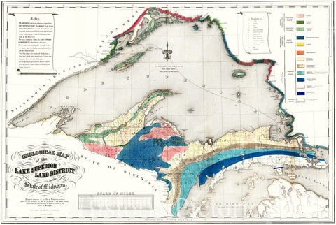
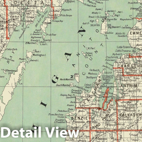
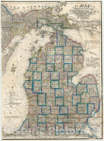
Map Of The State Of Michigan And the Surrounding Country Exhibiting the Sections and the latest surveys. Compiled From Authentic Sources By John Farmer. Detroit. 23rd edition. Entered ... 1844 by John Farmer of Detroit. Entered ... by John Farmer of Detroit ... 1849. Reentered ... 1858 by John Farmer ... (inset) Plat of the Copper District on L. Superior. Engraved by John Farmer. | Map Of The State Of Michigan And the Surrounding Country Exhibiting the Sections and the latest surveys. Compiled From Authentic Sources By John Farmer. Detroit. 23rd edition. Entered ... 1844 by John Farmer of Detroit. Entered ... by John Farmer of Detroit ... 1849. Reentered ... 1858 by John Farmer ... (inset) Plat of the Copper District on L. Superior. Engd. by J. Farmer. | The date has been erased on this copy, but the map otherwise corresponds to Karpinski 155 H12, which was issued in 1866. There are many changes from the 1853 edition (see our copy) including new towns, railroads, county boundaries, etc. The western edge of the map is trimmed without neat line in the same manner as the 1853 edition, so we assume this was how it was issued. Full color. Map is folded into textured dark green cloth covers 15x10 with "Farmer's Sectional Map of Michigan For Settlers & Land Dealers With Roads, Rail Roads, Cities Towns &c." stamped in gilt.
We print high quality reproductions of historical maps, photographs, prints, etc. Because of their historical nature, some of these images may show signs of wear and tear - small rips, stains, creases, etc. We believe that in many cases this contributes to the historical character of the item.


