icon

Free Shipping     |     Satisfaction Guaranteed

$49.99
& Free Shipping
  • MUSEUM QUALITY INKS AND PAPER: Printed on thick 192gsm heavyweight matte paper with archival giclee inks, this historic fine art will decorate your wall for years to come.
  • VINTAGE MAP REPRODUCTION: Add style to any room's decor with this beautiful print. Whether your interior design is modern or classic, a map is never out of fashion.
  • ATTENTION TO DETAIL: We edit every antique map for image quality, color and vibrance, so it can look its best while retaining historical character. Makes a great gift!
  • FRAME READY: Your unframed poster will arrive crease-free, rolled in a sturdy mailing tube. Many maps fit easy-to-find standard size frames 16x20, 16x24, 18x24, 24x30, 24x36, saving on custom framing.
  • Watermarks will not appear in the printed picture. Some blemishes, tears, or stamps may be removed from the final print.

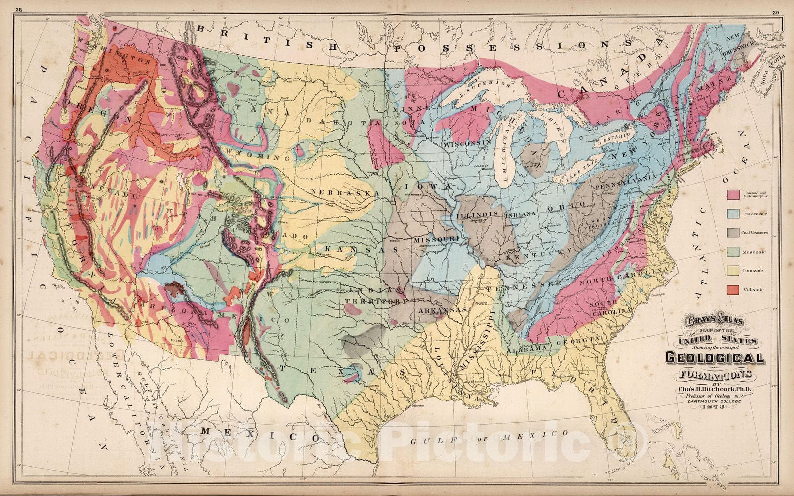
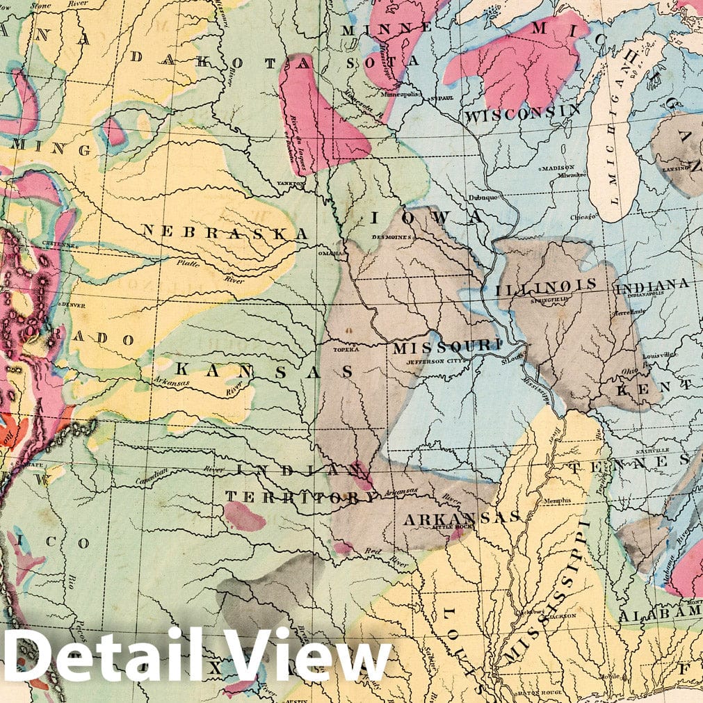
Gray's Atlas Map of the United States Showing the Principal Geological Formations by Cha's. H. Hitchcock, Ph.D. Professor of Geology in Dartmouth College. 1873. | Gray's Atlas Of The United States, With General Maps Of The World. Accompanied By Descriptions Geographical, Historical, Scientific and Statistical. By O.W. Gray, Civil And Topographical Engineer, No. 10 North Fifth Street, Philadelphia. Published By Stedman, Brown & Lyon, No. 10 North Fifth Street, Philadelphia. 1873. (on verso) Entered ... 1873, by O.W. Gray ... Washington. | First edition. Has same basic set of maps as the National Atlas and the Continental Atlas. Maps taken from Colton and Frank Gray (for example, Colton's single page Texas map from the 1856 World Atlas, updated). It is odd to see the Colton single page state maps from the 1856 edition atlas here reissued and updated almost twenty years later. Has an extra New Railroad and County Map of the States of Oregon, California and Nevada, in addition to the regular California/Nevada Map. There is also a business directory for San Francisco and Chicago. We believe this indicates that this edition was made for the west coast market; other editions used other regional maps, depending on the market. Maps are in full color.Atlas is bound in half leather dark green cloth covered boards stamped with "Gray's Atlas Of The United States And General Maps Of The World With Descriptions." in gilt; the spine reads "Gray's Atlas Of The United States."

item#: 556861_2416__M01

Free Shipping

We offer Free Standard Shipping for all orders within the United States. If you want your stuff there faster, see Expedited and Overnight shipping cost at checkout.

Our Guarantee

If you are not completely satisfied, just send the product back to us and we'll replace it with another one of your choice OR refund your purchase price 100%. Our address is on the contact us page.

100% Satisfaction

We painstakingly labor over the preparation and printing of each individual product we sell. We stand behind the materials and workmanship, and want nothing more than for you to be 100% happy with your order.

Just added to your wishlist:
My Wishlist
Just added to your cart:
My Cart