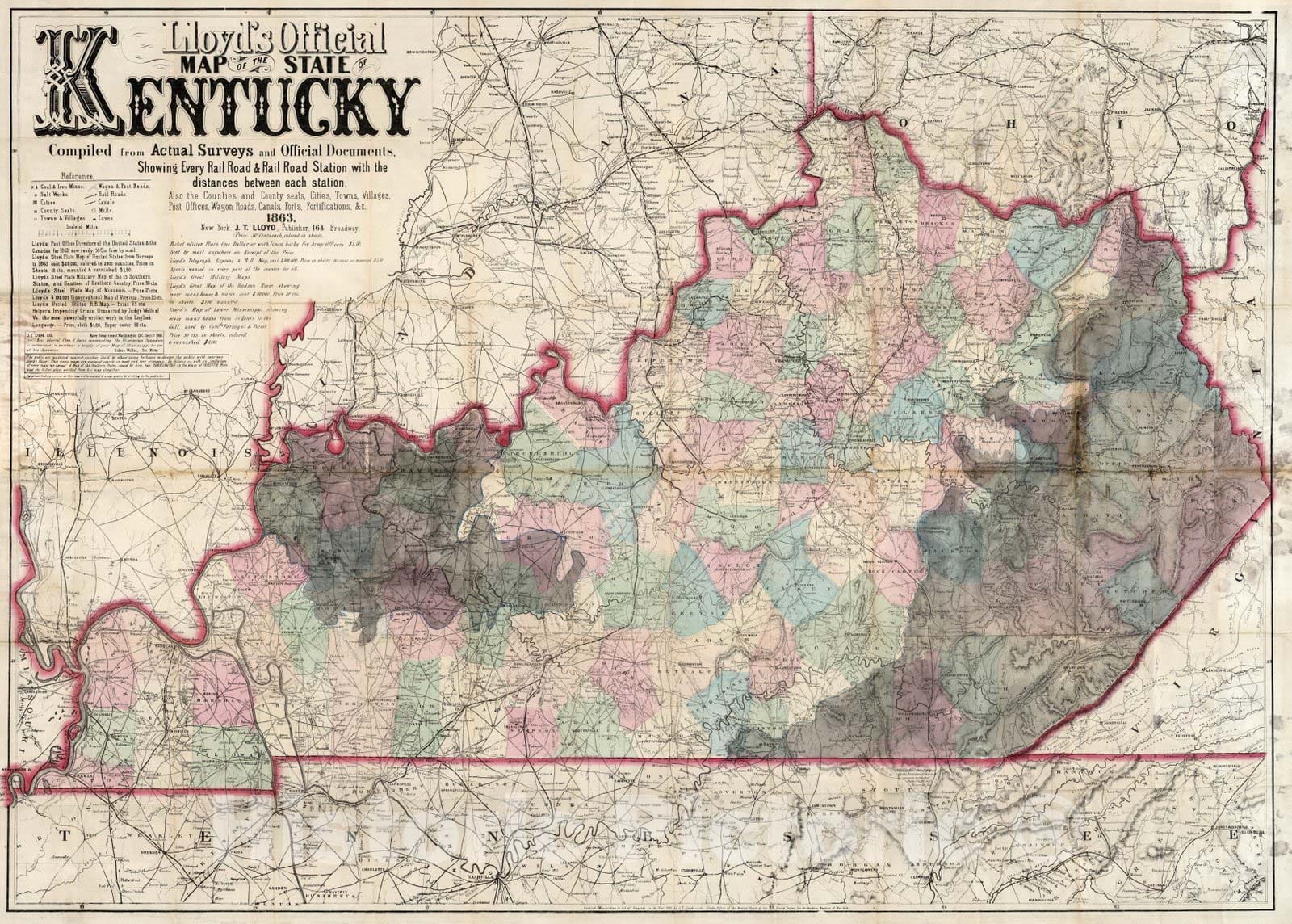
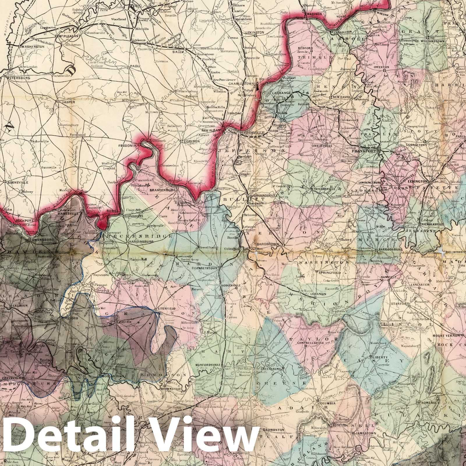
Lloyd's Official Map Of The State Of Kentucky Compiled from Actual Surveys and Official Documents, Showing Every Rail Road & Rail Road Station with the distances between each station ... 1863. New York, J.T. Lloyd, Publisher, 164 Broadway. Entered ... 1862 by J.T. Lloyd... New York. | Lloyd's Official Map Of The State Of Kentucky Compiled from Actual Surveys and Official Documents, Showing Every Rail Road & Rail Road Station with the distances between each station ... 1863. New York, J.T. Lloyd, Publisher, 164 Broadway. Entered ... 1862 by J.T. Lloyd... New York. | This is the same as our other copy except that the extensive coal fields in Eastern and Western Kentucky have been manuscript colored in gray wash, carefully delineated. David Owen published maps showing the Kentucky coal fields in 1852 and 1853 and they may have been the source of the information. The Kentucky coal fields were considered a strategic asset by the North in the Civil War. Coal mining in these areas began in earnest in the 1870's with the expansion of the railroads. This copy is folded into plain dark brown cloth covers 15x10, without the Colton imprint found in our other copy. Full color by county.
We print high quality reproductions of historical maps, photographs, prints, etc. Because of their historical nature, some of these images may show signs of wear and tear - small rips, stains, creases, etc. We believe that in many cases this contributes to the historical character of the item.


