icon

Free Shipping     |     Satisfaction Guaranteed

$49.99
& Free Shipping
  • MUSEUM QUALITY INKS AND PAPER: Printed on thick 192gsm heavyweight matte paper with archival giclee inks, this historic fine art will decorate your wall for years to come.
  • VINTAGE MAP REPRODUCTION: Add style to any room's decor with this beautiful print. Whether your interior design is modern or classic, a map is never out of fashion.
  • ATTENTION TO DETAIL: We edit every antique map for image quality, color and vibrance, so it can look its best while retaining historical character. Makes a great gift!
  • FRAME READY: Your unframed poster will arrive crease-free, rolled in a sturdy mailing tube. Many maps fit easy-to-find standard size frames 16x20, 16x24, 18x24, 24x30, 24x36, saving on custom framing.
  • Watermarks will not appear in the printed picture. Some blemishes, tears, or stamps may be removed from the final print.

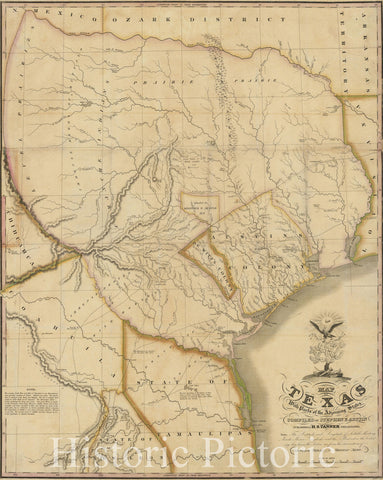
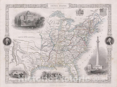
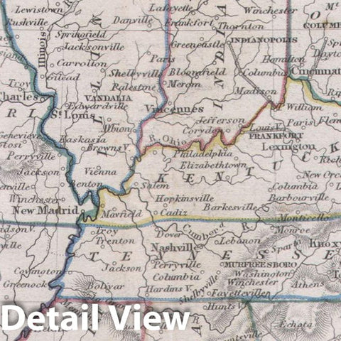
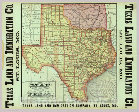
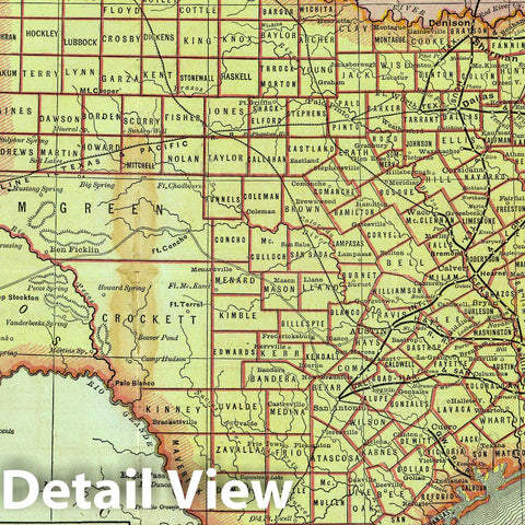
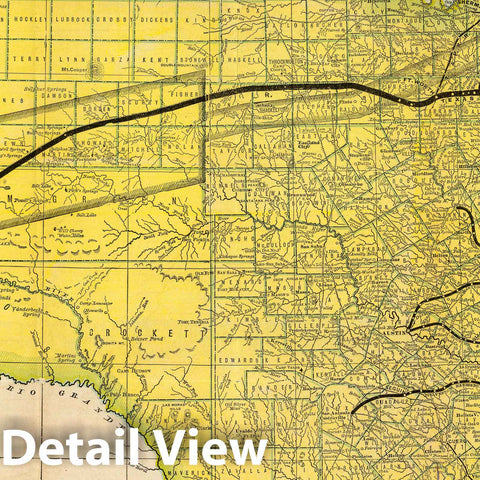
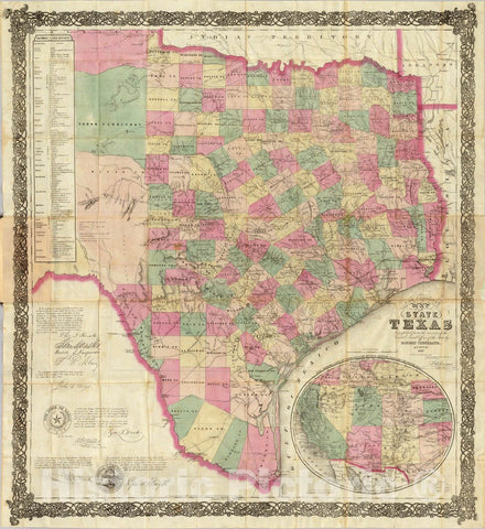
Geographical Description Of The State Of Texas; Also, Of That Part Of The West Coast Of North America, Which Includes Oregon, And Upper California. With Maps. Philadelphia: Thomas, Cowperthwait & Co. 1846. (on verso) Entered ... 1846, by Thomas, Cowperthwait & Co. ... Pennsylvania. (with) Map Of That Part Of The West Coast Of North America Comprising Oregon And Upper California. (with) Map Of The State Of Texas With Portions Of The Adjoining Regions. | A rare guide and map (actually two maps on one sheet) that is a "cousin" of Mitchell's "Accompaniment to Mitchell's New Map of Texas, Oregon and California with The Regions Adjoining" also issued in 1846. Although Howes lists this under Mitchell, Mitchell's name is not on any part of the guide or map; Streeter lists it under Thomas, Cowperthwait & Co., the publisher. There are 62 pages of text and several woodcut illustrations. The two full color maps are titled "Map of That Part of the West Coast of North America Comprising Oregon and Upper California" (26x20) and "Map of the State of Texas With Portions of the Adjoining Regions" (26x20) both printed on one sheet. These maps are earlier states of similar maps with slightly different titles that appear in Mitchell's School Atlas of 1846, maps #13 and #15.


We print high quality reproductions of historical maps, photographs, prints, etc. Because of their historical nature, some of these images may show signs of wear and tear - small rips, stains, creases, etc. We believe that in many cases this contributes to the historical character of the item.
item#: 553345_2416__M01

Free Shipping

We offer Free Standard Shipping for all orders within the United States. If you want your stuff there faster, see Expedited and Overnight shipping cost at checkout.

Our Guarantee

If you are not completely satisfied, just send the product back to us and we'll replace it with another one of your choice OR refund your purchase price 100%. Our address is on the contact us page.

100% Satisfaction

We painstakingly labor over the preparation and printing of each individual product we sell. We stand behind the materials and workmanship, and want nothing more than for you to be 100% happy with your order.

Just added to your wishlist:
My Wishlist
Just added to your cart:
My Cart