Skip to content
icon-X
Close menu
Maps
World Maps
World War 2 Maps
Pictorial Maps
USGS TopoGraphic Maps
Art Prints
Blueprints
Fine Art Museum Collections
Claude Monet
Photographs
Modern Photos
Posters
Collections
Kid's Room
Autos, Trains & Rails
Monet and Manet
Brewery, Beer, Liquor & more
Holiday Ready to Gift Products
Log in
Follow Us
instagram
Instagram
Facebook
twitter
Twitter
Cart
icon-X
Close cart
Your cart is currently empty.
Maps
World Maps
World War 2 Maps
Pictorial Maps
USGS TopoGraphic Maps
Art Prints
Blueprints
Fine Art Museum Collections
Claude Monet
Photographs
Modern Photos
Posters
Collections
Kid's Room
Autos, Trains & Rails
Monet and Manet
Brewery, Beer, Liquor & more
Holiday Ready to Gift Products
account
Log in
icon-search
Search
icon-hamburger
Site navigation
icon-bag-minimal
Cart
Search
Search
Free economy shipping for unframed orders of $75 or more!
Filter
icon-X
Close menu
Product type
Geologic Map
(1)
Map
(53)
Availability
In stock
(54)
Out of stock
(0)
Price
Arkansas State Maps
icon-filter
Filter
Historic Map : Department of The Interior General Land office Map - State of Arkansas. 1878 - Vintage Wall Art
From:
$49.99
Historic Map : States of Arkansas Mississippi and Louisiana Exhibiting the Counties, Cities & Villages; Rivers, Rail ways, & Common Roads including the Forts, Landings, Stations &c., 1862, Vintage Wall Art
From:
$49.99
Historic Map : States of Illinois, Missouri and Arkansas, 1857, Vintage Wall Art
From:
$49.99
Historic Map : States of Mississippi, Louisiana and the Arkansas Territory, 1832, Vintage Wall Art
From:
$49.99
Historic Map : National Highways map of the state of Arkansas showing twenty-two hundred miles of national highways proposed by the National Highways Association, 1919 , Vintage Wall Art
From:
$34.99
Historic Map : County Map of the States of Arkansas, Mississippi and Louisiana., 1867 , Vintage Wall Art
From:
$49.99
Historic Map : United States Maps, Arkansas 1894 , Vintage Wall Art
From:
$39.99
Map : Arkansas 1919, National Highways map of the state of Arkansas showing twenty-two hundred miles of national highways
From:
$34.99
Map : Arkansas 1916, National Highways preliminary map of the State of Arkansas showing eighteen hundred miles of national highways, Antique Vintage Reproduction
From:
$34.99
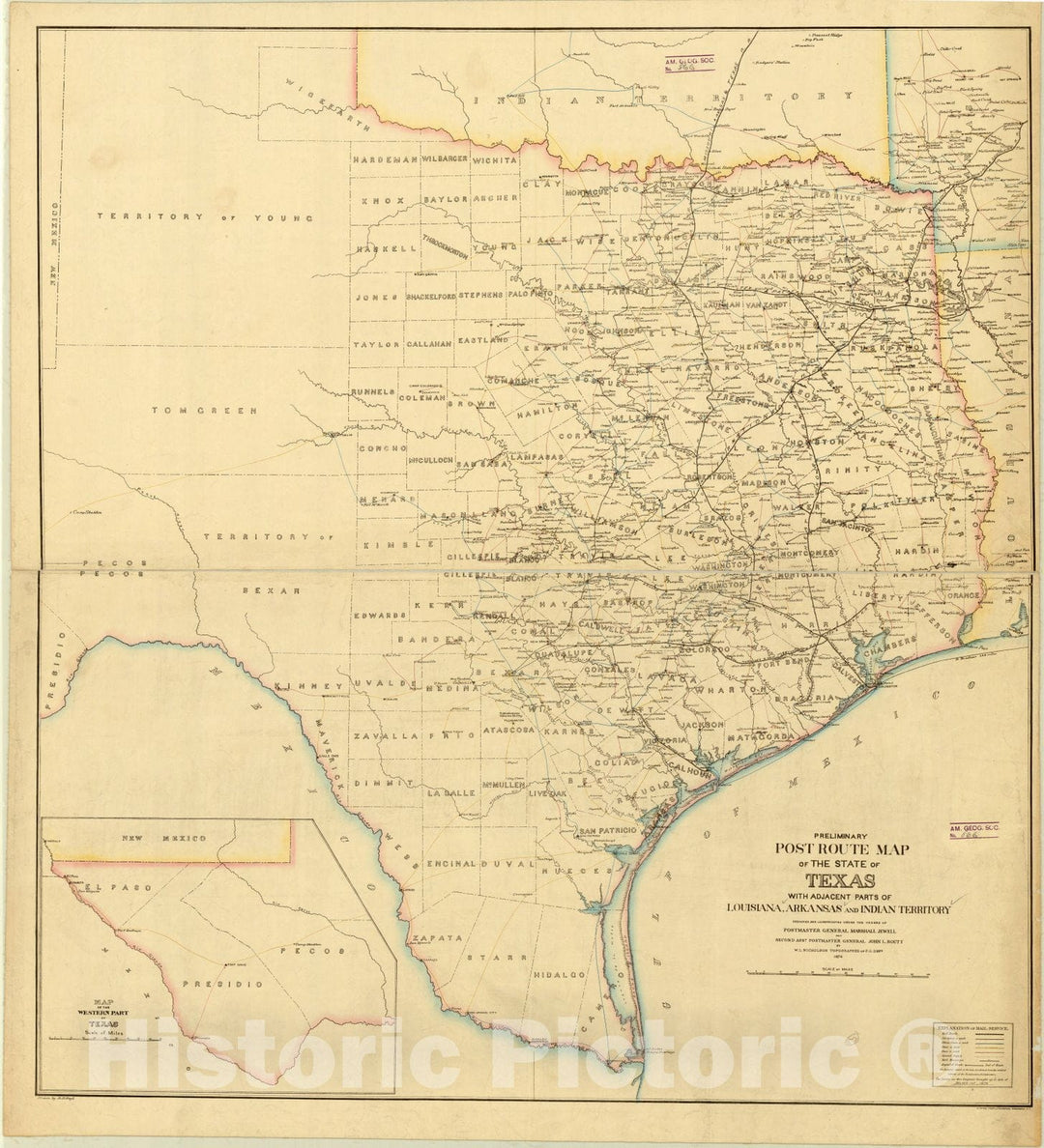
Map : Texas 1876, Preliminary post route map of the state of Texas : with adjacent parts of Louisiana, Arkansas and Indian Territory , Antique Vintage Reproduction
From:
$29.99
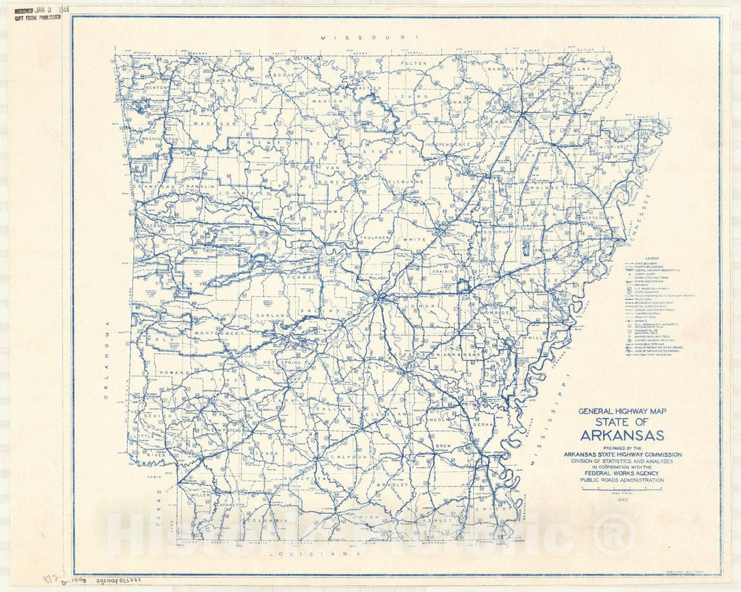
Map : Arkansas 1940, General highway map, State of Arkansas , Antique Vintage Reproduction
From:
$49.99
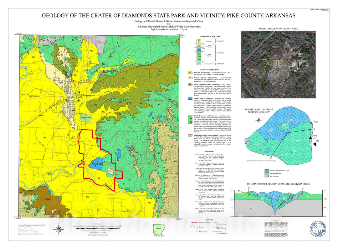
Map : Geology of the Crater of Diamonds State Park and vicinity, Pike County, Arkansas, 2007 Cartography Wall Art :
From:
$49.99
Historic Map - Civil War Proof maps : United States. - Arkansas
From:
$49.99
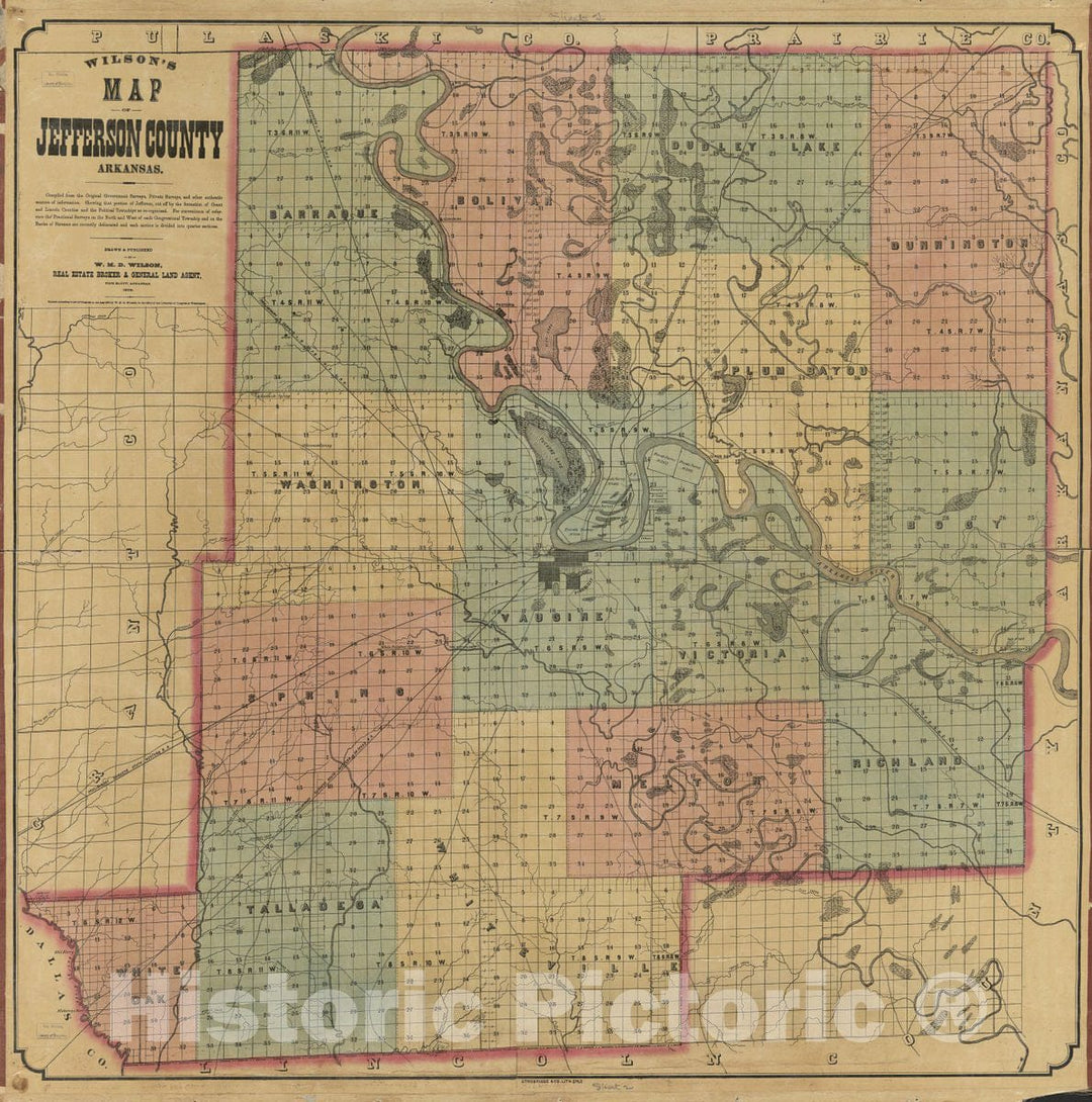
Historic 1872 Map - Wilson's map of Jefferson County, Arkansas/Drawn and published by W.H.D. Wilson, Real Estate Broker & General Land Agent.
From:
$34.99
Historic 1864 Map - Railway and County map of The Southern States; embracing The States of N. Carolina, S. Carolina, Georgia, Alabama, Florida, Mississippi, Louisiana, Arkansas, and Tenn
From:
$39.99
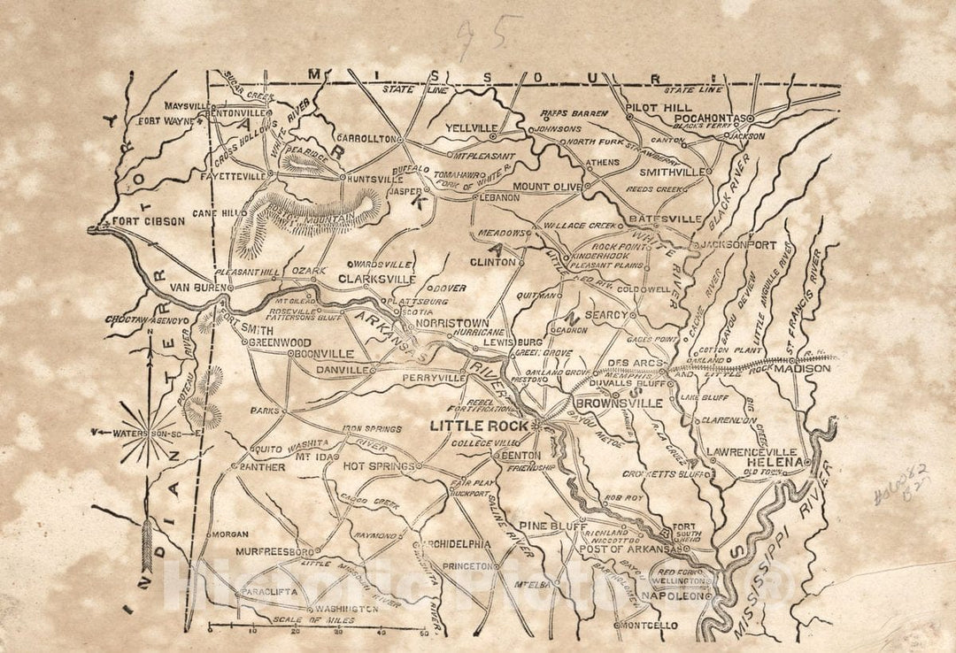
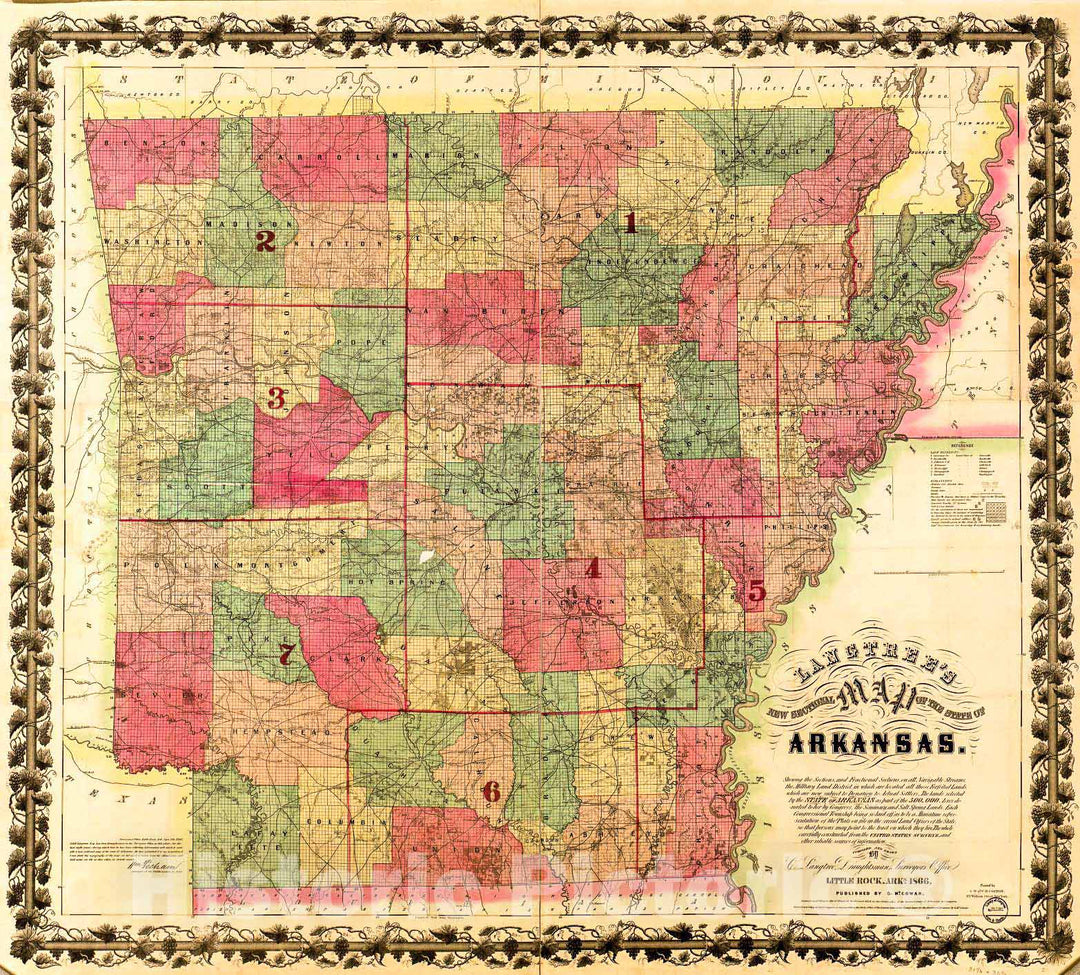
Historic 1866 Map - Langtree's New sectional map of The State of Arkansas
From:
$29.99
Historic 1861 Map - The Campaign Atlas, for 1861 : United States. - Arkansas
From:
$49.99
Historic Map : 1850 Map No. 6. United States (Mississippi, Louisiana, Arkansas and Texas) : Vintage Wall Art
From:
$49.99
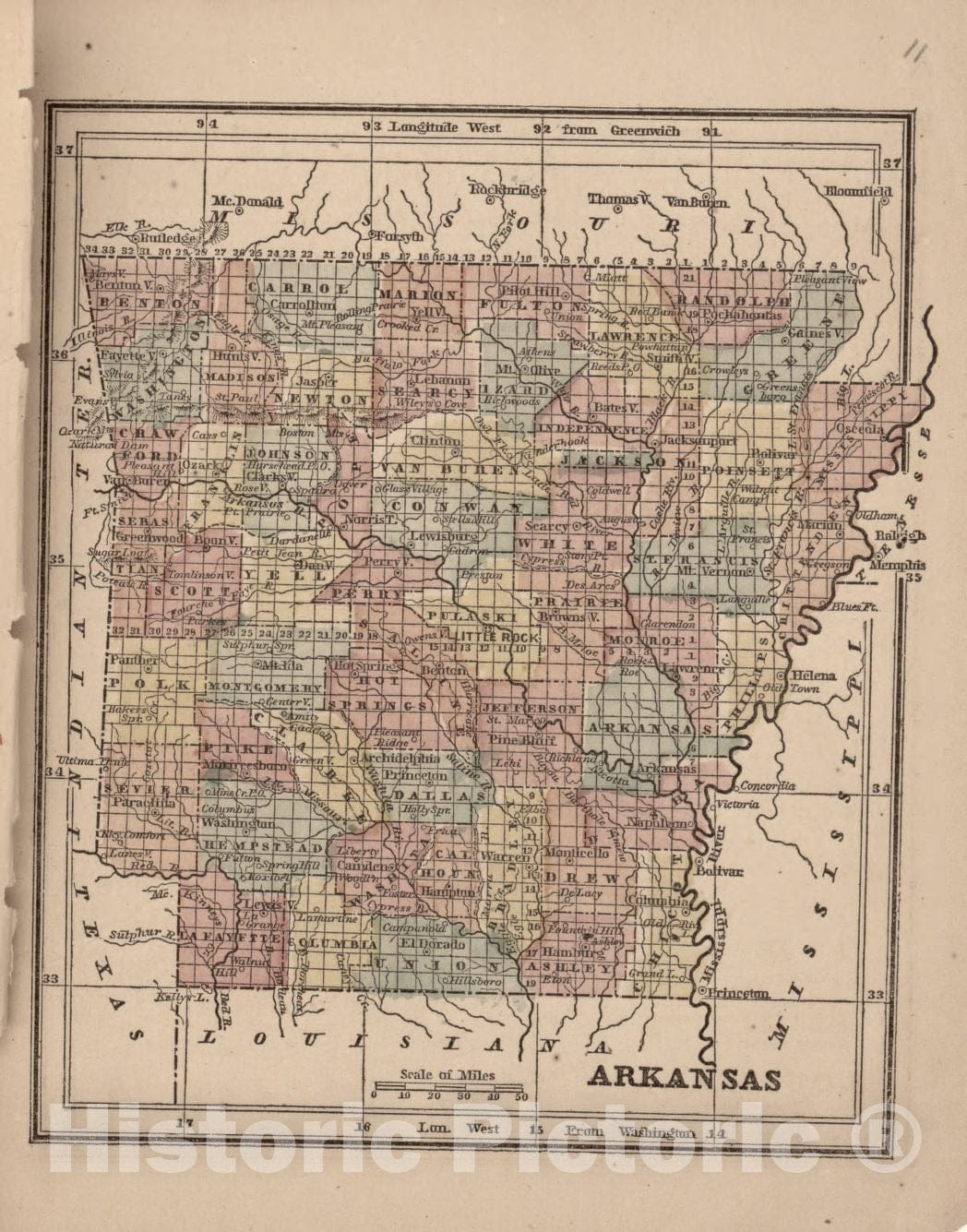
Historic Map : 1878 State of Arkansas : Vintage Wall Art
From:
$49.99
1
2
3
icon-chevron
Next
icon-X
"Close (esc)"
icon-chevron-left
icon-X
icon-chevron
icon-X
Arkansas State Wall Maps, Posters & Prints