Skip to content
icon-X
Close menu
Maps
World Maps
World War 2 Maps
Pictorial Maps
USGS TopoGraphic Maps
Art Prints
Blueprints
Fine Art Museum Collections
Claude Monet
Photographs
Modern Photos
Posters
Collections
Kid's Room
Autos, Trains & Rails
Monet and Manet
Brewery, Beer, Liquor & more
Holiday Ready to Gift Products
Log in
Follow Us
instagram
Instagram
Facebook
twitter
Twitter
Maps
World Maps
World War 2 Maps
Pictorial Maps
USGS TopoGraphic Maps
Art Prints
Blueprints
Fine Art Museum Collections
Claude Monet
Photographs
Modern Photos
Posters
Collections
Kid's Room
Autos, Trains & Rails
Monet and Manet
Brewery, Beer, Liquor & more
Holiday Ready to Gift Products
account
Log in
icon-search
Search
icon-hamburger
Site navigation
icon-bag-minimal
Cart
Search
Search
Free economy shipping for unframed orders of $75 or more!
Filter
icon-X
Close menu
Product type
Geologic Map
(11)
Map
(100)
Topographic Map
(31)
Availability
In stock
(143)
Out of stock
(0)
Price
Atlanta Maps
icon-filter
Filter
Historic Map - Germany: Map of the Occupation Areas/Map depicts Germany and Central Europe in the immediate wake of World War II, 1945, Atlanta Map - Vintage Wall Art
From:
$49.99
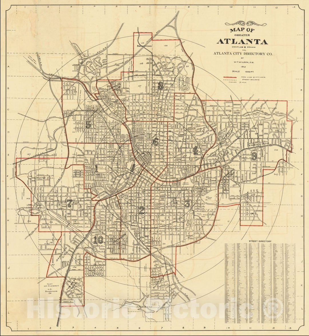
Historic Map : Greater Atlanta, 1912, Vintage Wall Art
From:
$29.99
Historic Map : Atlanta, 1892, Vintage Wall Art
From:
$49.99
Historic Map : Atlanta 1889 H.H. Saunders Publisher Office Chamber of Commerce, 1889, Vintage Wall Art
From:
$29.99
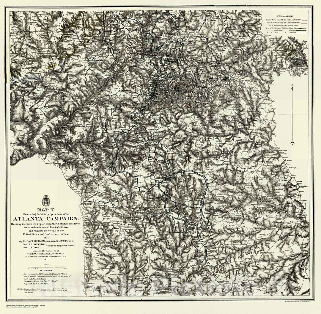
Historic Map : Title to maps 1 to 19 inclusive. Campaign maps showing position of the 20th Army Corps on the march from Chattanooga, Tenn., to Atlanta, 1864 , Vintage Wall Art
From:
$49.99
Historic Map : Map illustrating the siege of Atlanta, GA. by the United States Forces under command of Maj. Gen. W. T. Sherman from the passage of Peach Tree Creek, 1865 , Vintage Wall Art
From:
$49.99
Historic Map : Campaign Maps (Numbers 1 to 11 inclusive) showing position of the 20th Army Corps on march from Atlanta, GA., to Savannah, GA., 1865 , Vintage Wall Art
From:
$49.99
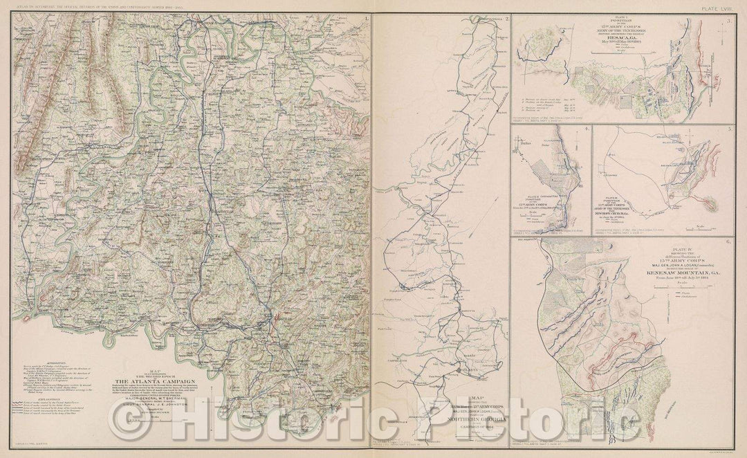
Historic Map : Map illustrating the second epoch of The Atlanta Campaign embracing the region from Resaca to the Etowah River, 1864 , Vintage Wall Art
From:
$49.99
Historic Nautical Map - Atlanta and Vicinity, GA, 1864 Civil War Historic Nautical Map - Vintage Wall Art
From:
$49.99
Historic Nautical Map - Map Illustrating The Military Operations In Front Of Atlanta, GA, 1875 Civil War Historic Nautical Map - Vintage Wall Art
From:
$34.99
Historic Nautical Map - The Operations Of The National Forces Under The Command Of Sherman During The Campaign Resulting In The Capture Of Atlanta, GA, 1864 Civil War Historic Nautical Map - Poster Wall Art Reprint - 0
From:
$49.99
Historic Nautical Map - Map Illustrating The Siege Of Atlanta, Ga, GA, 1864 Civil War Historic Nautical Map - Vintage Wall Art
From:
$39.99
Historic Nautical Map - Atlanta Campaign, Region From Chattahoochee River To Jonesboro, 5 Of 5, GA, 1877 NOAA Civil War - Vintage Wall Art
From:
$34.99
Historic Nautical Map - Atlanta Campaign, Region From Pine To Campbellton, 4 Of 5, GA, 1874 NOAA Civil War - Vintage Wall Art
From:
$34.99
Historic Nautical Map - Atlanta Campaign, Region From Rome To Marietta, 3 Of 5, GA, 1876 NOAA Civil War - Vintage Wall Art
From:
$49.99
Historic Nautical Map - Atlanta Campaign, Region From Resaca To Ackworth, 2 Of 5, GA, 1877 NOAA Civil War - Vintage Wall Art
From:
$49.99
Historic Nautical Map - Atlanta Campaign, Region From Tennessee River To Oostanaula River, 1 Of 5, GA, 1875 NOAA Civil War - Vintage Wall Art
From:
$49.99
Map : Atlanta, Georgia 1864 2, Antique Vintage Reproduction
From:
$49.99
1
2
3
…
8
icon-chevron
Next
icon-X
"Close (esc)"
icon-chevron-left
icon-X
icon-chevron
icon-X
Atlanta Maps, Posters & Prints