Skip to content
icon-X
Close menu
Maps
World Maps
World War 2 Maps
Pictorial Maps
USGS TopoGraphic Maps
Art Prints
Blueprints
Fine Art Museum Collections
Claude Monet
Photographs
Modern Photos
Posters
Collections
Kid's Room
Autos, Trains & Rails
Monet and Manet
Brewery, Beer, Liquor & more
Holiday Ready to Gift Products
Log in
Follow Us
instagram
Instagram
Facebook
twitter
Twitter
Maps
World Maps
World War 2 Maps
Pictorial Maps
USGS TopoGraphic Maps
Art Prints
Blueprints
Fine Art Museum Collections
Claude Monet
Photographs
Modern Photos
Posters
Collections
Kid's Room
Autos, Trains & Rails
Monet and Manet
Brewery, Beer, Liquor & more
Holiday Ready to Gift Products
account
Log in
icon-search
Search
icon-hamburger
Site navigation
icon-bag-minimal
Cart
Search
Search
Free economy shipping for unframed orders of $75 or more!
Filter
icon-X
Close menu
Product type
Geologic Map
(16)
Map
(141)
Print
(1)
Topographic Map
(51)
Availability
In stock
(209)
Out of stock
(0)
Price
Berlin Maps
icon-filter
Filter
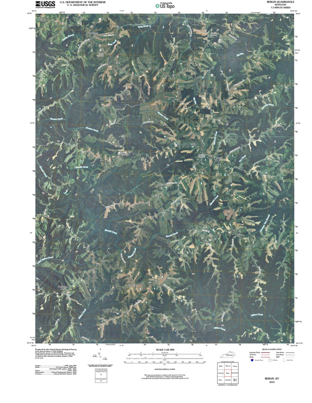
2010 Berlin, KY - Kentucky - USGS Topographic Map
From:
$49.99
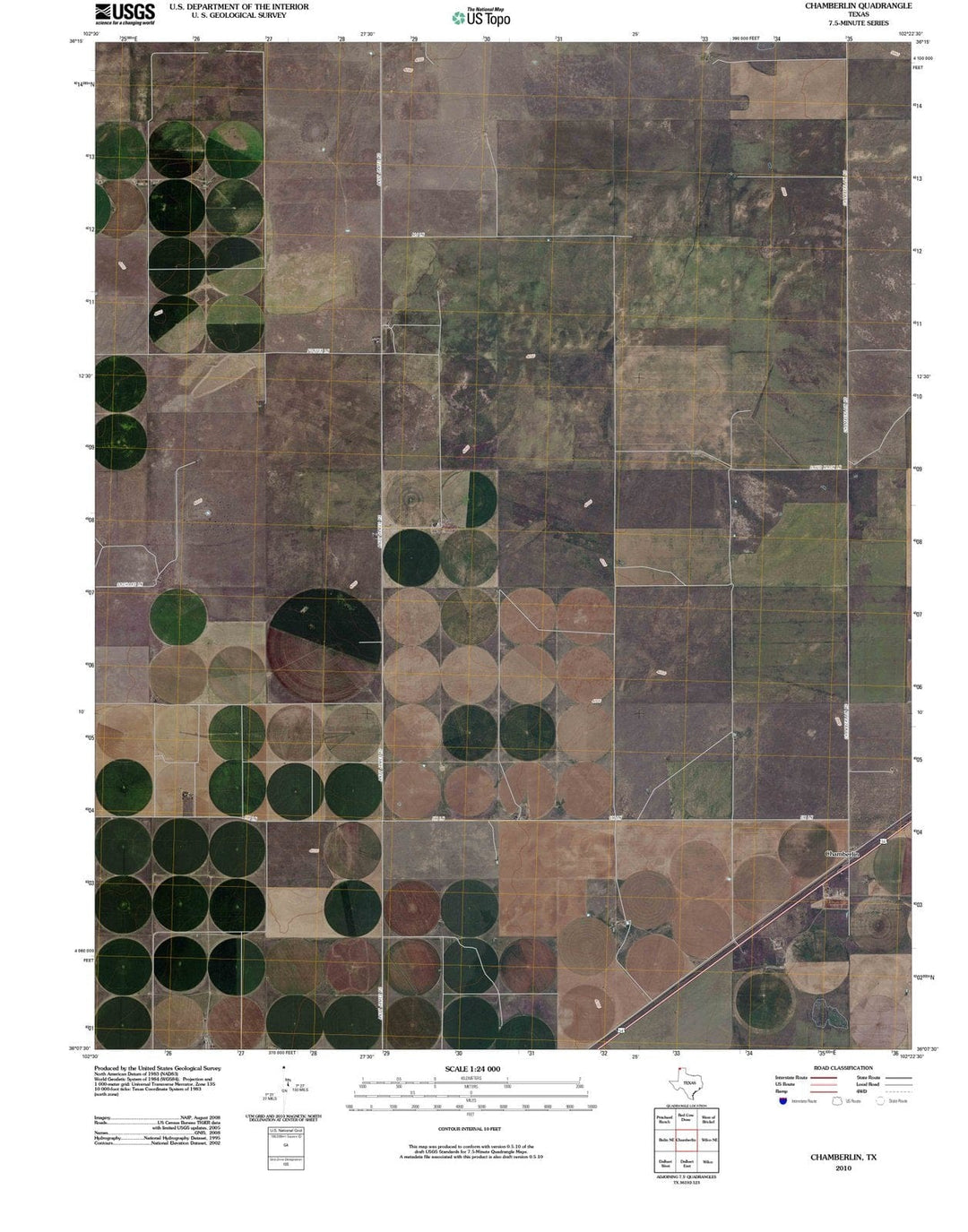
2010 Chamberlin, TX - Texas - USGS Topographic Map
From:
$49.99
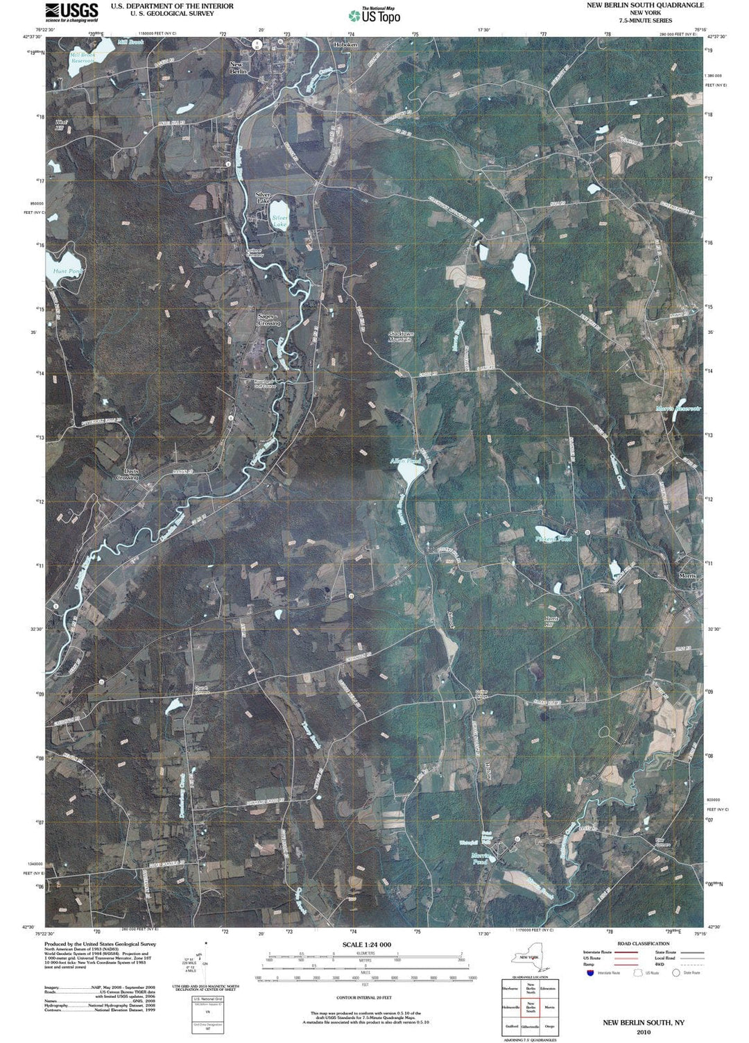
2010 New Berlin South, NY - New York - USGS Topographic Map
From:
$49.99
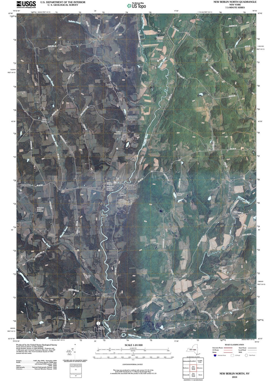
2010 New Berlin North, NY - New York - USGS Topographic Map
From:
$49.99
Historic Map - of the Occupation Areas :: depicts Germany and Central Europe in the immediate wake of World War II, Potsdam Conference,Berlin, 1945, 1945 - Vintage Wall Art
From:
$49.99
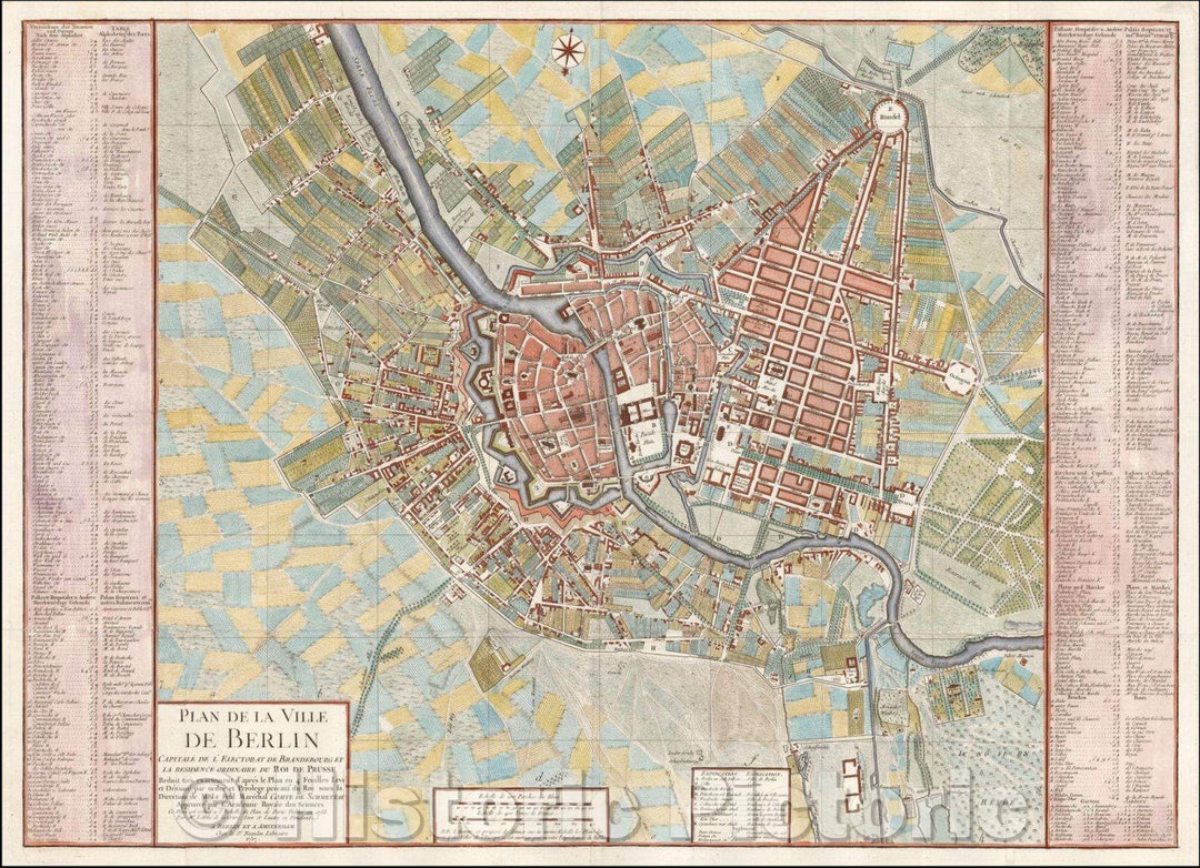
Historic Map - Plan de la Ville de Berlin Capitale de L'Electorat de Brandebourg et la re, 1757 - Vintage Wall Art
From:
$49.99
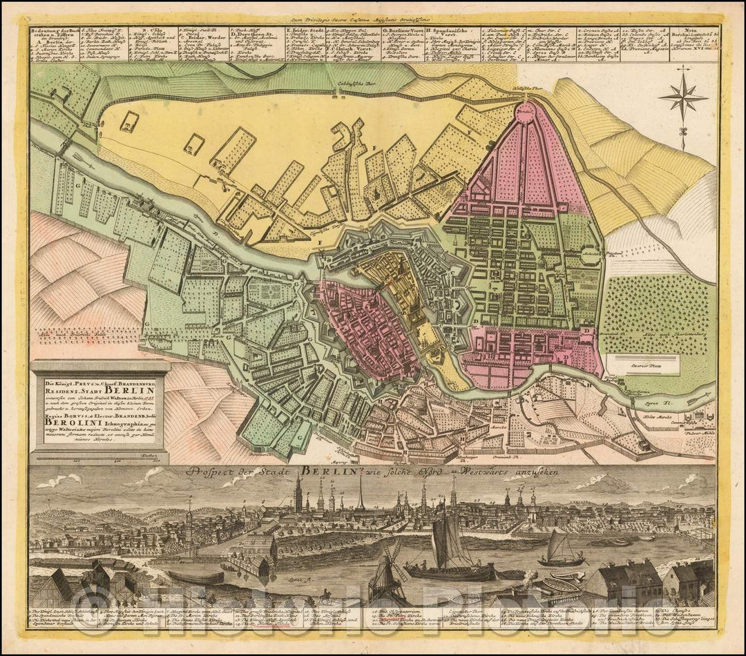
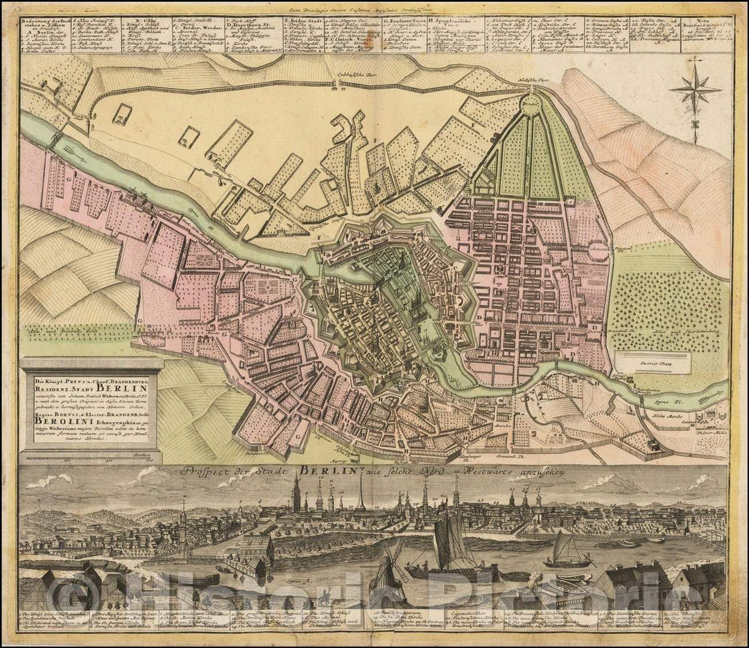
Historic Map - Die Konigl. Preus. u. Churf. Brandenburg. Residenz-Stadt Berlin, 1740, Homann Heirs v2
From:
$29.99
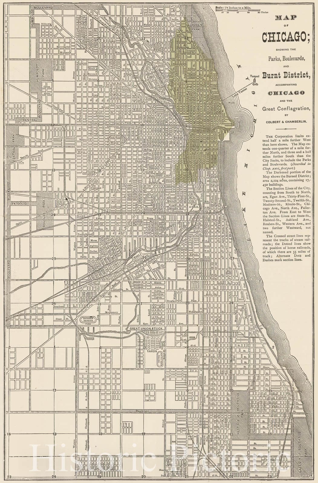
Historic Map of Chicago, Illinois(IL),1872, showing Parks, Boulevards, Colbert & Chamberlin - Vintage Wall Art
From:
$49.99
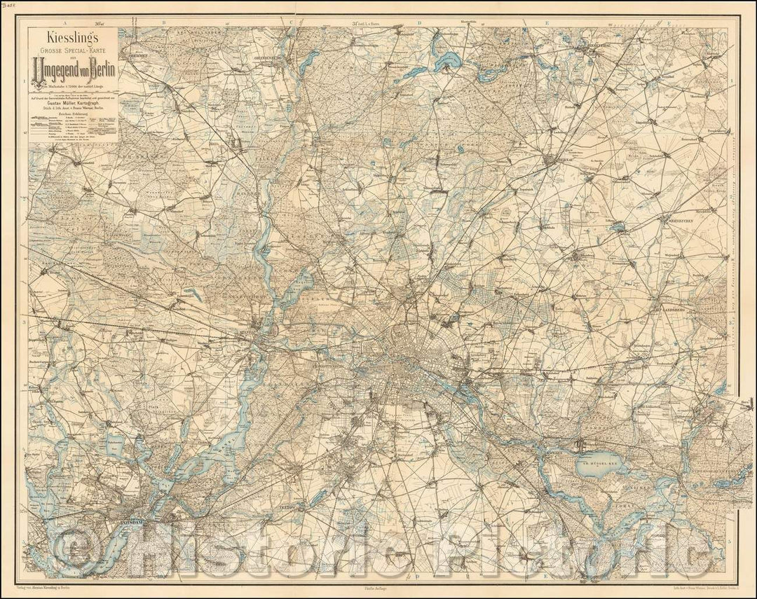
Historic Map - Kiessling's Grosse Special-Karte der Umgegend von Berlin/Map of the area around Berlin, 1900, Alexius Kiessling - Vintage Wall Art
From:
$49.99
Historic Map - Die Konigl. Preus. u. Churf. Brandenburg. Residenz-Stadt Berlin, 1740, Homann Heirs v1
From:
$49.99
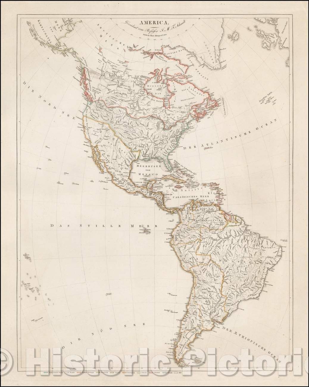
Historic Map - America Gezeichnet vom Professor J. M. F. Schmidt/Map of America, published in Berlin in 1820 by Simon Schropp et. Co, 1820 - Vintage Wall Art
From:
$49.99
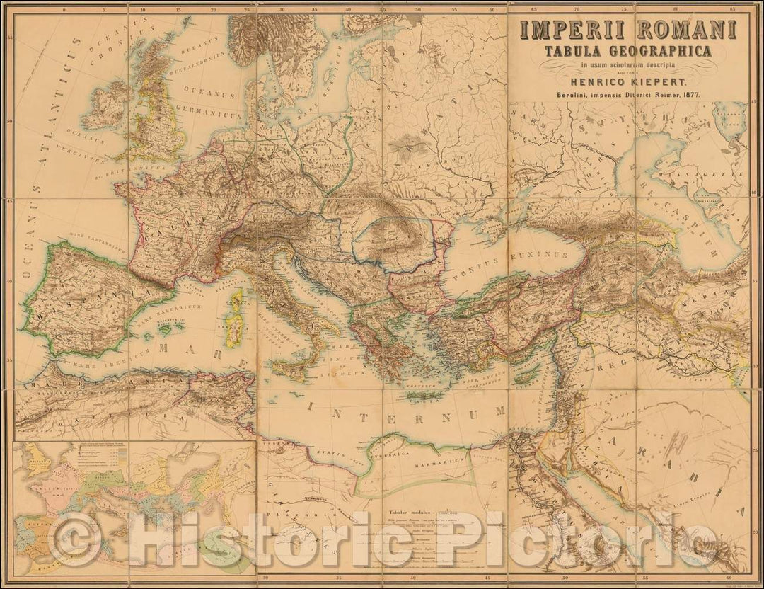
Historic Map - Imperii Romani Tabula Geographica in usum scholarum descripta Auctore Henrico Kiepert :: Roman Empire, published in Berlin by Kiepert, 1877 - Vintage Wall Art
From:
$49.99
Historic Map - Chart of the World on Mercator's Projection [with City plans of London, Paris, Berlin, Cairo, St. Petersberg & Vienna], 1897, George F. Cram v2
From:
$49.99
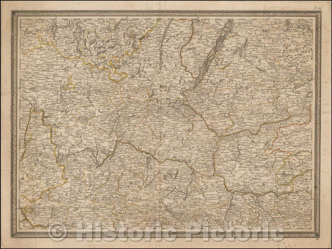
Historic Map - Eastern Germany, Western Poland (Berlin, Szczecin, Frankfurt Am Oder, Kro/Eastern Germany, 1790 - Vintage Wall Art
From:
$49.99
Historic Map - Berolinum. Berlin/Berolinum. Berlin, 1760, Georg Balthasar Probst - Vintage Wall Art
From:
$29.99
Historic Map - Berlin, Germany, 1760, Jeremiah Wolff - Vintage Wall Art
From:
$29.99
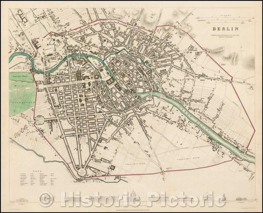
Historic Map - Berlin, Germany, 1833, SDUK v4
From:
$49.99
Historic Map - Chart of the World on Mercator's Projection [with City plans of London, Paris, Berlin, Cairo, St. Petersberg & Vienna], 1897, George F. Cram v1
From:
$49.99
Historic Map - Berlin, Germany, 1833, SDUK v3
From:
$49.99
icon-chevron-left
Previous
1
…
5
6
7
8
9
…
11
icon-chevron
Next
icon-X
"Close (esc)"
icon-chevron-left
icon-X
icon-chevron
icon-X
Berlin Maps, Posters & Prints

![Historic Map - Chart of the World on Mercator's Projection [with City plans of London, Paris, Berlin, Cairo, St. Petersberg & Vienna], 1897, George F. Cram v2](http://www.historicpictoric.com/cdn/shop/products/5189432_1wmrk.jpg?v=1598002182&width=1080)


![Historic Map - Chart of the World on Mercator's Projection [with City plans of London, Paris, Berlin, Cairo, St. Petersberg & Vienna], 1897, George F. Cram v1](http://www.historicpictoric.com/cdn/shop/products/5184689_1wmrk.jpg?v=1597998309&width=1080)
