Skip to content
icon-X
Close menu
Maps
World Maps
World War 2 Maps
Pictorial Maps
USGS TopoGraphic Maps
Art Prints
Blueprints
Fine Art Museum Collections
Claude Monet
Photographs
Modern Photos
Posters
Collections
Kid's Room
Autos, Trains & Rails
Monet and Manet
Brewery, Beer, Liquor & more
Holiday Ready to Gift Products
Log in
Follow Us
instagram
Instagram
Facebook
twitter
Twitter
Maps
World Maps
World War 2 Maps
Pictorial Maps
USGS TopoGraphic Maps
Art Prints
Blueprints
Fine Art Museum Collections
Claude Monet
Photographs
Modern Photos
Posters
Collections
Kid's Room
Autos, Trains & Rails
Monet and Manet
Brewery, Beer, Liquor & more
Holiday Ready to Gift Products
account
Log in
icon-search
Search
icon-hamburger
Site navigation
icon-bag-minimal
Cart
Search
Search
Free economy shipping for unframed orders of $75 or more!
Filter
icon-X
Close menu
Product type
Map
(66)
Availability
In stock
(66)
Out of stock
(0)
Price
Delaware State Maps
icon-filter
Filter
Historic Map : States of Delaware, Maryland, Virginia, with District of Columbia, 1857, Vintage Wall Art
From:
$49.99
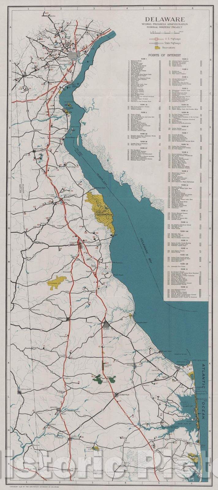
Historic Map : Delaware; a guide to the first state, compiled and written by the Federal writers' project of the WPA, c1940 , Vintage Wall Art
From:
$29.99
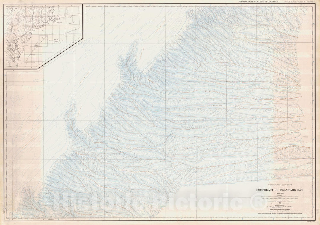
Historic Nautical Map - United States - East Coast Southeast Of Delaware Bay, USA, 1939 NOAA Chart - Vintage Wall Art
From:
$49.99
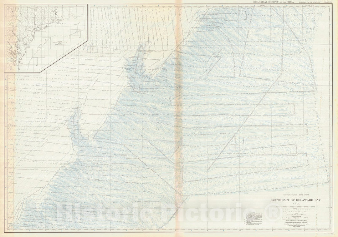
Historic Nautical Map - United States - East Coast Southeast Of Delaware Bay, USA, 1939 NOAA Bathymetric Historic Nautical Map - Vintage Wall Art
From:
$49.99
Historic Map : United States Maps, Delaware & Maryland 1894 , Vintage Wall Art
From:
$49.99
Historic Map - 1796 Delaware, The States Of Maryland And Delaware, From The Latest Surveys, 1795 - Vintage Wall Art
From:
$49.99
Historic 1842-[1845] Map - Maryland And Delaware. - United States - Delaware - Maps - Maryland - Atlases Of The United States - Vintage Wall Art
From:
$49.99
Historic 1828 Map - Virginia, Maryland, And Delaware - United States - Virginia - Maps - Virginia - Delaware - Maryland - Delaware - Maps - Maryland - Maps - Vintage Wall Art
From:
$49.99
Historic 1794 Map - Map Of Virginia, Maryland And Delaware - United States - Vintage Wall Art
From:
$49.99
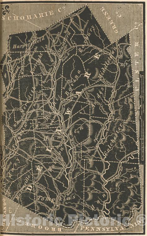
Historic 1838 Map - Delaware County. - New York (State) - Delaware County (N.Y.New York Atlas. - Vintage Wall Art
From:
$49.99
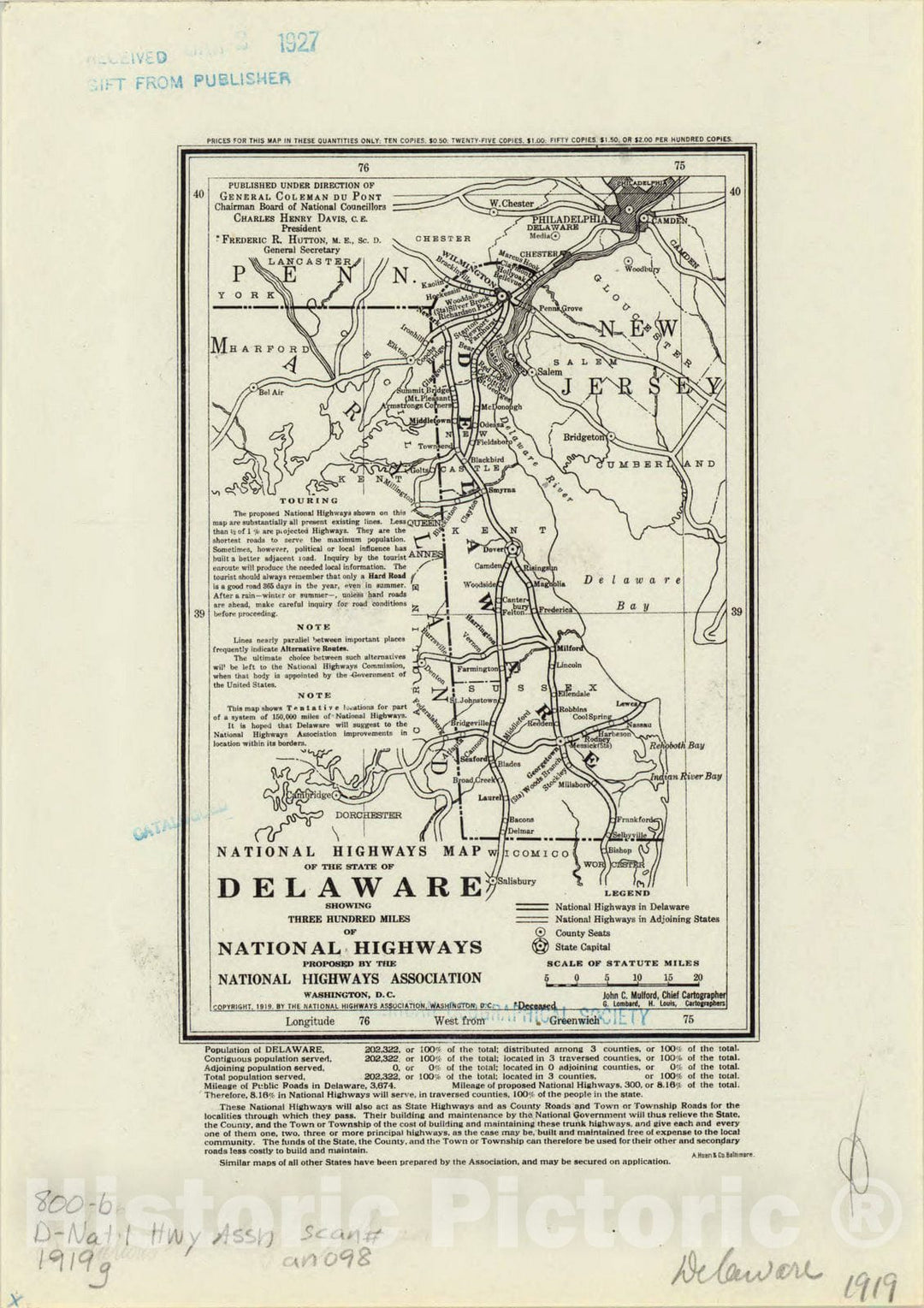
Map : Delaware 1919, National highways map of the state of Delaware : showing three hundred miles of national highways
From:
$49.99
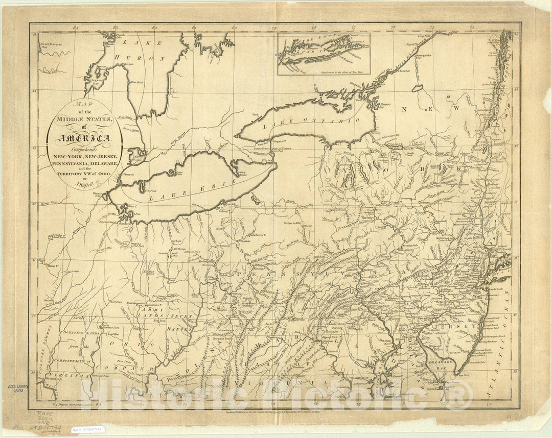
Map : United States, northeastern 1794, Map of the middle states of America : comprehends New-York, New-Jersey, Pennsylvania, Delaware, and the territory N.W. of Ohio
From:
$49.99
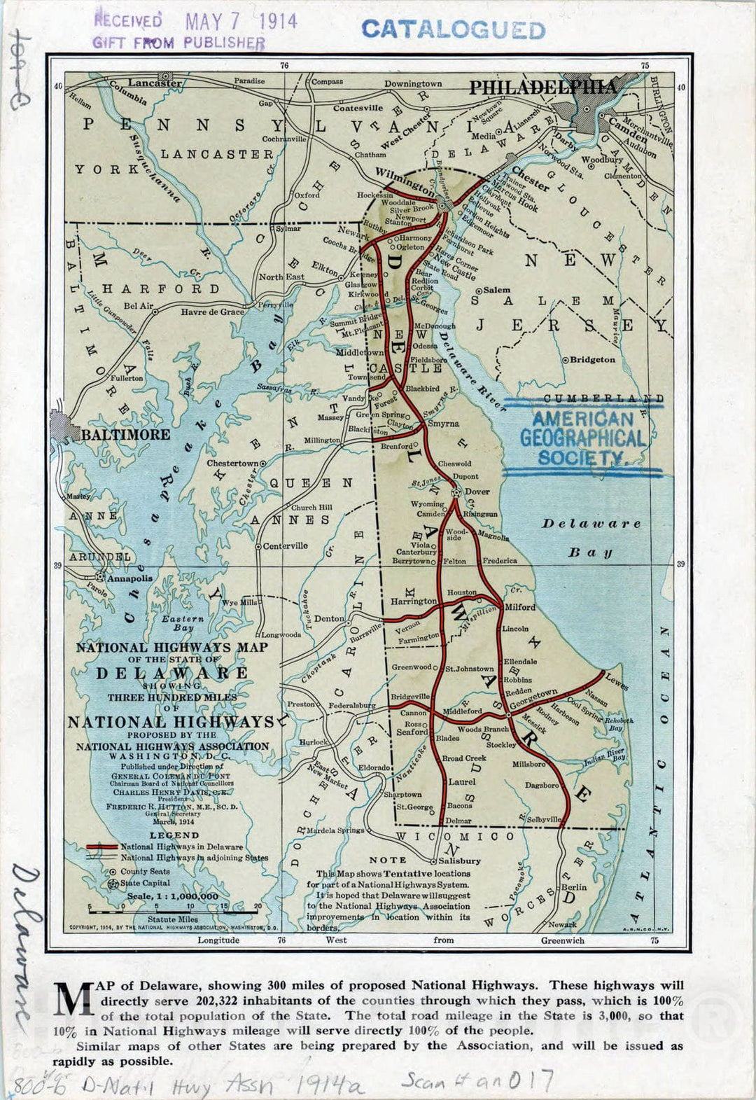
Map : Delaware 1914, National highways map of the state of Delaware : showing three hundred miles of national highways proposed by the National Highways Association
From:
$49.99
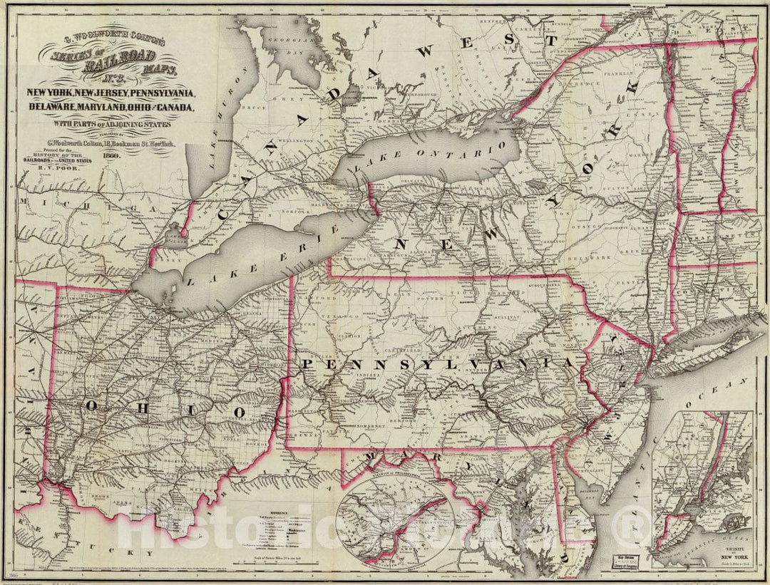
Historic 1860 Map - New York, New Jersey, Pennsylvania, Delaware, Maryland, Ohio and Canada, with Parts of adjoining States.
From:
$49.99
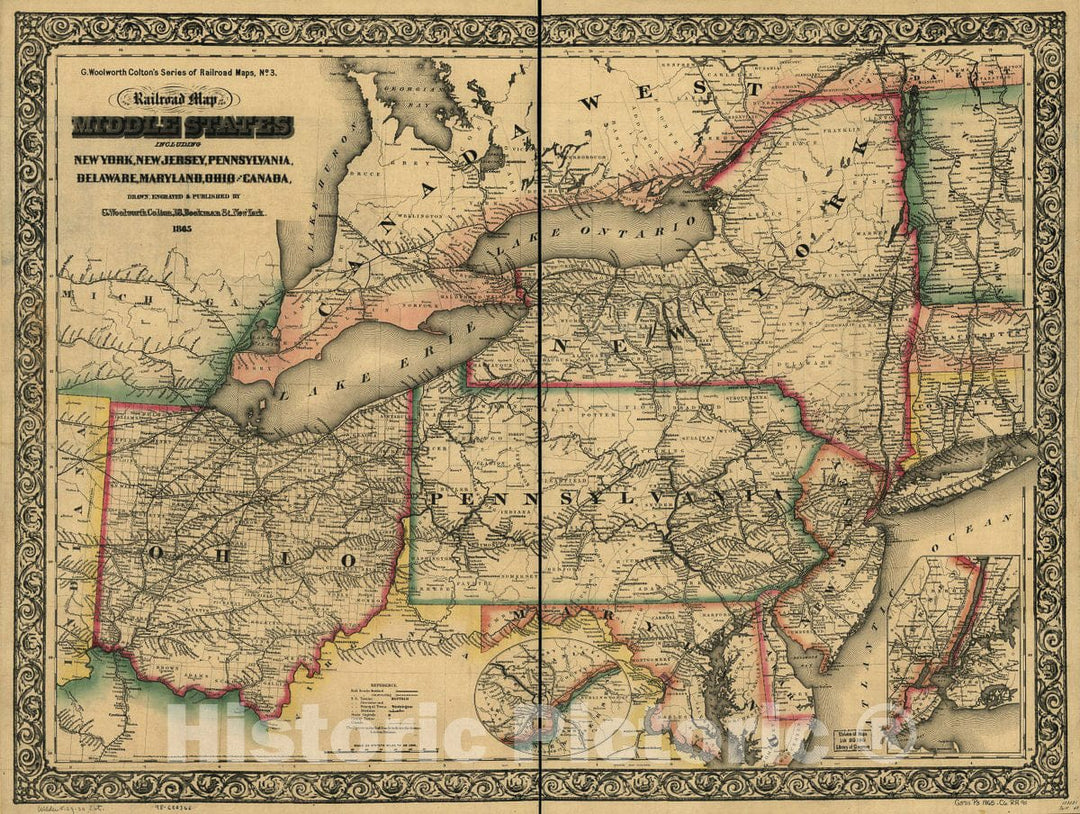
Historic 1865 Map - New Railroad map of The Middle States Including New York, New Jersey, Pennsylvania, Delaware, Maryland, Ohio and Canada
From:
$49.99
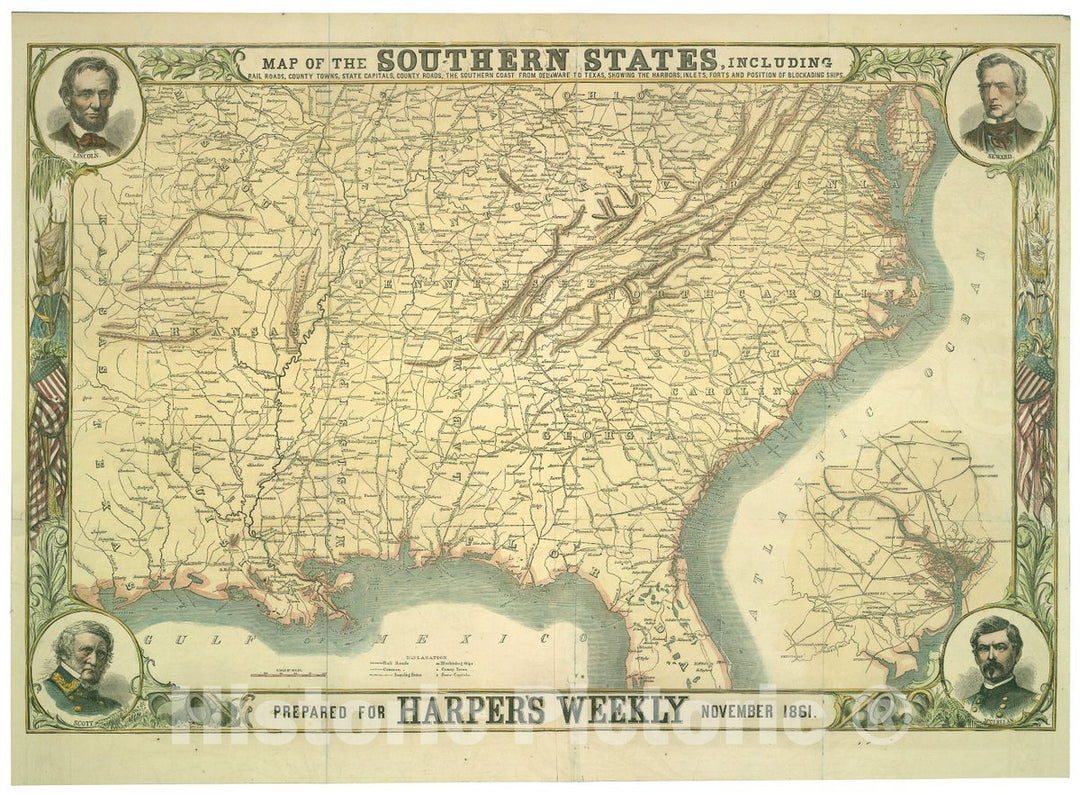
Historic 1861 Map - Map of The Southern States, Including Rail Roads, County Towns, State Capitals, County Roads, The Southern Coast from Delaware to Texas, Showing The Harbors, inlets
From:
$49.99
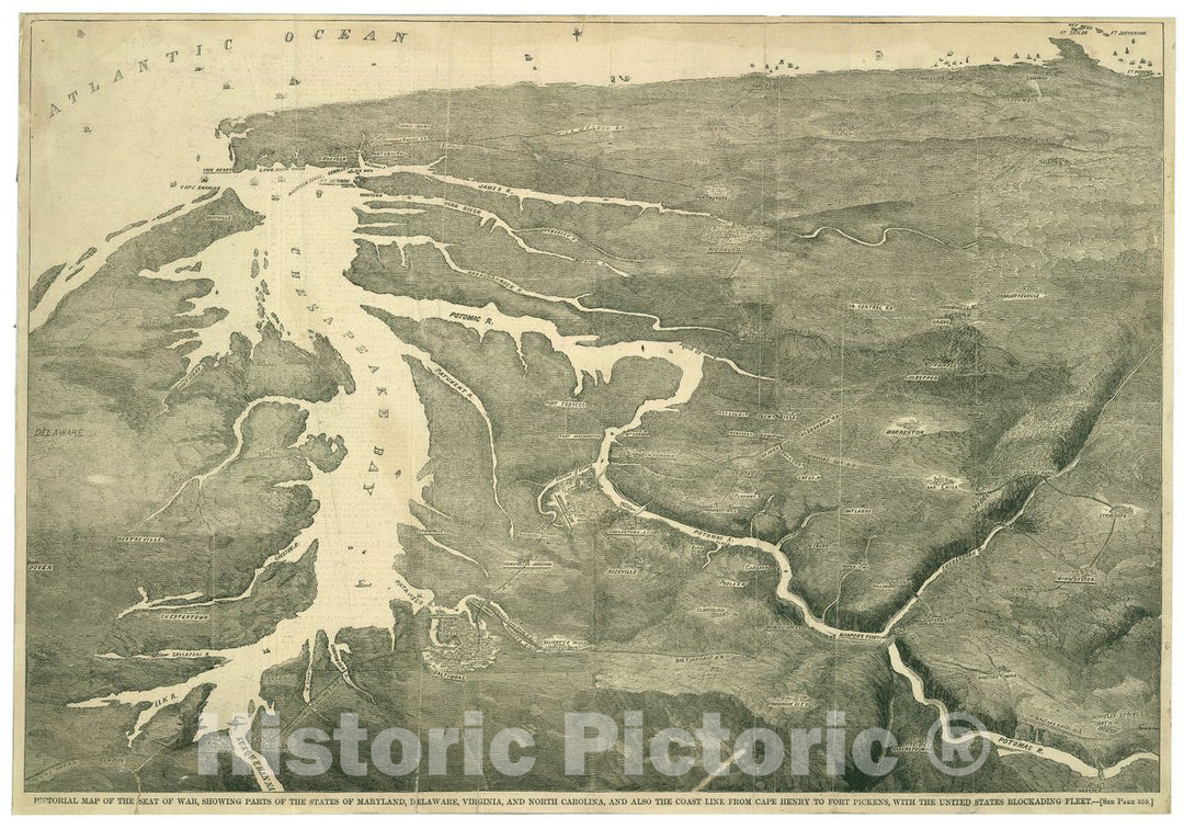
Historic 1861 Map - Pictorial map of The seat of war, Showing Parts of The States of Maryland, Delaware, Virginia, and North Carolina, and Also The Coast line from Cape Henry
From:
$49.99
Historic 1864 Map - Colton's New Topographical map of The States of Virginia, Maryland and Delaware, Showing Also Eastern Tennessee
From:
$49.99
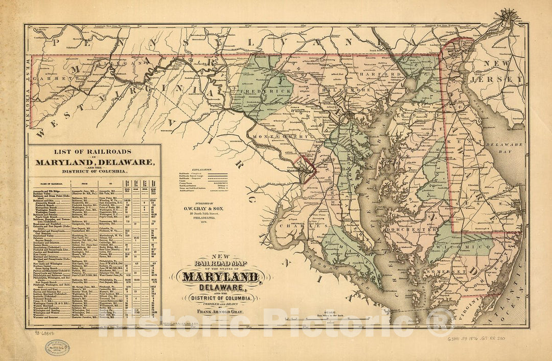
Historic 1876 Map - New Railroad map of The State of Maryland, Delaware, and The District of Columbia. Compiled and Drawn by Frank Arnold Gray.
From:
$49.99
1
2
3
4
icon-chevron
Next
icon-X
"Close (esc)"
icon-chevron-left
icon-X
icon-chevron
icon-X
Delaware State Wall Maps, Posters & Prints


![Historic 1842-[1845] Map - Maryland And Delaware. - United States - Delaware - Maps - Maryland - Atlases Of The United States - Vintage Wall Art](http://www.historicpictoric.com/cdn/shop/products/5129119_1wmark.jpg?v=1683482684&width=1080)