Skip to content
icon-X
Close menu
Maps
World Maps
World War 2 Maps
Pictorial Maps
USGS TopoGraphic Maps
Art Prints
Blueprints
Fine Art Museum Collections
Claude Monet
Photographs
Modern Photos
Posters
Collections
Kid's Room
Autos, Trains & Rails
Monet and Manet
Brewery, Beer, Liquor & more
Holiday Ready to Gift Products
Log in
Follow Us
instagram
Instagram
Facebook
twitter
Twitter
Maps
World Maps
World War 2 Maps
Pictorial Maps
USGS TopoGraphic Maps
Art Prints
Blueprints
Fine Art Museum Collections
Claude Monet
Photographs
Modern Photos
Posters
Collections
Kid's Room
Autos, Trains & Rails
Monet and Manet
Brewery, Beer, Liquor & more
Holiday Ready to Gift Products
account
Log in
icon-search
Search
icon-hamburger
Site navigation
icon-bag-minimal
Cart
Search
Search
Free economy shipping for unframed orders of $75 or more!
Filter
icon-X
Close menu
Product type
Geologic Map
(1)
Map
(103)
Topographic Map
(5)
Availability
In stock
(109)
Out of stock
(0)
Price
Georgia State Maps
icon-filter
Filter
Historic Map - Map of the State of Georgia, 1859, James R. Butts - Vintage Wall Art
From:
$49.99
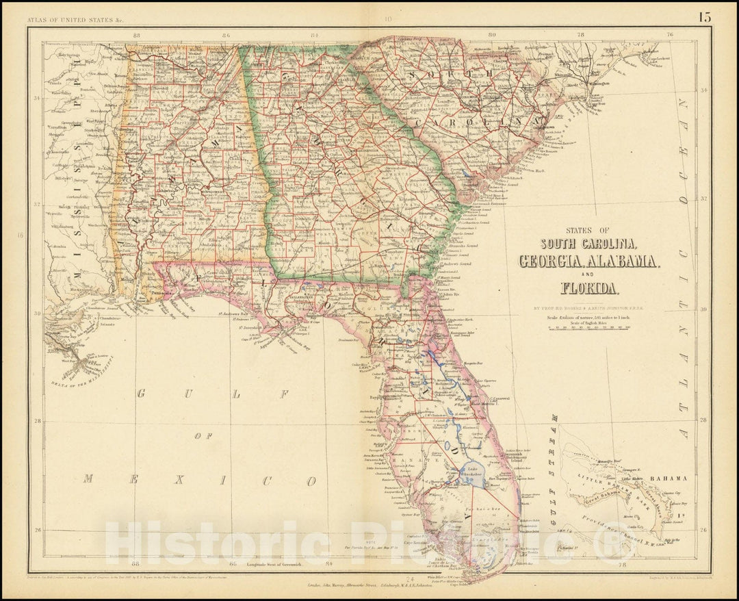
Historic Map : States of South Carolina, Georgia, Alabama And Florida, 1857, Vintage Wall Art
From:
$49.99
Historic Map : States of Alabama and Georgia , 1832, Vintage Wall Art
From:
$49.99
Historic Nautical Map - United States, 1956 NOAA Base Historic Nautical Map - Louisiana, Kentucky, Georgia, Wisconsin (LA, KY, GA, WI) - Vintage Wall Art
From:
$49.99
Historic Map : Atlas State of Rhode Island, Georgiaville & Greenville & Smithfield 1870 , Vintage Wall Art
From:
$49.99
Map : Georgia 1919, National highways map of the state of Georgia : showing thirty-three hundred miles of national highways
From:
$49.99
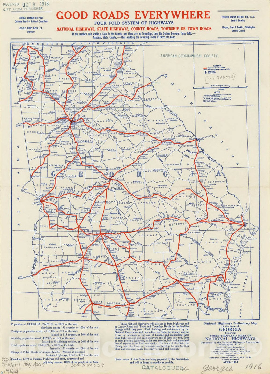
Map : Georgia 1916, National highways preliminary map of the state of Georgia : showing three thousand miles of national highways, Antique Vintage Reproduction
From:
$49.99
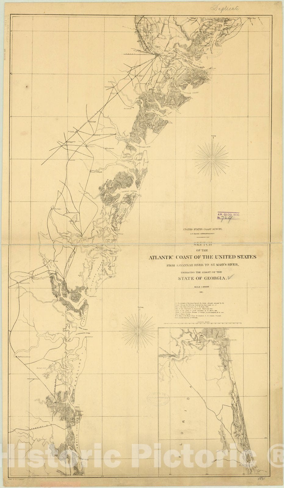
Map : Georgia 1861, Sketch of the Atlantic coast of the United States from Savannah River to St. Mary's River, embracing the coast of the State of Georgia
From:
$39.99
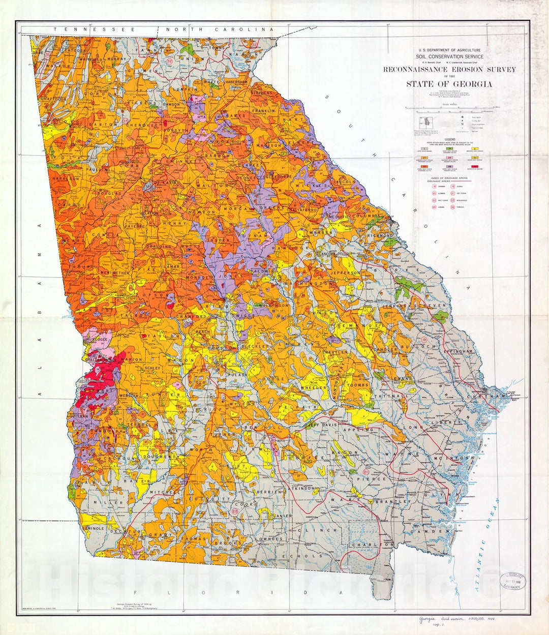
Map : Reconnaissance erosion survey of the State of Georgia, 1934 Cartography Wall Art :
From:
$49.99
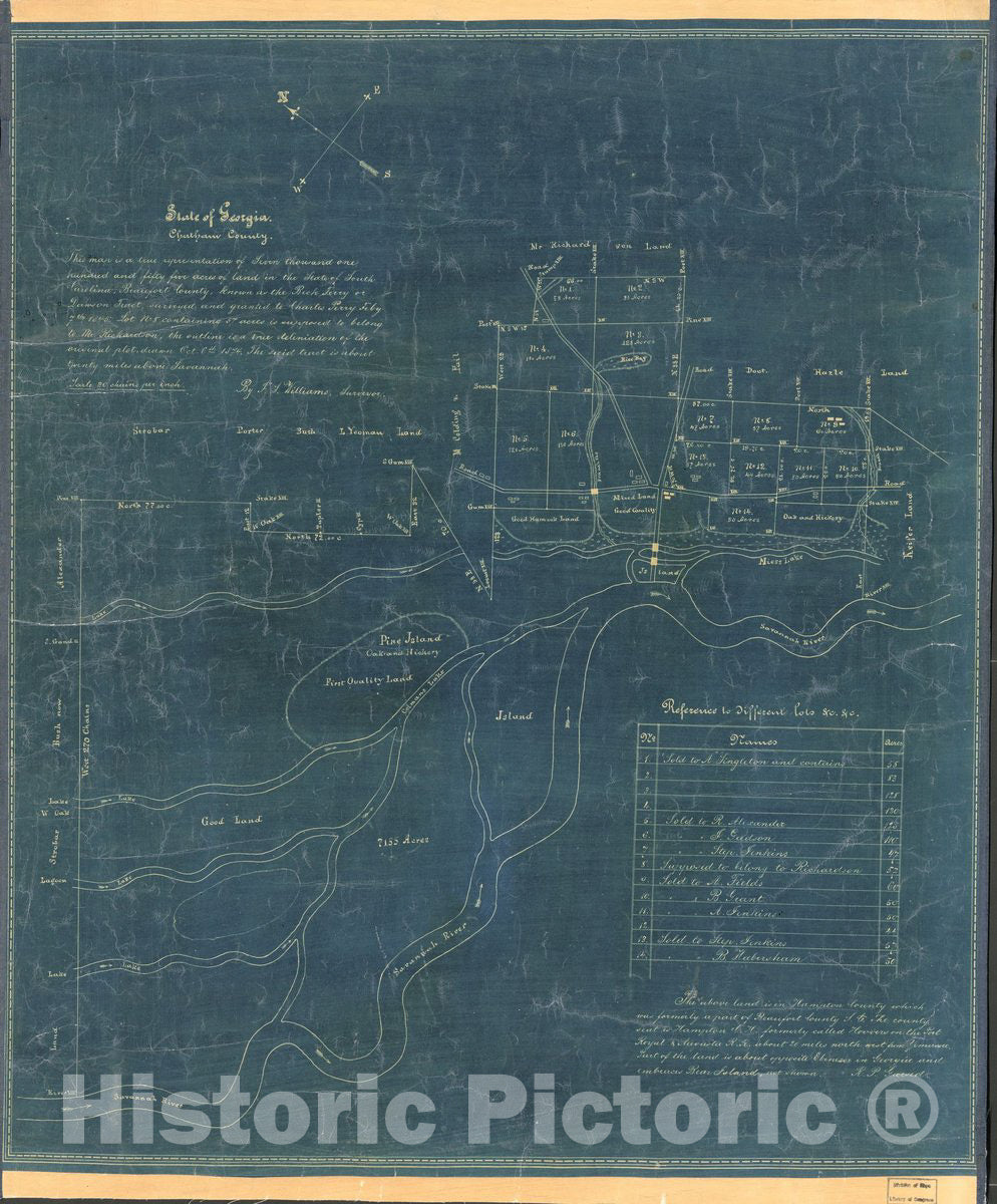
Historic 1874 Map - State of Georgia, Chatham County.
From:
$49.99
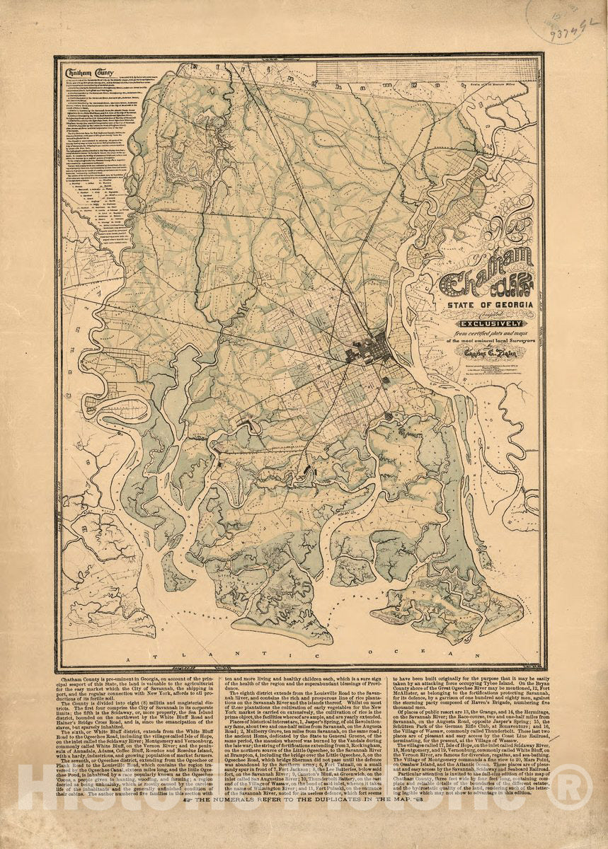
Historic 1875 Map - Map of Chatham County, State of Georgia 1
From:
$49.99
Historic 1864 Map - Railway and County map of The Southern States; embracing The States of N. Carolina, S. Carolina, Georgia, Alabama, Florida, Mississippi, Louisiana, Arkansas, and Tenn
From:
$39.99
Historic 1875 Map - Map of Chatham County, State of Georgia 2
From:
$49.99
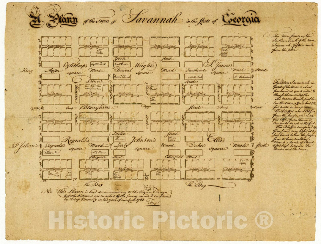
Historic 1761 Map - A plann of The Town of Savannah in The State of Georgia.
From:
$49.99
Historic 1964 Map - The State of Georgia, Civil War Centennial, 1864 : Showing The Major Campaign Areas and Engagement Sites of The Union and Confederate Armies
From:
$49.99
Historic 1862 Map - Colton's map of The Southern States, Including Maryland, Delaware, Virginia, Kentucky, Tennessee, Missouri, North Carolina, South Carolina, Georgia, Alabama, Miss
From:
$49.99
Historic 1861 Map - J. H. Colton's Topographical map of North and South Carolina. A Large Portion of Georgia & Part of adjoining States
From:
$49.99
Historic 1810 Map - The State of Georgia.
From:
$49.99
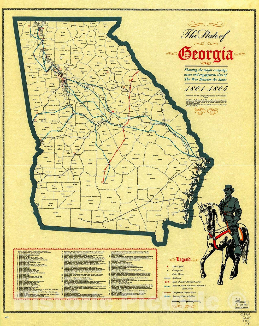
Historic 1961 Map - The State of Georgia, Showing The Major Campaign Areas and Engagement Sites of The War Between The States, 1861-1865.
From:
$49.99
1
2
3
…
6
icon-chevron
Next
icon-X
"Close (esc)"
icon-chevron-left
icon-X
icon-chevron
icon-X
Georgia State Wall Maps, Posters & Prints