Skip to content
icon-X
Close menu
Maps
World Maps
World War 2 Maps
Pictorial Maps
USGS TopoGraphic Maps
Art Prints
Blueprints
Fine Art Museum Collections
Claude Monet
Photographs
Modern Photos
Posters
Collections
Kid's Room
Autos, Trains & Rails
Monet and Manet
Brewery, Beer, Liquor & more
Holiday Ready to Gift Products
Log in
Follow Us
instagram
Instagram
Facebook
twitter
Twitter
Maps
World Maps
World War 2 Maps
Pictorial Maps
USGS TopoGraphic Maps
Art Prints
Blueprints
Fine Art Museum Collections
Claude Monet
Photographs
Modern Photos
Posters
Collections
Kid's Room
Autos, Trains & Rails
Monet and Manet
Brewery, Beer, Liquor & more
Holiday Ready to Gift Products
account
Log in
icon-search
Search
icon-hamburger
Site navigation
icon-bag-minimal
Cart
Search
Search
Free economy shipping for unframed orders of $75 or more!
Filter
icon-X
Close menu
Historic Maps
icon-filter
Filter
Historic Map - Novus Orbis Sive America Meridionalis et Septentrionalis, 1730, Matthaus Seutter v4
From:
$29.99
Historic Map : Big Bear Lake California, Big Bear Lake Souvenir Fun Map, 1947, George Ramsey, Vintage Wall Art
From:
$39.99
Historic Map : CBS American School of the Air, Air Age Map of the World, A Polar Projection, 1943 - Vintage Wall Art
From:
$49.99
Historic Map : Lincoln Highway Association Map of The Lincoln Highway, 1913, Vintage Wall Art
From:
$49.99
Historic Map - A Scott-Map of the White Mountains of New Hampshire, 1960 - Vintage Wall Art
From:
$49.99
Historic Map - Arizona Lost Mines and Ghost Towns Early Spanish Missions, 1963, Larry Toschik - Vintage Wall Art
From:
$49.99
Historic Map - Wall Map, United States - Geology: Physiographic & Structural Provinces 1983 - Vintage Wall Art
From:
$49.99
Historic Map - Map Prepared For Use With Guide To The John Muir Trail and The High Sierra Region, 1934, Sierra Club - Vintage Wall Art
From:
$29.99
Historic Map : Plantations on the Mississippi River From Natchez to New Orleans 1858., 1858, , Vintage Wall Art
From:
$39.99
Historic Map : Hudson River and Vicinity., 1836, Vintage Wall Decor
From:
$49.99
Historic Map - Wall Map, Pennsylvania - Geology 1960, - Vintage Wall Art
From:
$49.99
Historic Map : Pocket Map, Louisiana Purchase Exposition St. Louis 1904 - Vintage Wall Art
From:
$49.99
Historic Map - Map of the Battlefield of Gettysburg July 1st, 2nd, 3rd 1863, 1876, John B. Bachelder - Vintage Wall Art
From:
$29.99
Historic Map - Grand Canyon, 1931, Jo Mora - Vintage Wall Art
From:
$49.99
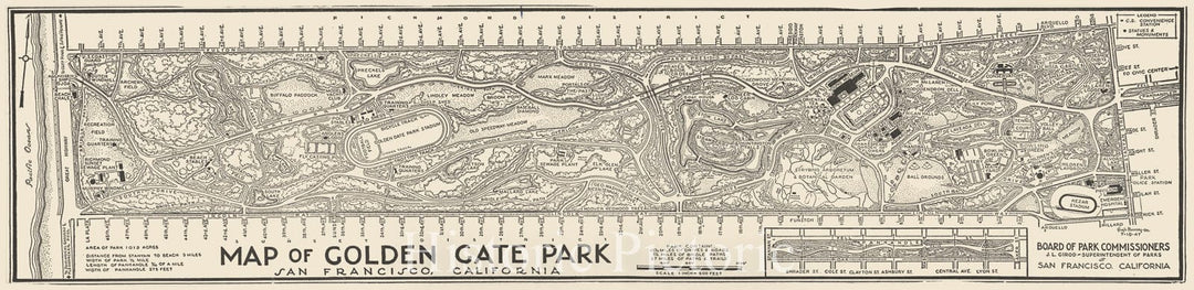
Historic Map : Golden Gate Park, San Francisco, California., 1947, Vintage Wall Decor
From:
$34.99
Historic Map : Skisterical map of Mt. Hood Recreation Area, 1939 - Vintage Wall Art
From:
$49.99
Historical Map, 1900 Map of Arnold Arboretum showing location of the trees and shrubs, Vintage Wall Art
From:
$39.99
Historic Map : Physiographic diagram, Atlantic Ocean (sheet 1). By Bruce C. Heezen and Marie Tharp, 1957 , Vintage Wall Art
From:
$39.99
Historic 2004 Map - Europe
From:
$59.99
icon-chevron-left
Previous
1
2
3
4
…
1316
icon-chevron
Next
icon-X
"Close (esc)"
icon-chevron-left
icon-X
icon-chevron
icon-X
Historic Maps