Skip to content
icon-X
Close menu
Maps
World Maps
World War 2 Maps
Pictorial Maps
USGS TopoGraphic Maps
Art Prints
Blueprints
Fine Art Museum Collections
Claude Monet
Photographs
Modern Photos
Posters
Collections
Kid's Room
Autos, Trains & Rails
Monet and Manet
Brewery, Beer, Liquor & more
Holiday Ready to Gift Products
Log in
Follow Us
instagram
Instagram
Facebook
twitter
Twitter
Cart
icon-X
Close cart
Your cart is currently empty.
Maps
World Maps
World War 2 Maps
Pictorial Maps
USGS TopoGraphic Maps
Art Prints
Blueprints
Fine Art Museum Collections
Claude Monet
Photographs
Modern Photos
Posters
Collections
Kid's Room
Autos, Trains & Rails
Monet and Manet
Brewery, Beer, Liquor & more
Holiday Ready to Gift Products
account
Log in
icon-search
Search
icon-hamburger
Site navigation
icon-bag-minimal
Cart
Search
Search
Free economy shipping for unframed orders of $75 or more!
Filter
icon-X
Close menu
Product type
Color Photo
(1)
Map
(55)
Availability
In stock
(56)
Out of stock
(0)
Price
Indiana State Maps
icon-filter
Filter
Historic Map : Department of The Interior General Land office Map - State of Indiana. 1878 - Vintage Wall Art
From:
$49.99
Historic Map : Standard Oil Company Indiana; Highway Map Southwestern Section of the United States, 1942 , Vintage Wall Art
From:
$49.99
Historic Map : Indiana, a guide to the Hoosier state, compiled by workers of the Writers' Program of the Work projects administration in the state of Indiana, Vintage Wall Art
From:
$49.99
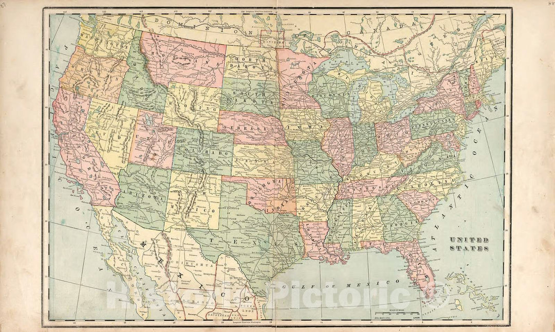
Historic Map : United States Maps, Indiana 1894 , Vintage Wall Art
From:
$49.99
Historic 1830 Map - Western States - Northwest, Old - Kentucky - Ohio - Indiana - Missouri - Illinoismaps Of North America. - Vintage Wall Art
From:
$49.99
Map : Indiana 1836, The tourist's pocket map of the state of Indiana : exhibiting its internal improvements, roads, distances & c , Antique Vintage Reproduction
From:
$49.99
Map : Indiana 1866, A diagram of the state of Indiana , Antique Vintage Reproduction
From:
$49.99
Map : Indiana, Ohio and the Territory of Michigan 1832, Map of the states of Indiana and Ohio with part of Michigan Territory , Antique Vintage Reproduction
From:
$49.99
Photo - Red barns are Quite Common Across The United States Like This barn Near Maplewood in Hendricks County, Indiana, That has Faded to Pink - Fine Art Photo Reproduction
From:
$24.99
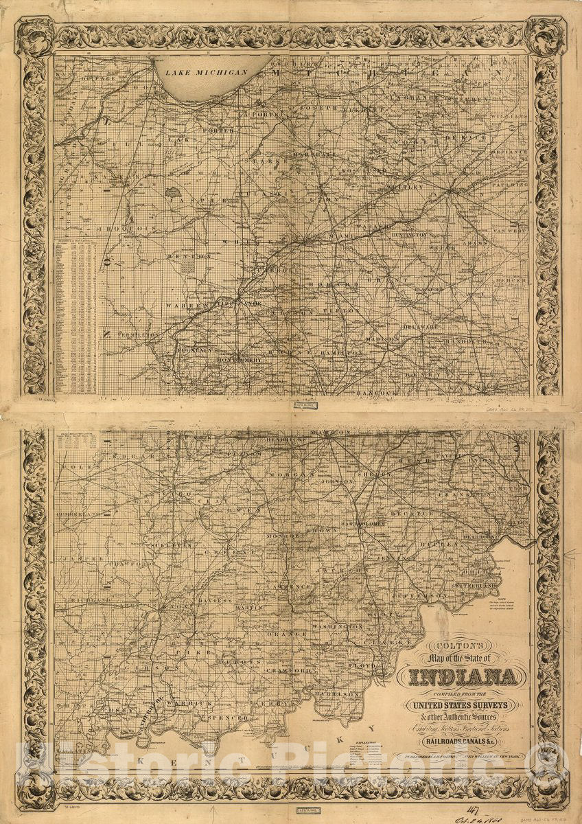
Historic 1860 Map - Colton's map of The State of Indiana, compiled from The United States surveys & Other Authentic Sources, exhibiting Sections, fractional Sections, Railroads, canals
From:
$49.99
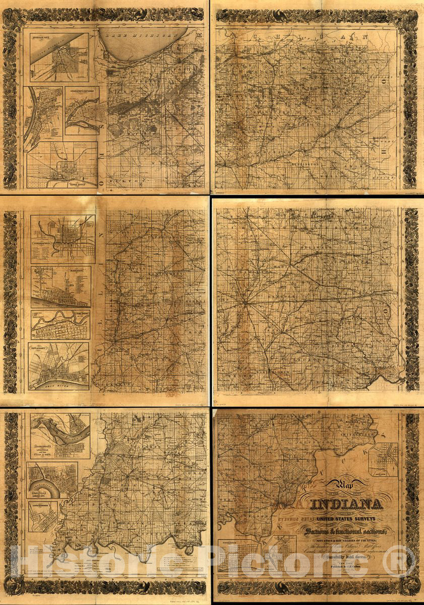
Historic 1852 Map - Map of The State of Indiana compiled from The United States surveys by S. D. King, Washington City; exhibiting The Sections & fractional Sections
From:
$49.99
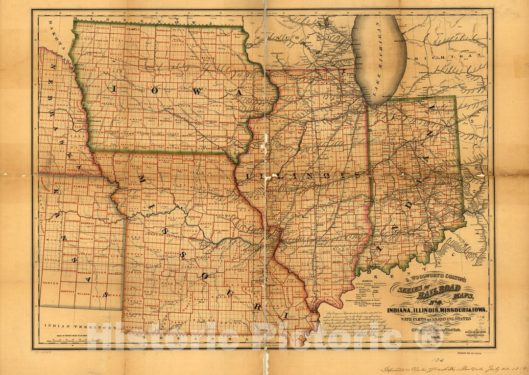
Historic 1858 Map - Indiana, Illinois, Missouri & Iowa with Parts of adjoining States.
From:
$49.99
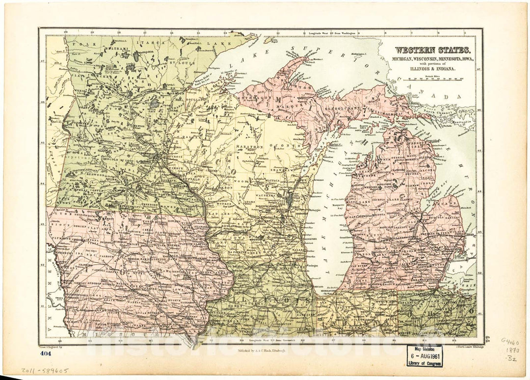
Historic 1873 Map - Western States, Michigan, Wisconsin, Minnesota, Iowa : with portions of Illinois & Indiana
From:
$49.99
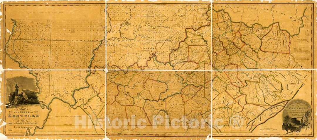
Historic 1818 Map - A map of The State of Kentucky : from Actual Survey ; Also Part of Indiana and Illinois
From:
$29.99
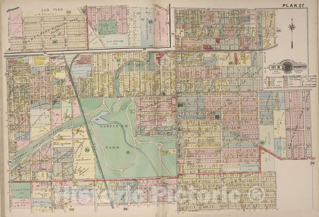
Historic 1916 Map - Baist's Real Estate Atlas of surveys of Indianapolis and Vicinity, Indiana - Plan 5 - Real Estate Atlas of surveys of Indianapolis and Vicinity, Indiana
From:
$49.99
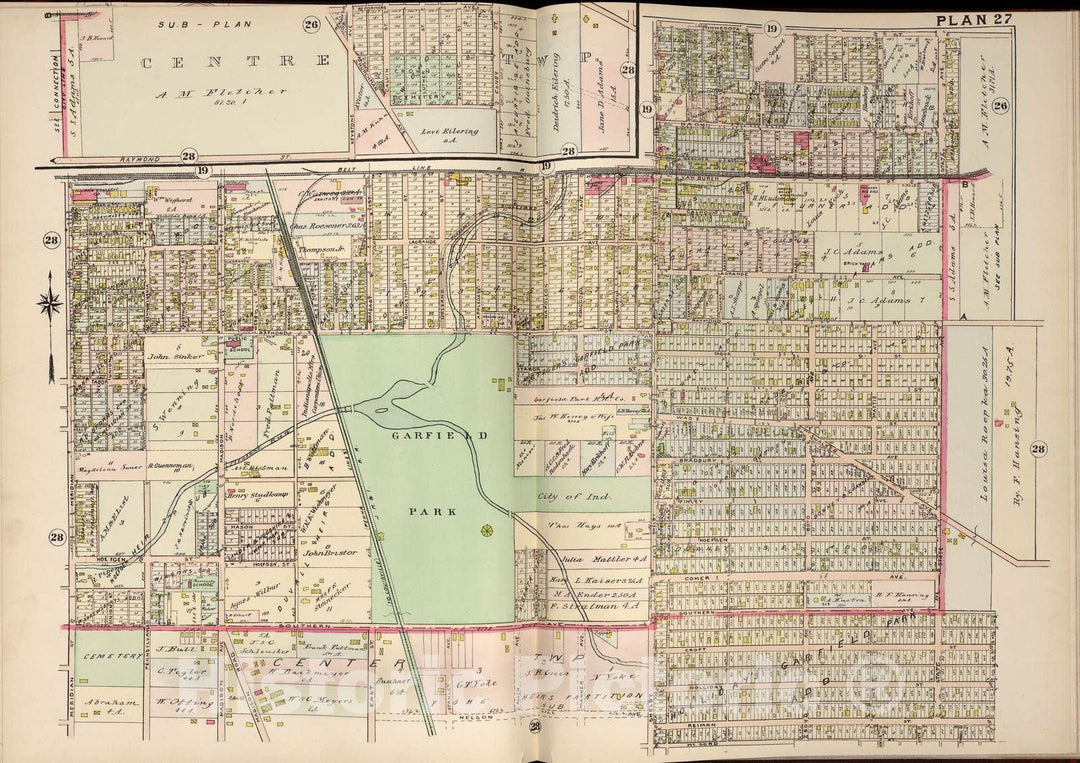
Historic 1908 Map - Baist's Real Estate Atlas of surveys of Indianapolis and Vicinity, Indiana - Plan 31 - Real Estate Atlas of surveys of Indianapolis and Vicinity, Indiana
From:
$49.99
Historic 1875 Map - Atlas of Dearborn County, Indiana : to which is Added a map of The State of Indiana, Also an Outline and Rail Road map of The United States - Lawrenceburgh 2
From:
$29.99
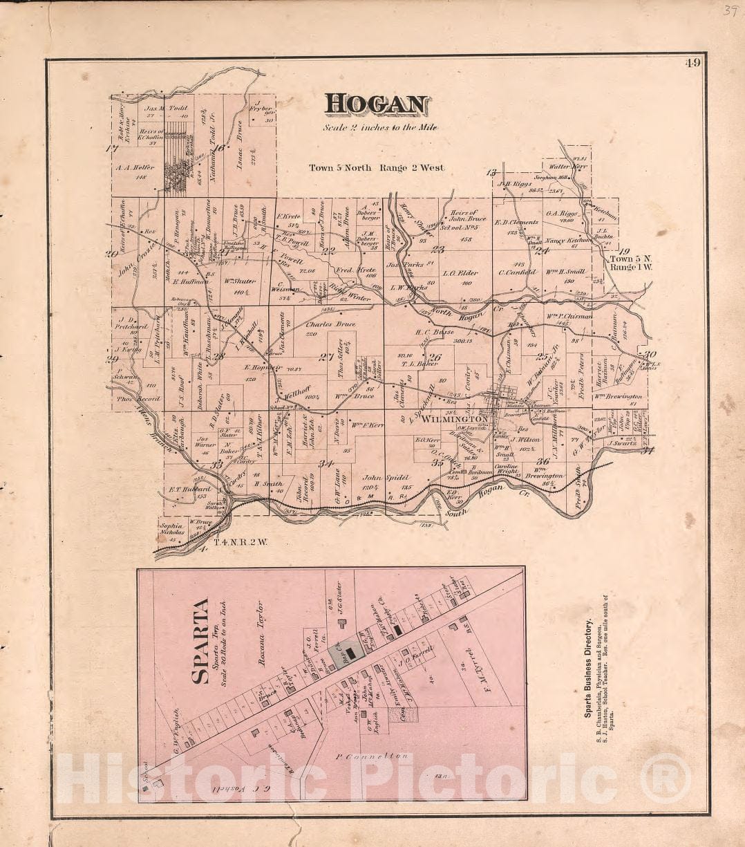
Historic 1898 Map - The Revised Montgomery County Atlas - United States - Illustrated Atlas of Montgomery County, Indiana
From:
$49.99
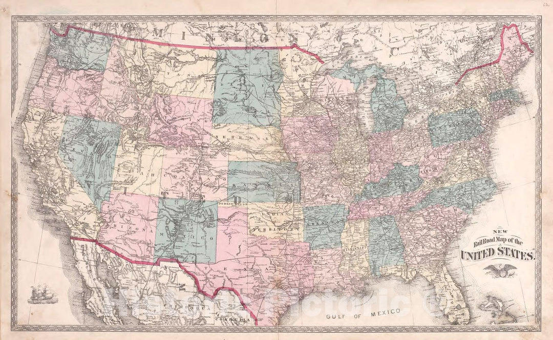
Historic 1880 Map - Atlas of Steuben Co, Indiana - New Railroad Map of The United States - Illustrated Historical Atlas of Steuben County, Indiana
From:
$49.99
1
2
3
icon-chevron
Next
icon-X
"Close (esc)"
icon-chevron-left
icon-X
icon-chevron
icon-X
Indiana State Maps, Posters & Prints