Skip to content
icon-X
Close menu
Maps
World Maps
World War 2 Maps
Pictorial Maps
USGS TopoGraphic Maps
Art Prints
Blueprints
Fine Art Museum Collections
Claude Monet
Photographs
Modern Photos
Posters
Collections
Kid's Room
Autos, Trains & Rails
Monet and Manet
Brewery, Beer, Liquor & more
Holiday Ready to Gift Products
Log in
Follow Us
instagram
Instagram
Facebook
twitter
Twitter
Maps
World Maps
World War 2 Maps
Pictorial Maps
USGS TopoGraphic Maps
Art Prints
Blueprints
Fine Art Museum Collections
Claude Monet
Photographs
Modern Photos
Posters
Collections
Kid's Room
Autos, Trains & Rails
Monet and Manet
Brewery, Beer, Liquor & more
Holiday Ready to Gift Products
account
Log in
icon-search
Search
icon-hamburger
Site navigation
icon-bag-minimal
Cart
Search
Search
Free economy shipping for unframed orders of $75 or more!
Filter
icon-X
Close menu
Lake Maps
icon-filter
Filter
Historic Nautical Map - Kealakekua Bay To Honaunau, 1973 NOAA Chart - Hawaii (HI) - Vintage Wall Art
From:
$49.99
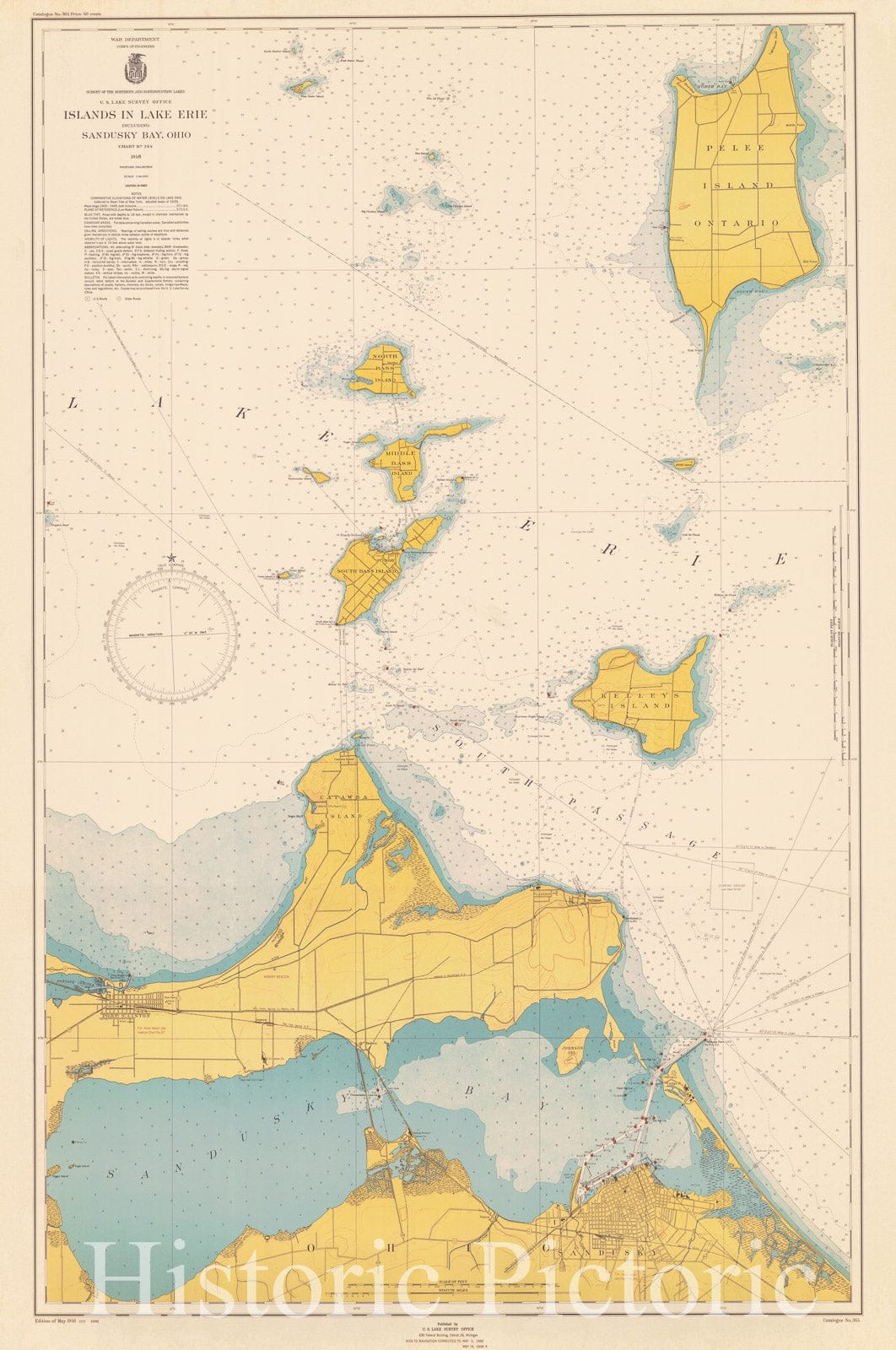
Historic Nautical Map - Islands In Lake Erie Including Sandusky Bay Ohio, 1946 NOAA Chart - Ohio (OH) - Vintage Wall Art
From:
$49.99
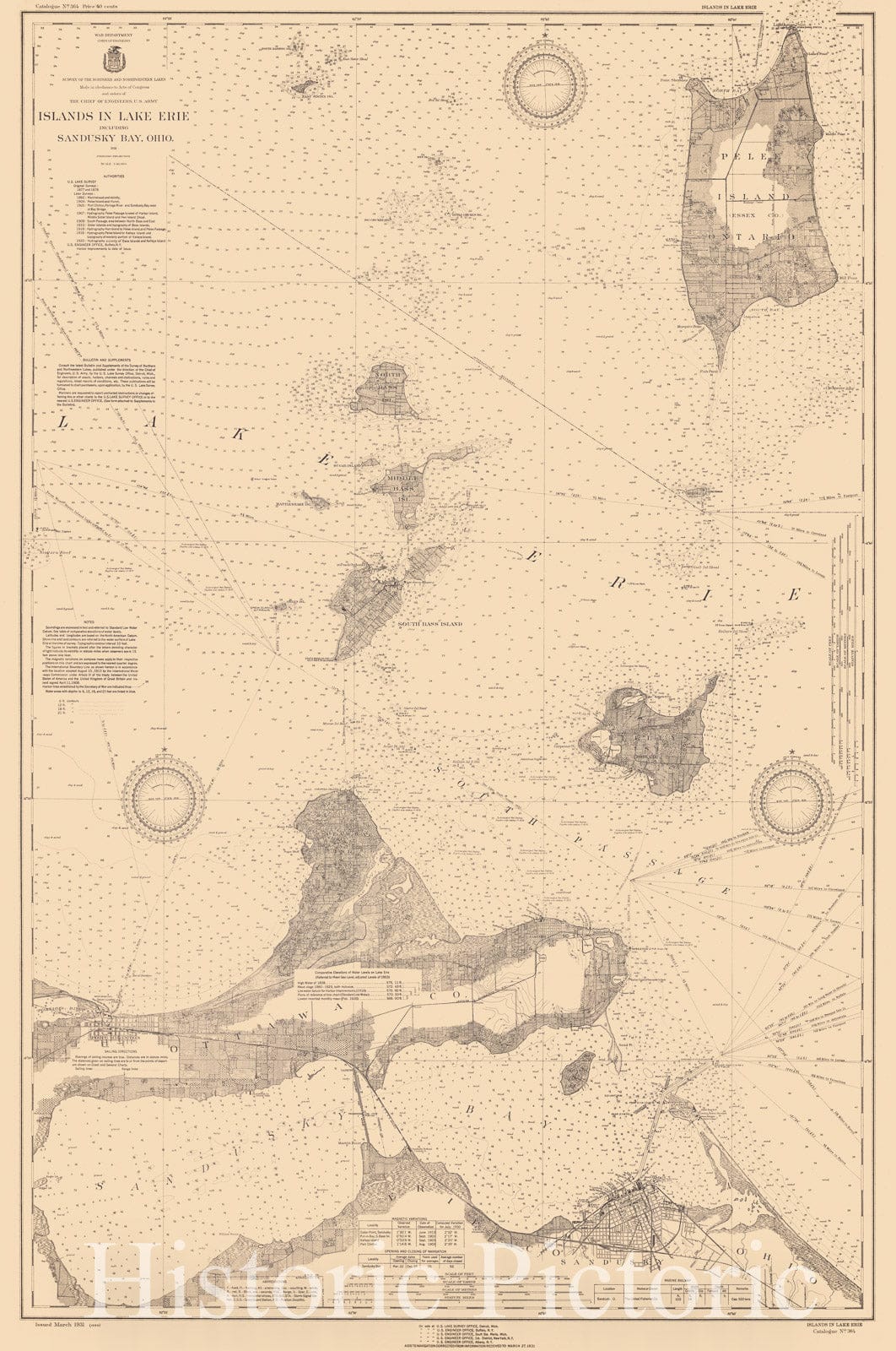
Historic Nautical Map - Islands In Lake Erie Including Sandusky Bay, Ohio, 1931 NOAA Chart - Ohio (OH) - Vintage Wall Art
$259.99
Historic Nautical Map - Lakes Erie And Ontario With The Southern Parts Of Lake Huron And Georgian Bay, 1923 NOAA Chart - Ohio, New York, Michigan, Pennsylvania Poster Wall Art Reprint - 0
From:
$49.99
Historic Nautical Map - Lake Huron And Georgian Bay, 1918 NOAA Chart - Michigan (MI) - Vintage Wall Art
From:
$49.99
Historic Nautical Map - Lake Huron And Georgian Bay, 1918 NOAA Chart - Michigan (MI) - Vintage Wall Art, v2
From:
$109.99
Historic Nautical Map - Lakes Pontchartrain And Maurepas, 1971 NOAA Chart - Louisiana (LA) - Vintage Wall Art
From:
$49.99
Historic Nautical Map - Lake Borgne And Approaches, 1974 NOAA Chart - Louisiana, Mississippi (LA, MS) - Vintage Wall Art
From:
$49.99
Historic Nautical Map - Grand Island South Coast Of Lake Superior, 1932 NOAA Chart - Vintage Wall Art
From:
$49.99
Historic Nautical Map - Upper Niagara River From Lake Erie To The Falls, 1917 NOAA Chart - Vintage Wall Art
From:
$49.99
Historic Nautical Map - Upper Niagara River From Lake Erie To The Falls, 1931 NOAA Chart - Vintage Wall Art
From:
$49.99
Historic Nautical Map - Upper Niagara River From Lake Erie To The Falls, 1934 NOAA Chart - Vintage Wall Art
From:
$49.99
Historic Nautical Map - Upper Niagara River From Lake Erie To The Falls, 1929 NOAA Chart - Vintage Wall Art
From:
$49.99
Historic Nautical Map - Lake Worth Inlet And Palm Beach, 1968 NOAA Chart - Vintage Wall Art
From:
$49.99
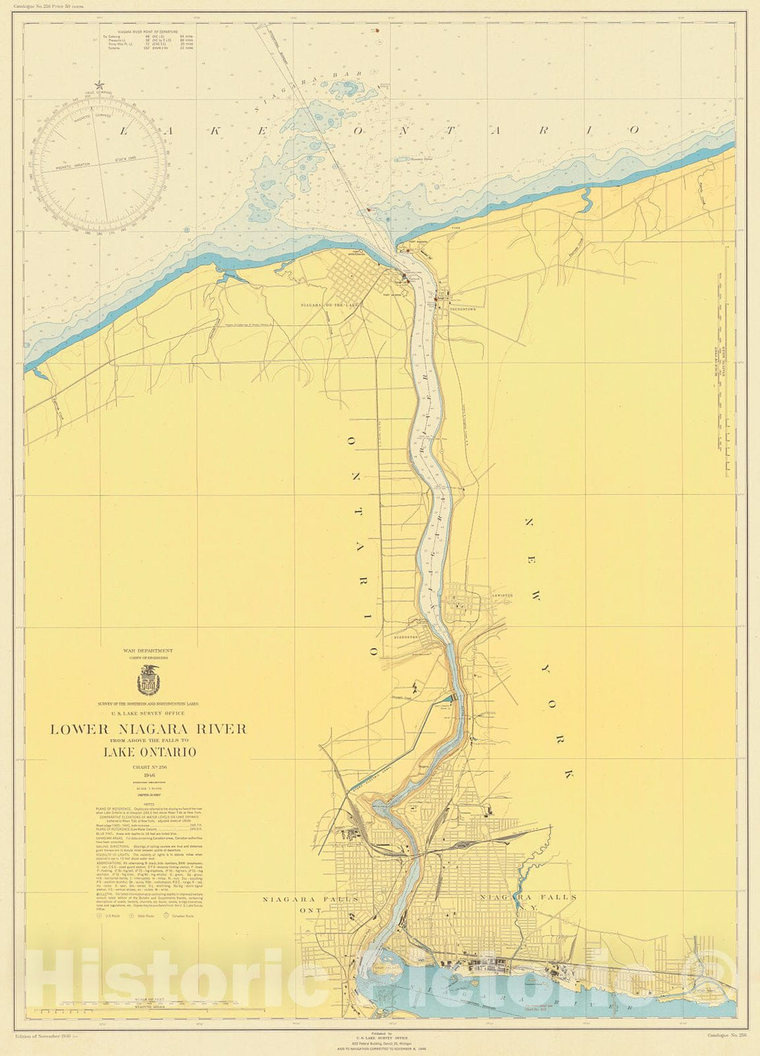
Historic Nautical Map - Lower Niagara River From Above The Falls To Lake Ontario, 1946 NOAA Chart - Vintage Wall Art
From:
$49.99
Historic Nautical Map - Niagara River From Above The Falls To Lake Ontario, 1909 NOAA Chart - Vintage Wall Art
From:
$49.99
Historic Nautical Map - Lower Niagara River Niagara Falls To Lake Ontario, 1968 NOAA Chart - Vintage Wall Art
From:
$49.99
Historic Nautical Map - Lake Of The Woods, 1930 NOAA Chart - Vintage Wall Art
From:
$49.99
Historic Nautical Map - Minnesota-Ontario Border Lakes Sea Gull Lake, 1950 NOAA Chart - Vintage Wall Art
From:
$49.99
icon-chevron-left
Previous
1
…
17
18
19
20
21
…
395
icon-chevron
Next
icon-X
"Close (esc)"
icon-chevron-left
icon-X
icon-chevron
icon-X
Lake Maps, Posters & Prints