Skip to content
icon-X
Close menu
Maps
World Maps
World War 2 Maps
Pictorial Maps
USGS TopoGraphic Maps
Art Prints
Blueprints
Fine Art Museum Collections
Claude Monet
Photographs
Modern Photos
Posters
Collections
Kid's Room
Autos, Trains & Rails
Monet and Manet
Brewery, Beer, Liquor & more
Holiday Ready to Gift Products
Log in
Follow Us
instagram
Instagram
Facebook
twitter
Twitter
Maps
World Maps
World War 2 Maps
Pictorial Maps
USGS TopoGraphic Maps
Art Prints
Blueprints
Fine Art Museum Collections
Claude Monet
Photographs
Modern Photos
Posters
Collections
Kid's Room
Autos, Trains & Rails
Monet and Manet
Brewery, Beer, Liquor & more
Holiday Ready to Gift Products
account
Log in
icon-search
Search
icon-hamburger
Site navigation
icon-bag-minimal
Cart
Search
Search
Free economy shipping for unframed orders of $75 or more!
Filter
icon-X
Close menu
Lake Maps
icon-filter
Filter
Historic Nautical Map - Lake Michigan, 1955 NOAA Chart - Vintage Wall Art
From:
$49.99
Historic Nautical Map - Lake Michigan Coast Algoma To Sheboygan, 1966 NOAA Chart - Vintage Wall Art
From:
$49.99
Historic Nautical Map - North End Of Green Bay, Islands At The Entrance And Northwest Shore Of Lake Michigan, 1908 NOAA Chart - Vintage Wall Art
From:
$49.99
Historic Nautical Map - Lake Michigan Coast Algoma To Sheboygan, 1957 NOAA Chart - Vintage Wall Art
From:
$49.99
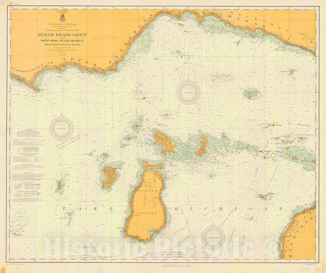
Historic Historic Nautical Map - Beaver Island Group Including North Shore Of Lake Michigan From Waugoshance Point To Seul Choix Point, 1911 NOAA Chart - Antique Vintage Decor Poster Wall Art Reproduction
From:
$49.99
Historic Nautical Map - Lake Michigan, 1938 NOAA Chart - Vintage Wall Art
From:
$49.99
Historic Nautical Map - St Joseph Channel And Western End Of North Channel Lake Huron, 1909 NOAA Chart - Vintage Wall Art
From:
$49.99
Historic Nautical Map - St. Marys River. Head Of Hay Lake To Whitefish Bay, 1915 NOAA Chart - Vintage Wall Art
From:
$49.99
Historic Nautical Map - St Marys River Head Of Lake Nicolet To Whitefish Bay, 1946 NOAA Chart - Vintage Wall Art
From:
$49.99
Historic Nautical Map - St Marys River Lake Munuscong To Sault Ste Marie, 1948 NOAA Chart - Vintage Wall Art
From:
$49.99
Historic Nautical Map - St Marys River Head Of Hay Lake To Whitefish Bay, 1906 NOAA Chart - Vintage Wall Art
From:
$49.99
Historic Nautical Map - St Marys River Lake Munuscong To Sault Ste Marie, 1946 NOAA Chart - Vintage Wall Art
From:
$49.99
Historic Nautical Map - St Marys River Lake Munuscong To Sault Ste Marie, 1940 NOAA Chart - Vintage Wall Art
From:
$49.99
Historic Nautical Map - St Marys River Lake Munuscong To Sault Ste Marie, 1955 NOAA Chart - Vintage Wall Art
From:
$49.99
Historic Nautical Map - St Marys River Lake Huron To Lake Munuscong, 1946 NOAA Chart - Vintage Wall Art
From:
$49.99
Historic Nautical Map - St Marys River From Lake Huron To Twin Islands, 1906 NOAA Chart - Vintage Wall Art
From:
$49.99
Historic Nautical Map - Lake Huron. Straits Of Mackinac, Detour Passage To Waugoshance Point, 1951 NOAA Chart - Vintage Wall Art
From:
$49.99
Historic Nautical Map - Lake Huron. Straits Of Mackinac, Martin Reef To St. Ignace, 1940 NOAA Chart - Vintage Wall Art
From:
$49.99
Historic Nautical Map - Northeast Coast Of Georgian Bay Lake Huron From Parry Island To Killarney Harbor, 1905 NOAA Chart - Vintage Wall Art
From:
$49.99
icon-chevron-left
Previous
1
…
20
21
22
23
24
…
395
icon-chevron
Next
icon-X
"Close (esc)"
icon-chevron-left
icon-X
icon-chevron
icon-X
Lake Maps, Posters & Prints