Skip to content
icon-X
Close menu
Maps
World Maps
World War 2 Maps
Pictorial Maps
USGS TopoGraphic Maps
Art Prints
Blueprints
Fine Art Museum Collections
Claude Monet
Photographs
Modern Photos
Posters
Collections
Kid's Room
Autos, Trains & Rails
Monet and Manet
Brewery, Beer, Liquor & more
Holiday Ready to Gift Products
Log in
Follow Us
instagram
Instagram
Facebook
twitter
Twitter
Cart
icon-X
Close cart
Your cart is currently empty.
Maps
World Maps
World War 2 Maps
Pictorial Maps
USGS TopoGraphic Maps
Art Prints
Blueprints
Fine Art Museum Collections
Claude Monet
Photographs
Modern Photos
Posters
Collections
Kid's Room
Autos, Trains & Rails
Monet and Manet
Brewery, Beer, Liquor & more
Holiday Ready to Gift Products
account
Log in
icon-search
Search
icon-hamburger
Site navigation
icon-bag-minimal
Cart
Search
Search
Free economy shipping for unframed orders of $75 or more!
Filter
icon-X
Close menu
Product type
Geologic Map
(3)
Map
(53)
Topographic Map
(4)
Availability
In stock
(60)
Out of stock
(0)
Price
Nevada State Maps
icon-filter
Filter
Historic Map : United States Maps, Nevada 1894 , Vintage Wall Art
From:
$49.99
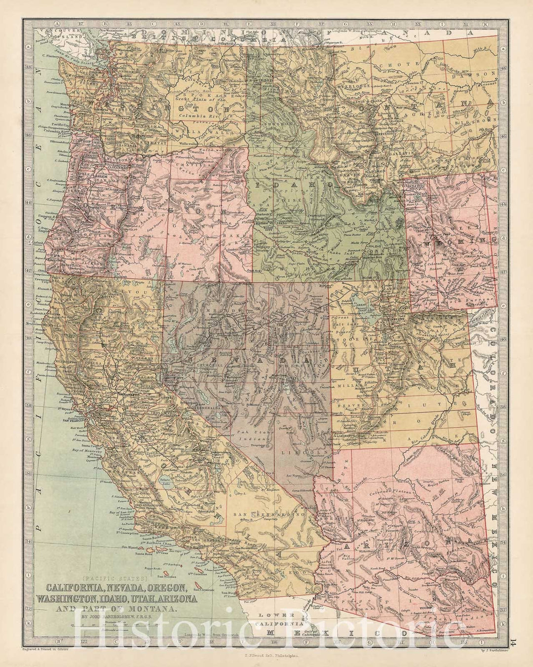
Historic Map - Pacific States California, Nevada, Oregon, Washington, Idaho, Utah, Arizona and Part of Montana, 1873, T. Ellwood Zell - Vintage Wall Art
From:
$49.99
Historic Map - Sutro Tunnel And The Comstock Lode State of Nevada 1873, Historic Map - Vintage Wall Art
From:
$34.99
Historic Map : Department of The Interior General Land office Map - State of Nevada. 1879 - Vintage Wall Art
From:
$49.99
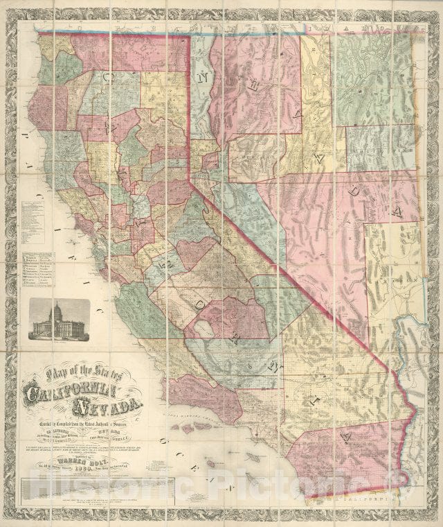
Historic Map - Map of the States of California and Nevada, 1876, Warren Holt v2
From:
$49.99
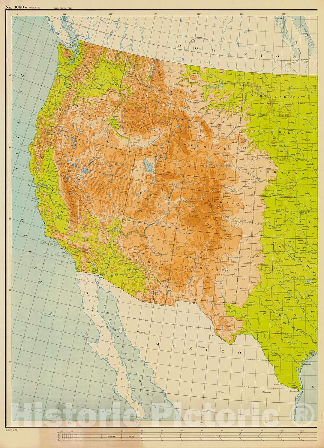
Historic Nautical Map - United States, 1956 NOAA Base Historic Nautical Map - Utah, Nevada, Texas, North Dakota (UT, NV, TX, ND) - Vintage Wall Art
From:
$49.99
Historic 1869 Map - Map Of The States Of California And Nevada - California - Nevadamaps Of North America. - Vintage Wall Art
From:
$49.99
Map : Sierra Nevada de Santa Marta (Colombia) 1881, South America map of Sierra Nevada de Santa Marta, State of Magdalena, United States of Colombia
From:
$49.99
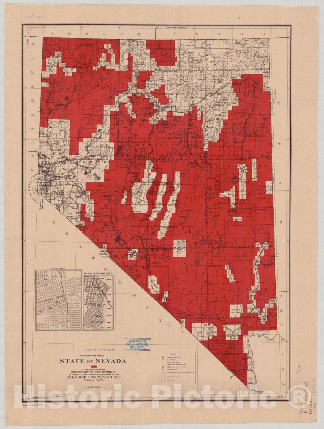
Historic Map : Nevada 1912 1, State of Nevada : lands designated by the Secretary of the Interior under the provisions of the enlarged Homestead Act of February 19, 1909
From:
$49.99
Map : Nevada 1919, National highways map of the state of Nevada: showing thirty-two hundred miles of national highways
From:
$49.99
Map : Nevada 1916, National highways preliminary map of the state of Nevada : showing twenty-five hundred miles of national highways, Antique Vintage Reproduction
From:
$49.99
Historic Map : Nevada 1912 2, State of Nevada : lands designated by the Secretary of the Interior under the provisions of the enlarged Homestead Act of February 19, 1909
From:
$49.99
Historic Map : Nevada 1916, State of Nevada : lands designated by the Secretary of the Interior under the provisions of the enlarged Homestead Act , Antique Vintage Reproduction
From:
$49.99
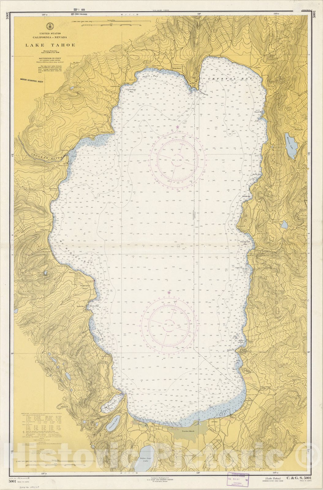
Map : California--Nevada, Lake Tahoe 1959, United States, California--Nevada, Lake Tahoe , Antique Vintage Reproduction
From:
$49.99
Map : Geologic Map of the State Line Peak Quadrangle, Nevada-California, 1984 Cartography Wall Art :
From:
$49.99
Map : Hydrogeologic framework of the Great Basin region of Nevada, Utah, and adjacent states, 1996 Cartography Wall Art :
From:
$49.99
Map : Geochemistry and isotope hydrology of representative aquifers in the Great Basin region of Nevada, Utah, and adjacent states, 1996 Cartography Wall Art :
From:
$49.99
Historic 1866 Map - Map of The State of Nevada
From:
$49.99
Historic 1866 Map - Map of The State of Nevada : to accompany The Annual Report of The Commr. Genl. Land Office
From:
$49.99
1
2
3
4
icon-chevron
Next
icon-X
"Close (esc)"
icon-chevron-left
icon-X
icon-chevron
icon-X
Nevada State Wall Maps, Posters & Prints