Skip to content
icon-X
Close menu
Maps
World Maps
World War 2 Maps
Pictorial Maps
USGS TopoGraphic Maps
Art Prints
Blueprints
Fine Art Museum Collections
Claude Monet
Photographs
Modern Photos
Posters
Collections
Kid's Room
Autos, Trains & Rails
Monet and Manet
Brewery, Beer, Liquor & more
Holiday Ready to Gift Products
Log in
Follow Us
instagram
Instagram
Facebook
twitter
Twitter
Maps
World Maps
World War 2 Maps
Pictorial Maps
USGS TopoGraphic Maps
Art Prints
Blueprints
Fine Art Museum Collections
Claude Monet
Photographs
Modern Photos
Posters
Collections
Kid's Room
Autos, Trains & Rails
Monet and Manet
Brewery, Beer, Liquor & more
Holiday Ready to Gift Products
account
Log in
icon-search
Search
icon-hamburger
Site navigation
icon-bag-minimal
Cart
Search
Search
Free economy shipping for unframed orders of $75 or more!
Filter
icon-X
Close menu
Non-LIVEARf
icon-filter
Filter
Historic Photo : White House, 1600 Pennsylvania Avenue, Northwest, Washington, District of Columbia, DC 41 Photograph
From:
$24.99
Historic Photo : White House, 1600 Pennsylvania Avenue, Northwest, Washington, District of Columbia, DC 108 Photograph
From:
$24.99
Historic Photo : White House, 1600 Pennsylvania Avenue, Northwest, Washington, District of Columbia, DC 97 Photograph
From:
$24.99
Historic Photo : White House, 1600 Pennsylvania Avenue, Northwest, Washington, District of Columbia, DC 49 Photograph
From:
$24.99
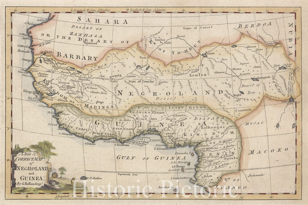
Historic 1700 Map - A New & Correct Map Of Negroland And Guinea - Africa, West - Vintage Wall Art
From:
$49.99
Historic 1761 Map - A New Map Of North America From The Latest Discoveries - North America - Maps - Early Works To 1800Maps Of North America. - Vintage Wall Art
From:
$49.99
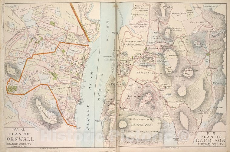
Historic 1891 Map - Plan Of Cornwall Orange County; Plan Of Garrison Putnam County - Vintage Wall Art
From:
$49.99
Historic Map - Malverne And Lake View - Nassau County (N.Y.)- New York (State) - Nassau County - Vintage Wall Art
From:
$49.99
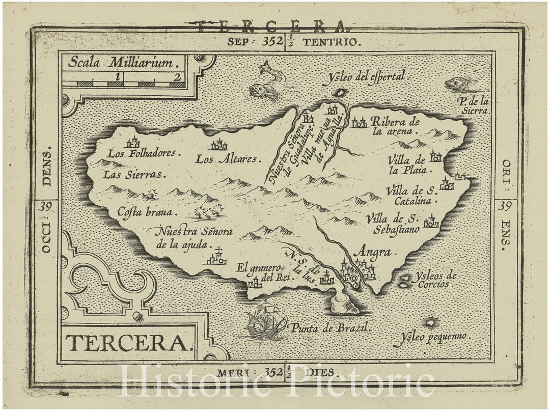
Historic Map - 1603 Terceira Island (Azores), Tercera, Abraham Ortelius - Vintage Wall Art
From:
$49.99
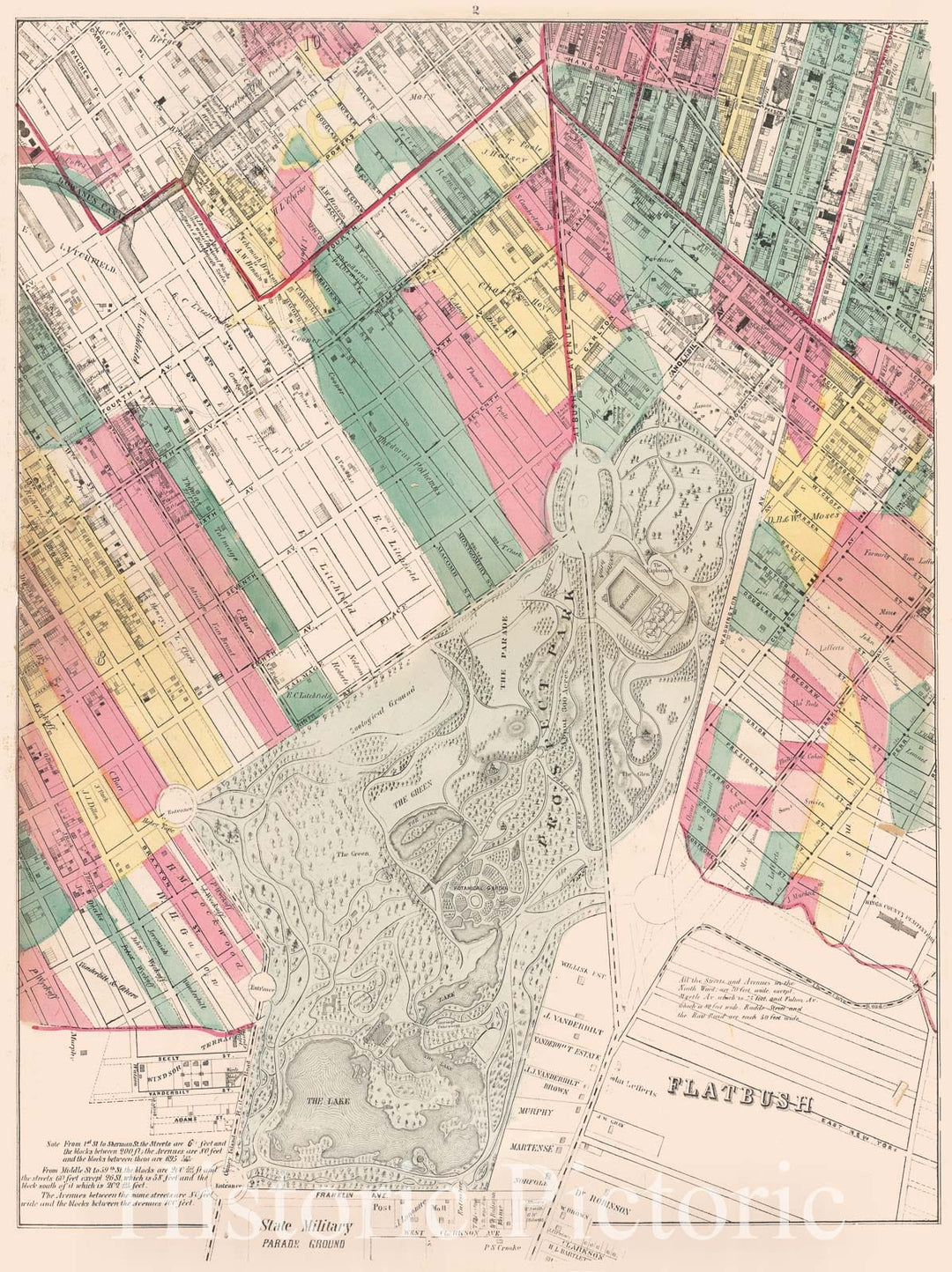
Historic Map - 1869, Brooklyn (New York, N.Y.)[Prospect Park, Windsor Terrace, Park Slope, Carroll Gardens, Gowanus Canal, Fort Greene, Clinton Hill And Prospect - Vintage Wall Art
From:
$49.99
Map : Alaska 1959, A pictorial map of Alaska : the 49th State... , Antique Vintage Reproduction
From:
$49.99
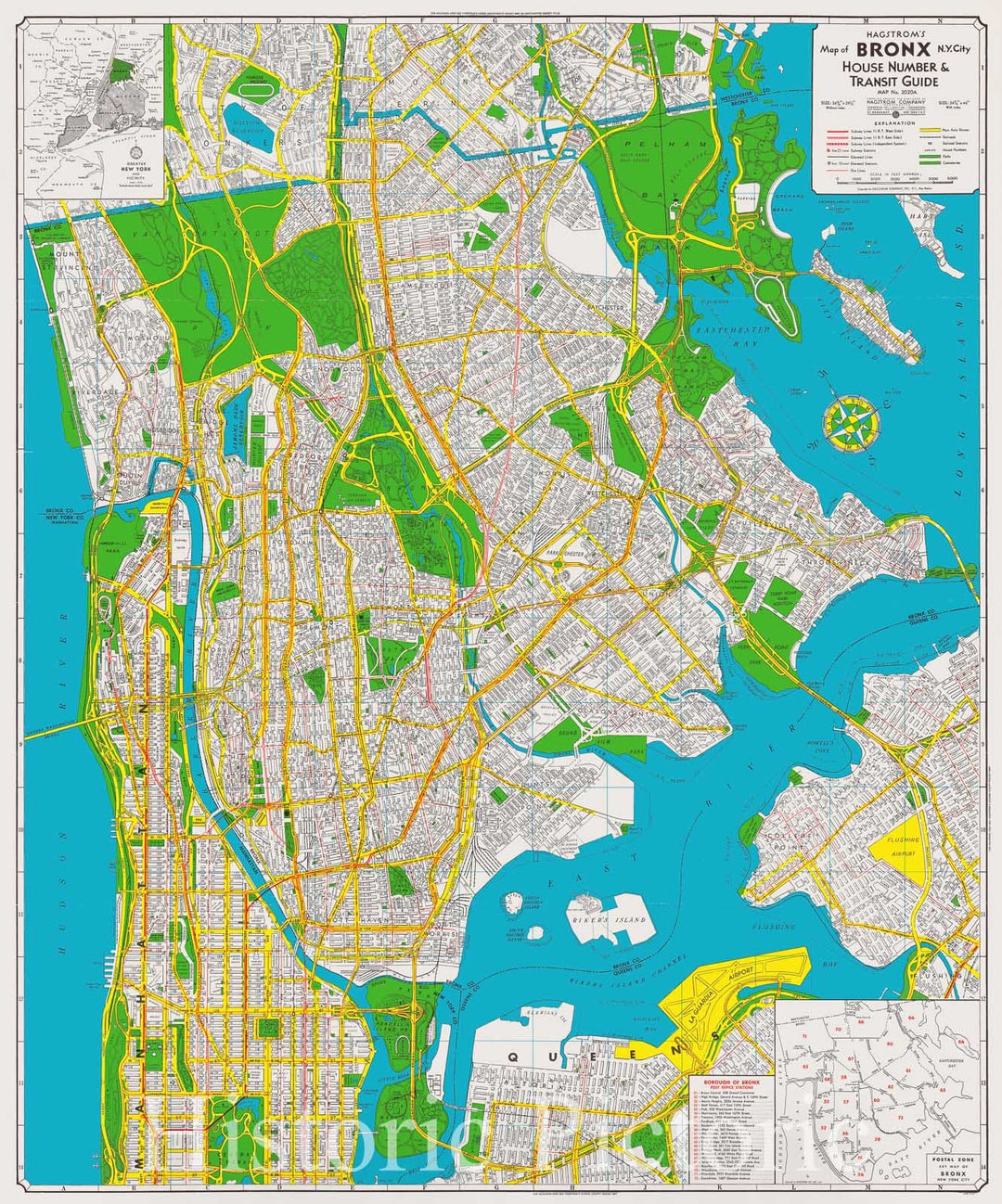
Map : Bronx, New York 1959, Hagstrom's map of Bronx, N.Y. City, house number & transit guide , Antique Vintage Reproduction
From:
$49.99
Map : Lower Mississippi River 1944 27, Geological investigation of the alluvial valley of the lower Mississippi river , Antique Vintage Reproduction
From:
$49.99
Map : France 1951, Carte gastronomique et vinicole de la France (Gastronomic and wine map of France)
From:
$34.99
Map : Galveston Texas 1929, Visitors guide, city of Galveston, Texas , Antique Vintage Reproduction
From:
$49.99
Map : Lunigiana, Italy 1775, Carta della Provincia della Lunigiana , Antique Vintage Reproduction
From:
$34.99
Map : California 1915, official railroad map, Official railroad map of California , Antique Vintage Reproduction
From:
$49.99
Map : Michigan 1865, Geological map of Michigan , Antique Vintage Reproduction
From:
$49.99
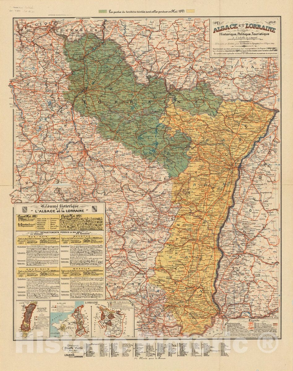
Map : Alsace Lorraine, France 1938, Alsace et Lorraine, historique, politique, touristique , Antique Vintage Reproduction
From:
$49.99
icon-chevron-left
Previous
1
…
15
16
17
18
19
…
1316
icon-chevron
Next
icon-X
"Close (esc)"
icon-chevron-left
icon-X
icon-chevron
icon-X
Non-LIVEARf