Skip to content
icon-X
Close menu
MAPS
PHOTOS
PRINTS
POSTERS
COLLECTIONS
SALE
Follow Us
instagram
Instagram
Facebook
twitter
Twitter
Cart
icon-X
Close cart
Your cart is currently empty.
MAPS
PHOTOS
PRINTS
POSTERS
COLLECTIONS
SALE
account
Log in
icon-search
Search
icon-hamburger
Site navigation
icon-bag-minimal
Cart
Search
Search
Free economy shipping for unframed orders of $75 or more!
Filter
icon-X
Close menu
Product type
Architectural Blueprint
(1)
Map
(112)
Availability
In stock
(113)
Out of stock
(0)
Price
$0.00
$534.00
Ohio State Maps
icon-filter
Filter
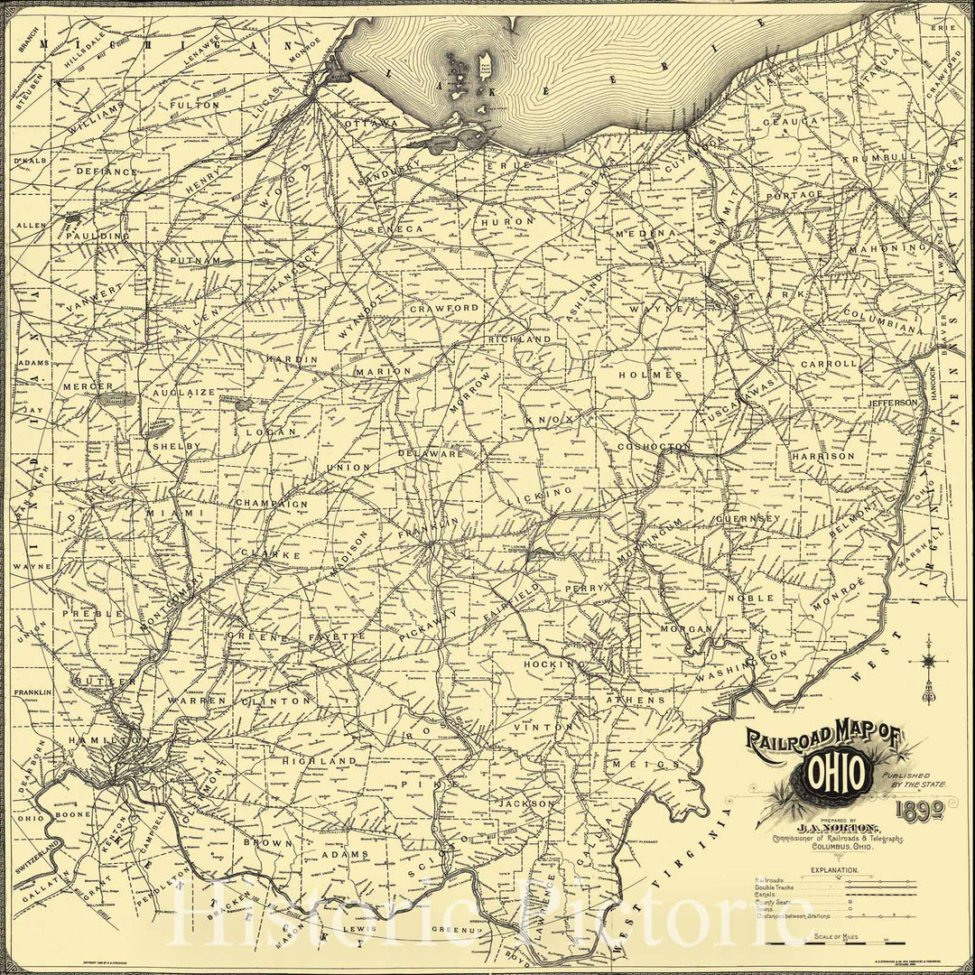
Historic 1890 Map - Railroad map of Ohio published by The State. 1890. Prepared by J. A. Norton, Commissioner of Railroads & telegraphs. Copyright by H. B. Stranahan.
From:
$34.99
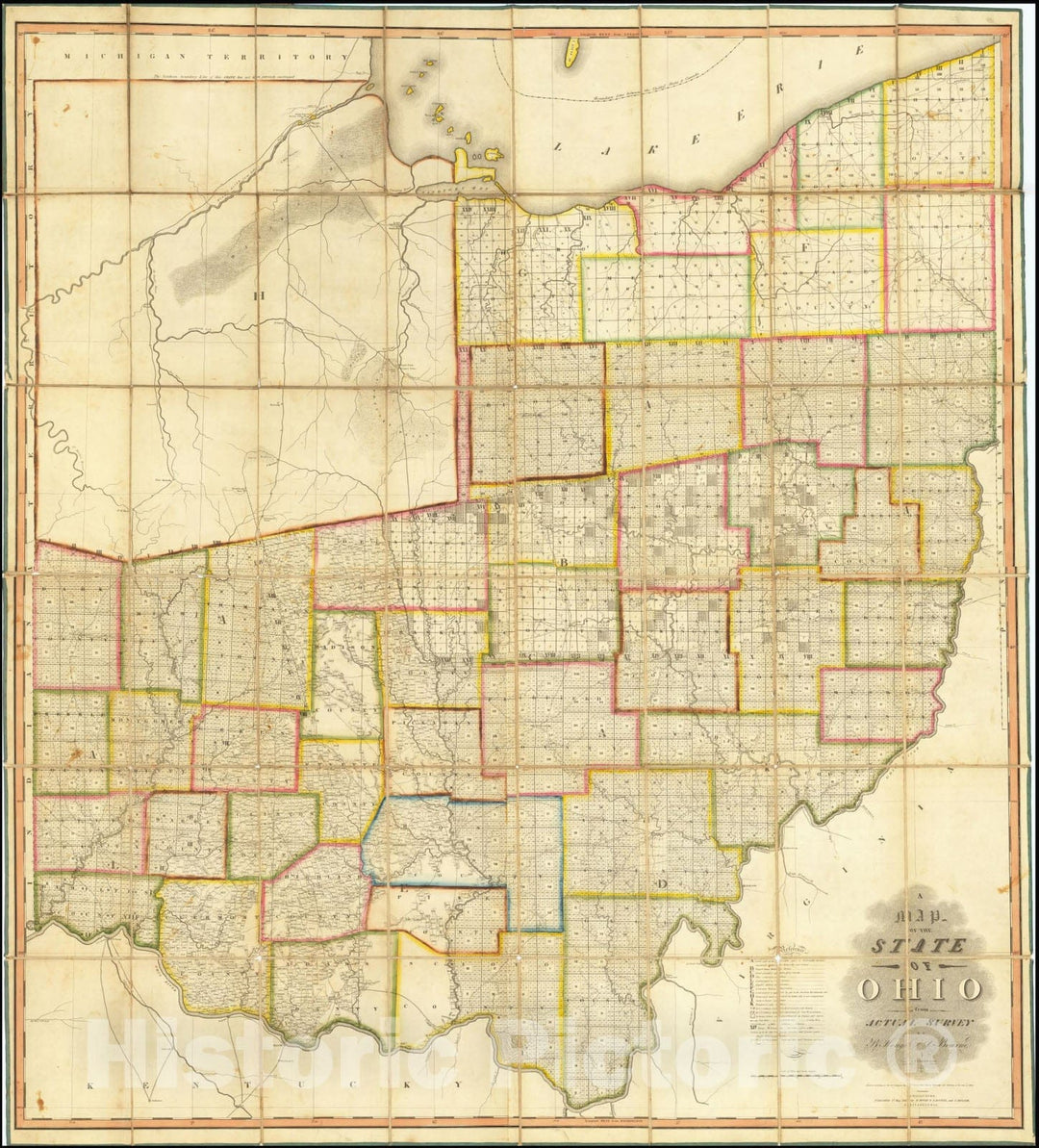
Historic Map : A State of Ohio from Actual Survey By A. Hough & C. Bourne, 1815, Vintage Wall Art
From:
$29.99
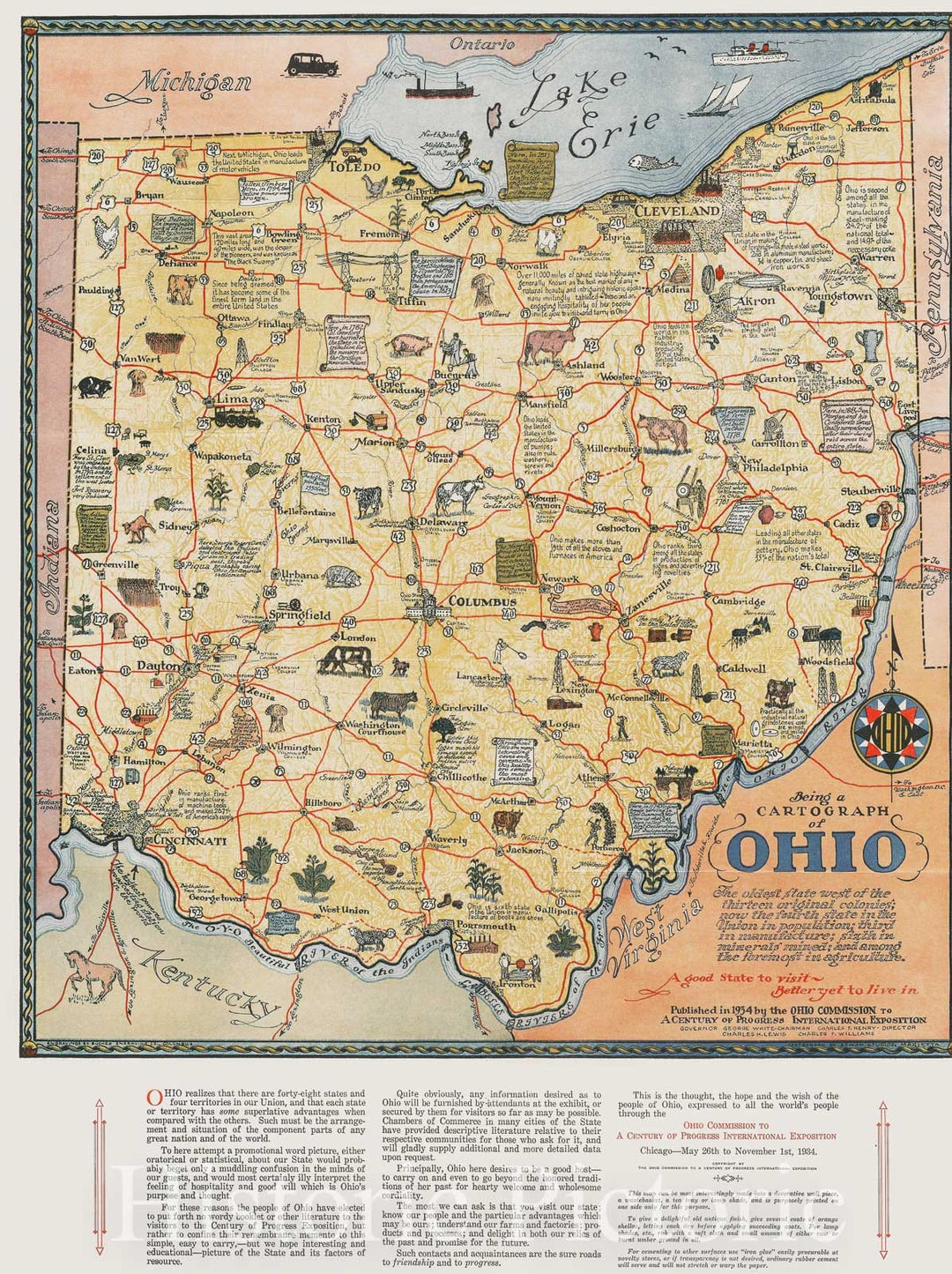
Historic Map : Being a cartograph of Ohio : the oldest state west of the thirteen original colonies ... and among the foremost in agriculture, 1934 , Vintage Wall Art
From:
$49.99
Historic Map : United States Maps, Ohio 1894 , Vintage Wall Art
From:
$49.99
Historic 1830 Map - Western States - Northwest, Old - Kentucky - Ohio - Indiana - Missouri - Illinoismaps Of North America. - Vintage Wall Art
From:
$49.99
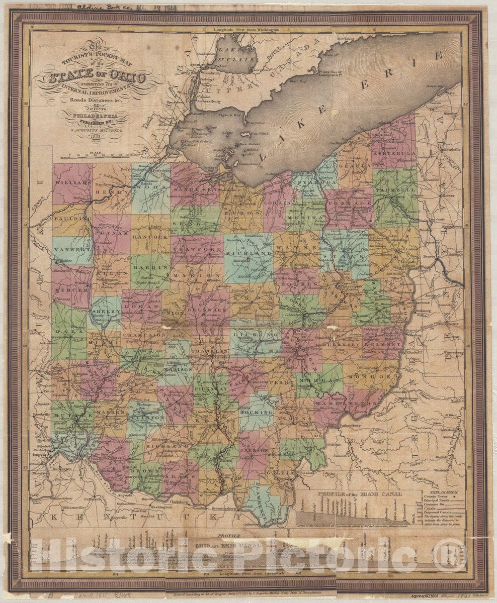
Map : Ohio 1834, The tourist's pocket map of the state of Ohio : exhibiting its internal improvements, roads, distances &c. , Antique Vintage Reproduction
From:
$49.99
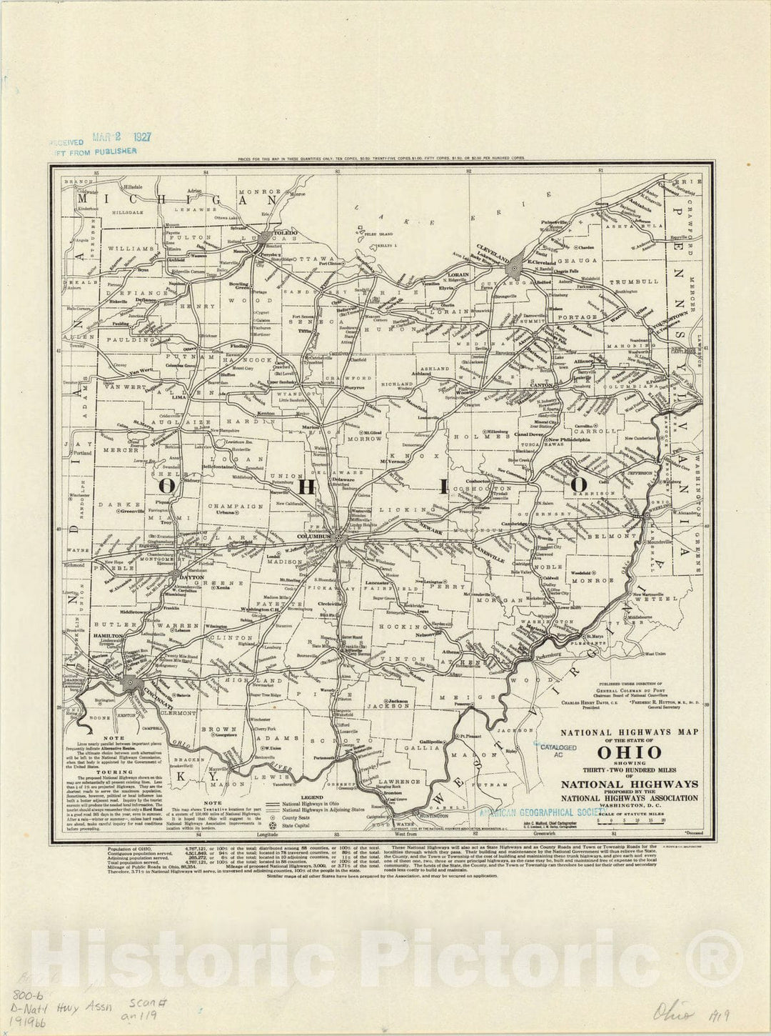
Map : Ohio 1919, National highways map of the state of Ohio : showing thirty-two hundred miles of national highways
From:
$49.99
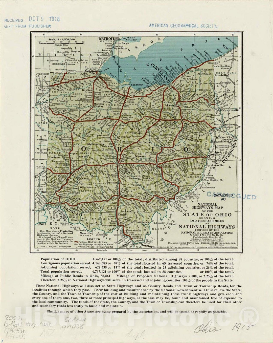
Map : Ohio 1915, National highways map of the state of Ohio : showing two thousand miles of national highways
From:
$49.99
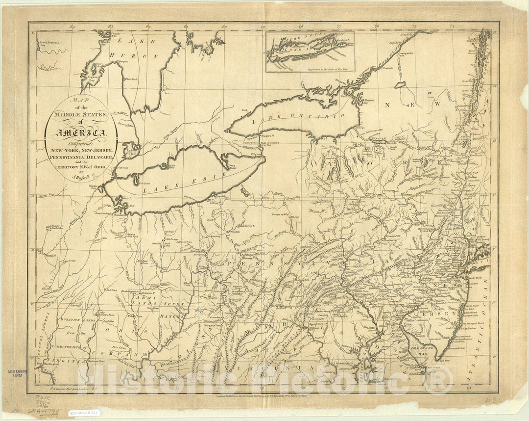
Map : United States, northeastern 1794, Map of the middle states of America : comprehends New-York, New-Jersey, Pennsylvania, Delaware, and the territory N.W. of Ohio
From:
$49.99
Map : Indiana, Ohio and the Territory of Michigan 1832, Map of the states of Indiana and Ohio with part of Michigan Territory , Antique Vintage Reproduction
From:
$49.99
Blueprint Locator map, site plan and statement of significance - Chesapeake & Ohio Railway Station, Main Street between Union & Ferry Streets, Scottsville, Albemarle County, VA
From:
$34.99
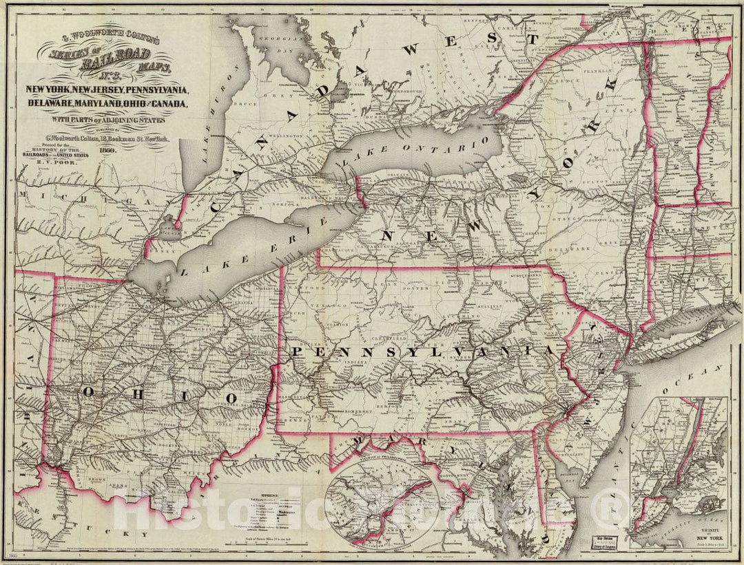
Historic 1860 Map - New York, New Jersey, Pennsylvania, Delaware, Maryland, Ohio and Canada, with Parts of adjoining States.
From:
$49.99
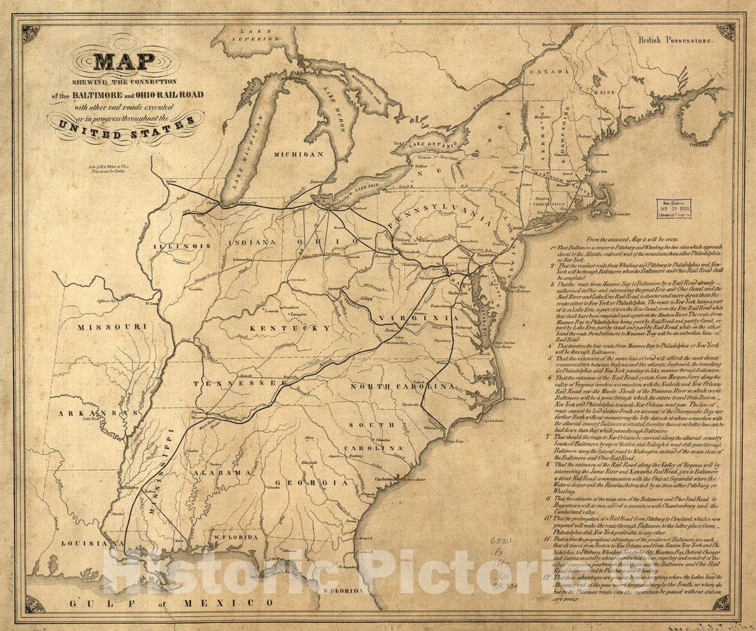
Historic 1840 Map - Map shewing The Connection of The Baltimore and Ohio-Rail-Road with Other Rail Roads executed or in Progress Throughout The United States.
From:
$49.99
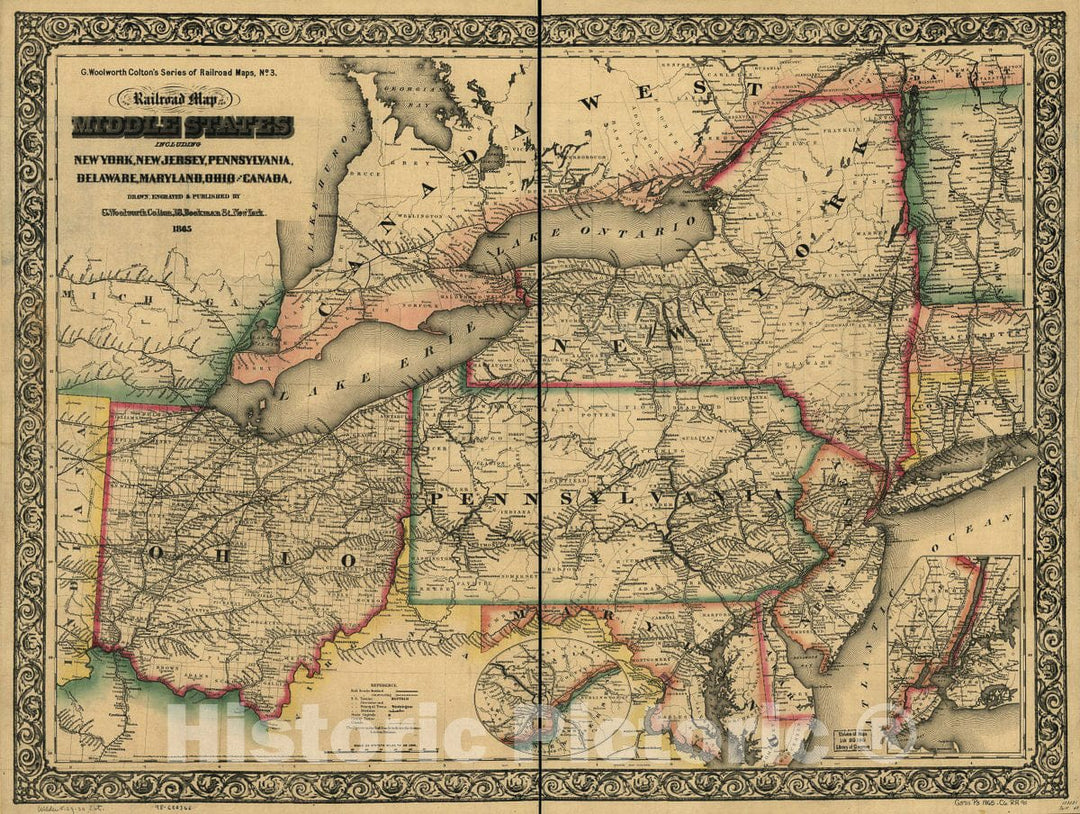
Historic 1865 Map - New Railroad map of The Middle States Including New York, New Jersey, Pennsylvania, Delaware, Maryland, Ohio and Canada
From:
$49.99
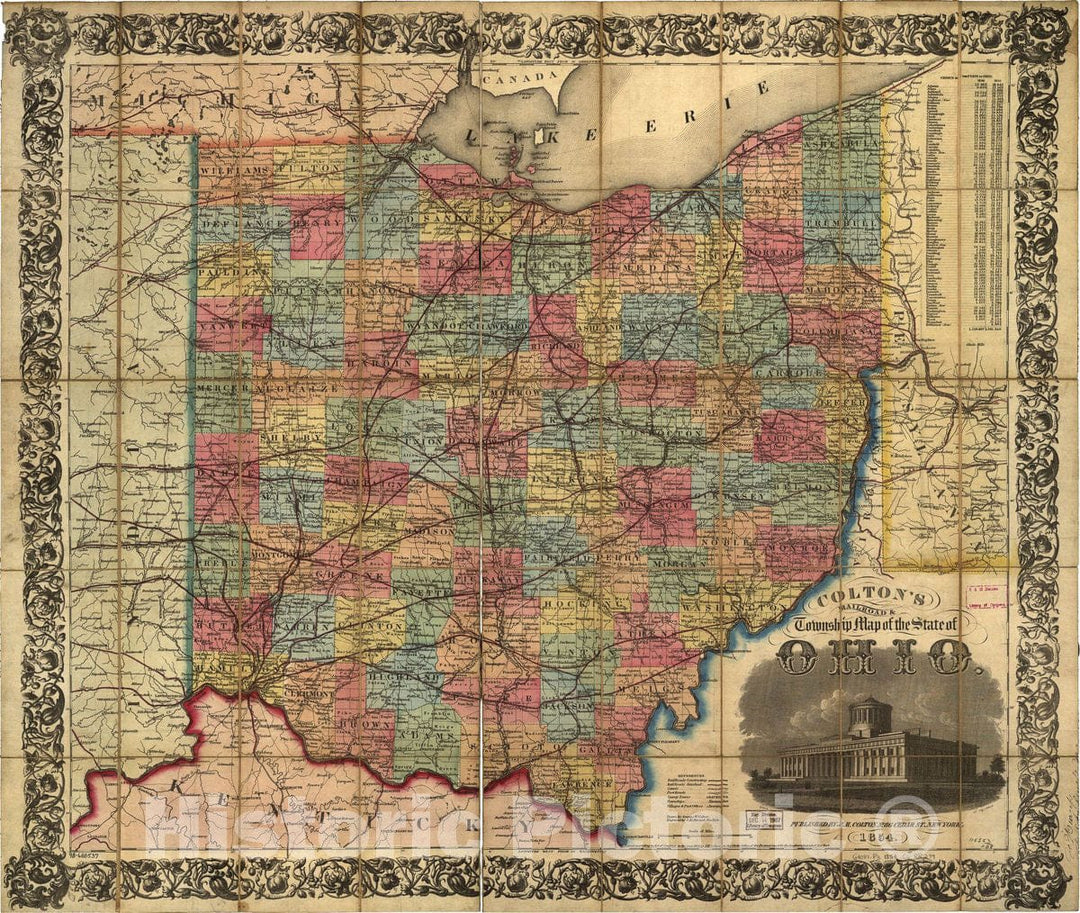
Historic 1854 Map - Colton's Railroad & Township map of The State of Ohio, Drawn by George W. Colton, Engraved by J M. Atwood.
From:
$49.99
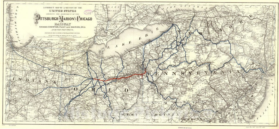
Historic 1887 Map - A Correct map of a Section of The United States Showing The Allignment sic of The Pittsburgh, Marion, and Chicago Railway Between Chewton, Penna. and Marion, Ohio
From:
$29.99
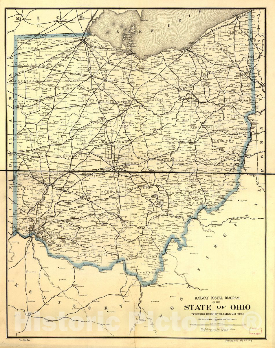
Historic 1882 Map - Railway Postal Diagram of The State of Ohio Prepared for The use of The Railway Mail Service by W. L. Nicholson, Topographer of The Post Office Dept.
From:
$49.99
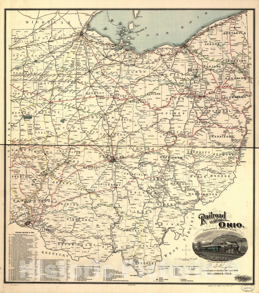
Historic 1898 Map - Railroad map of Ohio published by The State, Prepared Under The Direction of Commissioner of Railroads and telegraphs.
From:
$29.99
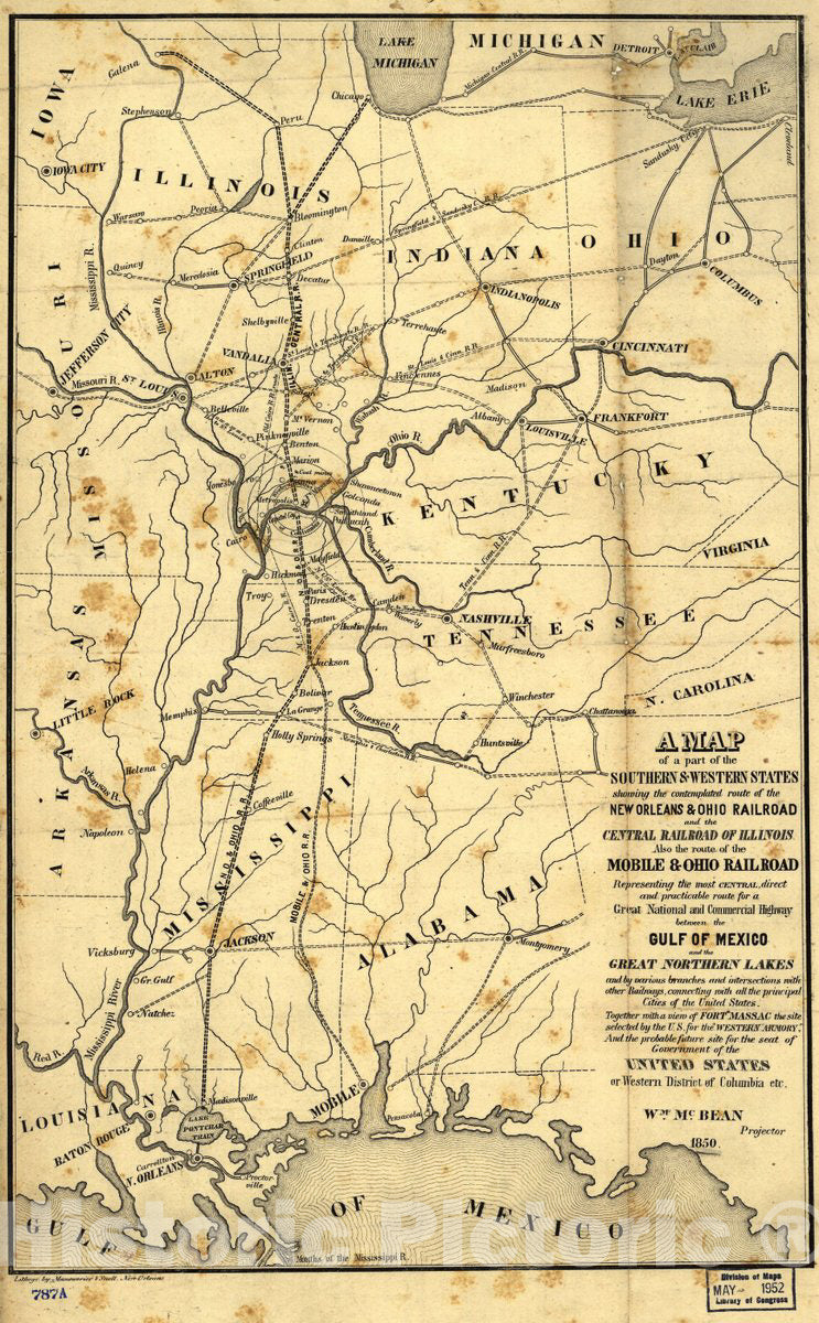
Historic 1850 Map - A map of a Part of The Southern & Western States Showing The contemplated Route of The New Orleans & Ohio Railroad and The Central Railroad of Illinois
From:
$49.99
1
2
3
…
6
icon-chevron
Next
icon-X
"Close (esc)"
icon-chevron-left
icon-X
icon-chevron
icon-X
Ohio State Maps, Posters & Prints