Skip to content
icon-X
Close menu
Maps
World Maps
World War 2 Maps
Pictorial Maps
USGS TopoGraphic Maps
Art Prints
Blueprints
Fine Art Museum Collections
Claude Monet
Photographs
Modern Photos
Posters
Collections
Kid's Room
Autos, Trains & Rails
Monet and Manet
Brewery, Beer, Liquor & more
Holiday Ready to Gift Products
Log in
Follow Us
instagram
Instagram
Facebook
twitter
Twitter
Maps
World Maps
World War 2 Maps
Pictorial Maps
USGS TopoGraphic Maps
Art Prints
Blueprints
Fine Art Museum Collections
Claude Monet
Photographs
Modern Photos
Posters
Collections
Kid's Room
Autos, Trains & Rails
Monet and Manet
Brewery, Beer, Liquor & more
Holiday Ready to Gift Products
account
Log in
icon-search
Search
icon-hamburger
Site navigation
icon-bag-minimal
Cart
Search
Search
Free economy shipping for unframed orders of $75 or more!
Filter
icon-X
Close menu
Product type
Geologic Map
(2)
Map
(111)
Topographic Map
(2)
Availability
In stock
(115)
Out of stock
(0)
Price
Pennsylvania State Maps
icon-filter
Filter
Historic Map : the State of Pennsylvania, 1942 - Vintage Wall Art
From:
$49.99
Historic 1874 Map - Atlas of Centre County, Pennsylvania - Map of The State of Pennsylvania
From:
$49.99
Historic Map : The State of Pennsylvania, 1811 - Vintage Wall Art
From:
$49.99
Historic Map : The State of Pennsylvania, 1792 v2
From:
$39.99
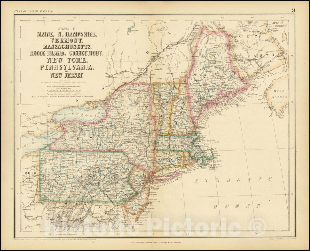
Historic Map : States of Maine, N. Hampshire, Vermont, Massachusettes, Rhode Island, Connecticut, New York, Pennsylvania, and New Jersey, 1857, Vintage Wall Art
From:
$49.99
Historic Map : A New Map of Part of the United States of North America, exhibiting the Western Territory, Kentucky, Pennsylvania, Maryland, Virginia, 1805 , Vintage Wall Art
From:
$29.99
Historic Nautical Map - Map Of The United States Pt. 2, 1954 AeroNOAA Chart - West Virginia, New York, Pennsylvania, Maryland (WV, NY, PA, MD) - Vintage Wall Art
From:
$49.99
Historic Map : United States Maps, Pennsylvania 1894 , Vintage Wall Art
From:
$49.99
Historic Map : Pennsylvania: Scranton Section 1910 , Northeast U.S. State & City Maps , Vintage Wall Art
From:
$49.99
Historic 1700 Map - A New Map Of New Jarsey And Pensilvania. - Middle Atlantic States - New Jersey - Pennsylvania - Charts And Maps - Vintage Wall Art
From:
$49.99
Historic 1 August, 1792 Map - A Map Of The State Of Pennsylvania - Vintage Wall Art, V2
From:
$49.99
Historic 1831 Map - Map Of The States Of Virginia And Maryland - Virginia - Maps - Virginia - Pennsylvania - Maryland - Maps Of North America. - Vintage Wall Art
From:
$49.99
Historic 1833 Map - New-York, N. Jersey And Pennsylvania. - New Jersey - Maps - New York (State) - Maps - Pennsylvania - Maps Of North America. - Vintage Wall Art
From:
$49.99
Historic Map - 1839 A Map Of The Canals & Rail Roads Of Pennsylvania And New Jersey And The Adjoining States - Vintage Wall Art
From:
$49.99
Historic 1828 Map - Pennsylvania And New Jersey. - United States - New Jersey - Pennsylvania - New Jersey - Maps - Pennsylvania - Maps - Vintage Wall Art
From:
$49.99
Historic 1794 Map - A Map Of Pennsylvania, From The Best Authorities. - United States - Vintage Wall Art
From:
$49.99
Historic 1 August, 1792 Map - A Map Of The State Of Pennsylvania - Vintage Wall Art
From:
$49.99
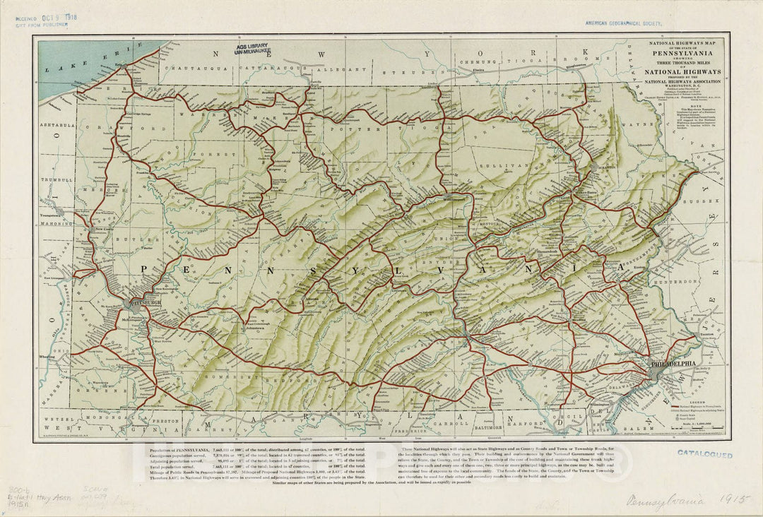
Map : Pennsylvania 1915, National highways map of the State of Pennsylvania : showing three thousand miles of national highways
From:
$49.99
Map : Pennsylvania 1913, National highways map of the State of Pennsylvania : showing three thousand miles of national highways
From:
$49.99
1
2
3
…
7
icon-chevron
Next
icon-X
"Close (esc)"
icon-chevron-left
icon-X
icon-chevron
icon-X
Pennsylvania State Wall Maps, Posters & Prints