Skip to content
icon-X
Close menu
Maps
World Maps
World War 2 Maps
Pictorial Maps
USGS TopoGraphic Maps
Art Prints
Blueprints
Fine Art Museum Collections
Claude Monet
Photographs
Modern Photos
Posters
Collections
Kid's Room
Autos, Trains & Rails
Monet and Manet
Brewery, Beer, Liquor & more
Holiday Ready to Gift Products
Log in
Follow Us
instagram
Instagram
Facebook
twitter
Twitter
Maps
World Maps
World War 2 Maps
Pictorial Maps
USGS TopoGraphic Maps
Art Prints
Blueprints
Fine Art Museum Collections
Claude Monet
Photographs
Modern Photos
Posters
Collections
Kid's Room
Autos, Trains & Rails
Monet and Manet
Brewery, Beer, Liquor & more
Holiday Ready to Gift Products
account
Log in
icon-search
Search
icon-hamburger
Site navigation
icon-bag-minimal
Cart
Search
Search
Free economy shipping for unframed orders of $75 or more!
Filter
icon-X
Close menu
State Maps
icon-filter
Filter
Historic Map - The United States of America, 1935, Ernest Dudley Chase - Vintage Wall Art
From:
$49.99
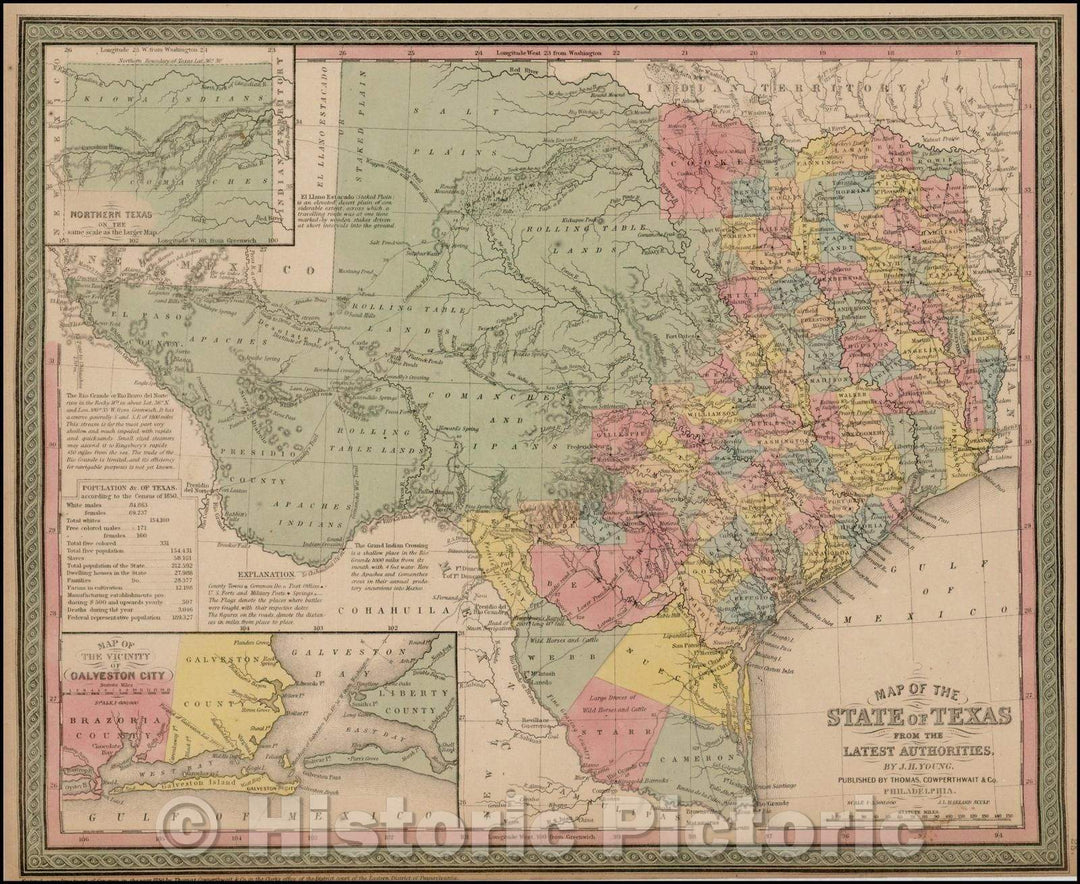
Historic Map - Map of the State of Texas From The Latest Authorities, 1852, Thomas, Cowperthwait & Co. - Vintage Wall Art
From:
$49.99
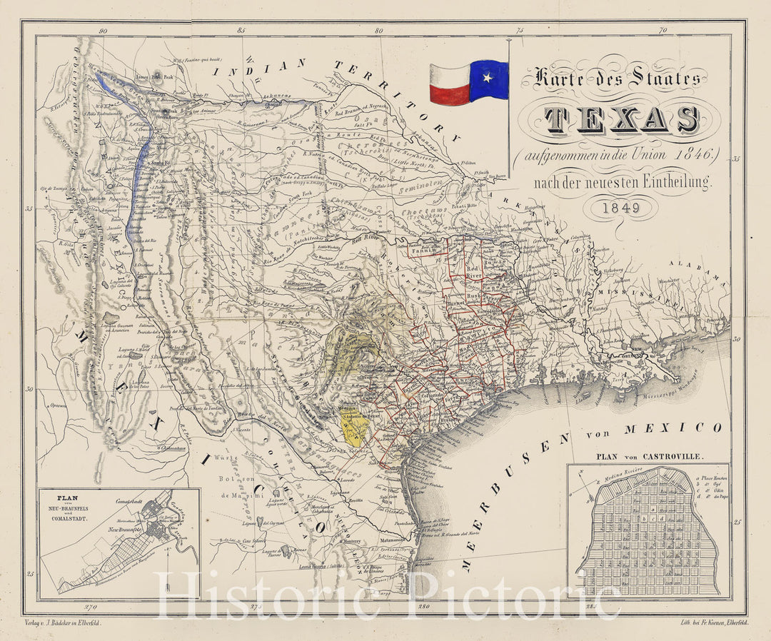
Historic Map - Karte des Staates Texas (aufgenommen in die Union 1846.) nach der neuesten :: State of Texas (admitted to the Union, 1849 - Vintage Wall Art
From:
$49.99
Historic Map - County Map of the State of California (with Large inset plan of San Francisco), 1881, Samuel Augustus Mitchell Jr. v1
From:
$49.99
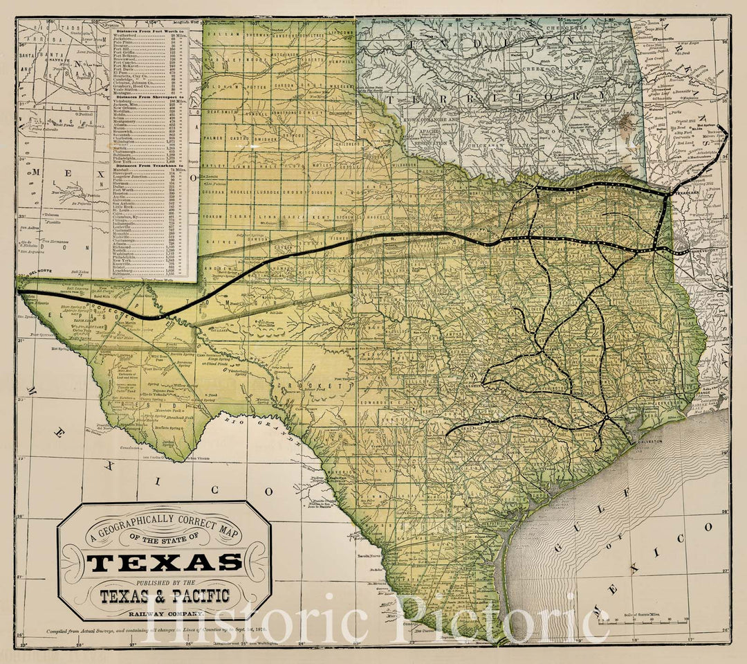
Historic Map - A Geographically Correct Map of the State of Texas, 1876, Texas & Pacific Railway Company v2
From:
$29.99
Historic Map - Map of the State of Connecticut, 1887, J.B. Beers - Vintage Wall Art
From:
$49.99
Historic Map : Camping? Visit California's Recreation Grounds the National Forests, c1915, United States GPO, Vintage Wall Art
From:
$49.99
Historic Map : Map of the Black Hills of South Dakota The Sunshine State, c1940, K. Pyle, Vintage Wall Art
From:
$49.99
Historic Map : Map of that part of the State of Missouri? called Platte Country, 1842, Edward Hutawa, v1, Vintage Wall Art
From:
$49.99
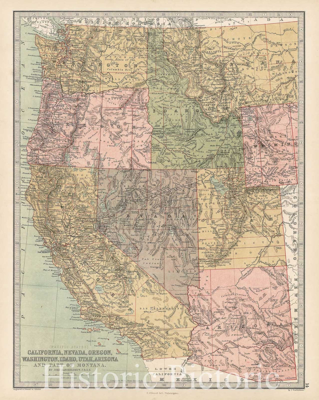
Historic Map - Pacific States California, Nevada, Oregon, Washington, Idaho, Utah, Arizona and Part of Montana, 1873, T. Ellwood Zell - Vintage Wall Art
From:
$49.99
Historic Map : Shell Highway Map of Western United States., 1951, Vintage Wall Art
From:
$49.99
Historic Map : Road map United States., 1947, Vintage Wall Art
From:
$49.99
Historic Map : 1796 Map of The United States. - Vintage Wall Art
From:
$49.99
Historic Map : National Atlas - 1956 Shell Highway Map of United States. - Vintage Wall Art
From:
$49.99
Historic Map : 1870 Prussia, German States. - Vintage Wall Art
From:
$49.99
Historic Map : 1880 Prussia, German States. - Vintage Wall Art
From:
$49.99
Historic Map : 1875 Map of Mitchell County, State of Iowa. - Vintage Wall Art
From:
$49.99
Historic Map : Case Map, United States of North America. 1796 - Vintage Wall Art
From:
$49.99
Historic Map : Railway Distance Map of the State of Wyoming, 1934 - Vintage Wall Art
From:
$49.99
icon-chevron-left
Previous
1
…
3
4
5
6
7
…
508
icon-chevron
Next
icon-X
"Close (esc)"
icon-chevron-left
icon-X
icon-chevron
icon-X
State Wall Maps, Posters & Prints