Skip to content
icon-X
Close menu
Maps
World Maps
World War 2 Maps
Pictorial Maps
USGS TopoGraphic Maps
Art Prints
Blueprints
Fine Art Museum Collections
Claude Monet
Photographs
Modern Photos
Posters
Collections
Kid's Room
Autos, Trains & Rails
Monet and Manet
Brewery, Beer, Liquor & more
Holiday Ready to Gift Products
Log in
Follow Us
instagram
Instagram
Facebook
twitter
Twitter
Maps
World Maps
World War 2 Maps
Pictorial Maps
USGS TopoGraphic Maps
Art Prints
Blueprints
Fine Art Museum Collections
Claude Monet
Photographs
Modern Photos
Posters
Collections
Kid's Room
Autos, Trains & Rails
Monet and Manet
Brewery, Beer, Liquor & more
Holiday Ready to Gift Products
account
Log in
icon-search
Search
icon-hamburger
Site navigation
icon-bag-minimal
Cart
Search
Search
Free economy shipping for unframed orders of $75 or more!
Filter
icon-X
Close menu
Product type
Architectural Blueprint
(1)
Color Photo
(1)
Geologic Map
(216)
Map
(4194)
Availability
In stock
(4414)
Out of stock
(1)
Price
United States Maps
icon-filter
Filter
Historic 1842-[1845] Map - Maine. - United States - Maine - Vintage Wall Art
From:
$49.99
Historic 1842-[1845] Map - Iowa. - United States - Iowa-Atlases Of The United States - Vintage Wall Art
From:
$49.99
Historic 1842-[1845] Map - New York - United States - Vintage Wall Art
From:
$49.99
Historic 1828 Map - New England. - United States - Vintage Wall Art
From:
$49.99
Historic 1857 Map - Map Of The Territory Of The United States From The Mississippi T - West (U.S.) - United Statesmaps Of North America. - Vintage Wall Art
From:
$34.99
Historic 1801 Map - States Of America, Drawn From The Best Authorities - United States - Maps Of North America. - Vintage Wall Art
From:
$49.99
Historic Map - 1850 Map Of The United States Of America, The British Provinces, Mexico, The West Indies And Central America, With Part Of New Granada And Venezuela - Vintage Wall Art
From:
$49.99
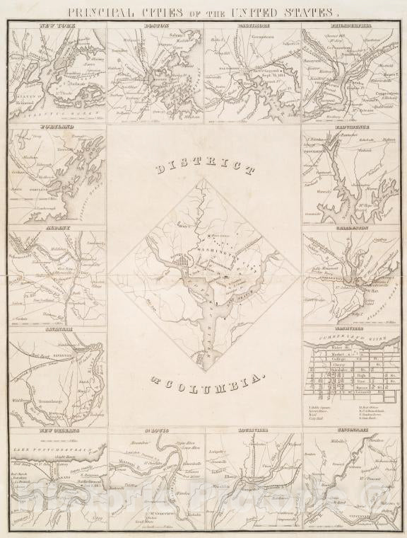
Historic 1850 Map - Principal Cities Of The United States. - Vintage Wall Art
From:
$49.99
Historic 1776 Map - Carte Nouvelle De L'Amerique Angloise : Contenant Tout Ce Que Le - United States - Great Britain - North America - Charts And Maps - Vintage Wall Art
From:
$49.99
Historic 1806 Map - A New Map Of Part Of The United States Of North America : Contai - - Vintage Wall Art
From:
$49.99
Map : United States, west 1841 1887, Map showing country explored by John Charles Fremont, from 1841 to 1854 inclusive, Antique Vintage Reproduction
From:
$34.99
Map : United States, west 1879, Map showing routes of expeditions of the North Brothers, Antique Vintage Reproduction
From:
$49.99
Map : United States, west 1870 1993, 1830-1870 western emigrant trails, major trails, cutoffs, and alternates , Antique Vintage Reproduction
From:
$49.99
Map : United States, west 1870 1999, 1820-1870 western emigrant trails. : historic trails cutoffs, and alternates , Antique Vintage Reproduction
From:
$49.99
Map : United States, west 1985, Congressional districts : January 1985 , Antique Vintage Reproduction
From:
$49.99
Map : United States, west 1822 1990, The Santa Fe Trail , Antique Vintage Reproduction
From:
$49.99
Map : United States 1856, Carte des Etats-Unis , Antique Vintage Reproduction
From:
$49.99
Map : United States 1757, Carte de la Floride, de la Louisiane, et pays voisin : pour servir a l'historie generale des voyages , Antique Vintage Reproduction
From:
$49.99
Map : United States, eastern 1890, Antique Vintage Reproduction
From:
$49.99
icon-chevron-left
Previous
1
…
38
39
40
41
42
…
233
icon-chevron
Next
icon-X
"Close (esc)"
icon-chevron-left
icon-X
icon-chevron
icon-X
United States Wall Maps, Posters & Prints
![Historic 1842-[1845] Map - Maine. - United States - Maine - Vintage Wall Art](http://www.historicpictoric.com/cdn/shop/products/5123939_1wmark.jpg?v=1599519285&width=1080)
![Historic 1842-[1845] Map - Iowa. - United States - Iowa-Atlases Of The United States - Vintage Wall Art](http://www.historicpictoric.com/cdn/shop/products/5123940_1wmark.jpg?v=1599519285&width=1080)
![Historic 1842-[1845] Map - New York - United States - Vintage Wall Art](http://www.historicpictoric.com/cdn/shop/products/5123903_1wmark.jpg?v=1599519253&width=1080)