Skip to content
icon-X
Close menu
Maps
World Maps
World War 2 Maps
Pictorial Maps
USGS TopoGraphic Maps
Art Prints
Blueprints
Fine Art Museum Collections
Claude Monet
Photographs
Modern Photos
Posters
Collections
Kid's Room
Autos, Trains & Rails
Monet and Manet
Brewery, Beer, Liquor & more
Holiday Ready to Gift Products
Log in
Follow Us
instagram
Instagram
Facebook
twitter
Twitter
Cart
icon-X
Close cart
Your cart is currently empty.
Maps
World Maps
World War 2 Maps
Pictorial Maps
USGS TopoGraphic Maps
Art Prints
Blueprints
Fine Art Museum Collections
Claude Monet
Photographs
Modern Photos
Posters
Collections
Kid's Room
Autos, Trains & Rails
Monet and Manet
Brewery, Beer, Liquor & more
Holiday Ready to Gift Products
account
Log in
icon-search
Search
icon-hamburger
Site navigation
icon-bag-minimal
Cart
Search
Search
Free economy shipping for unframed orders of $75 or more!
Filter
icon-X
Close menu
Vintage Maps
icon-filter
Filter
Historic Golf Course Map - Augusta National Golf Club Course, 1954 - Vintage Wall Art
From:
$34.99
Historic Map - Map of the World, 1587, Urbano Monte - Vintage Wall Art
From:
$49.99
Historic Map : Oak Island Treasure, Nova Scotia, Canada, Nolan, 1974, Vintage Wall Art
From:
$49.99
Historic Map : Negroland, adjacent countries., 1747, Vintage Wall Art
From:
$49.99
Historic Map - Pictorial Map of Frick Park, Pittsburgh, Pennsylvania, 1939, - Vintage Wall Art
From:
$49.99
Historic Map : Temperance Broadside - Black Valley Railroad, Hanks, 1863, Vintage Wall Art
From:
$49.99
Historic Map : Plantations on the Mississippi River From Natchez to New Orleans 1858., 1858, Joseph Aiena, Vintage Wall Art
From:
$49.99
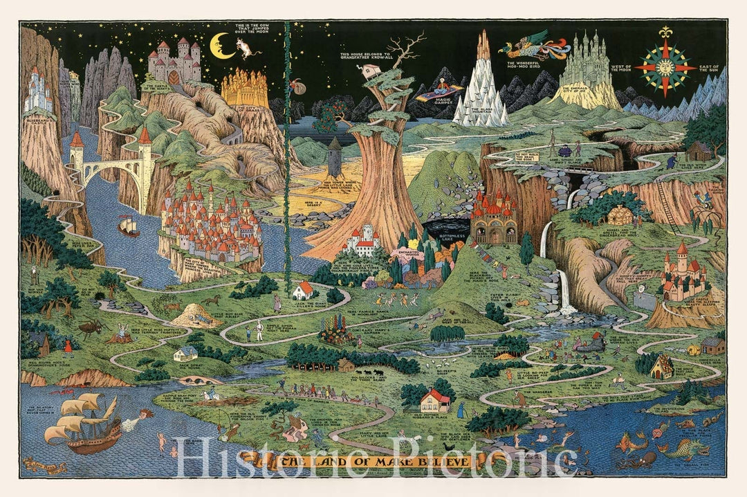
Historic Map : The land of make believe. Published by Jaro Hess 1930, 1930, Vintage Wall Art
From:
$49.99
Historic Map - Florida. (inset: Western part of Florida). Five flags have flown over Florida. 1953 - Vintage Wall Art
From:
$49.99
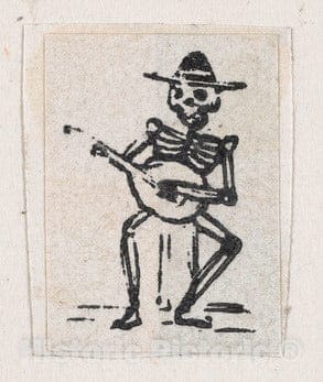
Art Print : Skeleton Playing The Guitar - Artist: Jose Guadalupe Posada - Created: c1889 : Vintage Wall Art
From:
$29.99
Historic Map : Vaux and Olmsted Map of Prospect Park, Brooklyn, New York, 1868, Vintage Wall Art
From:
$49.99
Historic Map - Cartomap Leech Lake Minnesota Showing Leech Lake and Vicinity with Roads to Resorts and Historical Data Pertinent to the Lake, 1940 - Vintage Wall Art
From:
$49.99
Historic Map : The Land of Make Believe., 1958, Vintage Wall Art
From:
$49.99
Historic Map - A map of the Chesapeake Bay :"land of pleasant living", 1959, - Vintage Wall Art
From:
$49.99
Wall Map, World - Ocean Floors and Land Relief. 1976 - Vintage Wall Art
From:
$49.99
Historic Map : Bird's-Eye View of The Life of Christ , Chronological, Geographical and Harmonical,1892 (1894), Vintage Wall Art
From:
$49.99
Historic Map : Big Bear Lake California, Big Bear Lake Souvenir Fun Map, 1947, George Ramsey, Vintage Wall Art
From:
$39.99
Historic Map : CBS American School of the Air, Air Age Map of the World, A Polar Projection, 1943 - Vintage Wall Art
From:
$49.99
Historic Map : Lincoln Highway Association Map of The Lincoln Highway, 1913, Vintage Wall Art
From:
$49.99
1
2
3
…
1316
icon-chevron
Next
icon-X
"Close (esc)"
icon-chevron-left
icon-X
icon-chevron
icon-X
Vintage Maps