Skip to content
icon-X
Close menu
Maps
World Maps
World War 2 Maps
Pictorial Maps
USGS TopoGraphic Maps
Art Prints
Blueprints
Fine Art Museum Collections
Claude Monet
Photographs
Modern Photos
Posters
Collections
Kid's Room
Autos, Trains & Rails
Monet and Manet
Brewery, Beer, Liquor & more
Holiday Ready to Gift Products
Log in
Follow Us
instagram
Instagram
Facebook
twitter
Twitter
Maps
World Maps
World War 2 Maps
Pictorial Maps
USGS TopoGraphic Maps
Art Prints
Blueprints
Fine Art Museum Collections
Claude Monet
Photographs
Modern Photos
Posters
Collections
Kid's Room
Autos, Trains & Rails
Monet and Manet
Brewery, Beer, Liquor & more
Holiday Ready to Gift Products
account
Log in
icon-search
Search
icon-hamburger
Site navigation
icon-bag-minimal
Cart
Search
Search
Free economy shipping for unframed orders of $75 or more!
Filter
icon-X
Close menu
Product type
Geologic Map
(6)
Map
(162)
Availability
In stock
(168)
Out of stock
(0)
Price
Washington State Maps
icon-filter
Filter
Map : Geologic map of Washington State, 2005 Cartography Wall Art :
From:
$49.99
Historic Map - Pictorial Map of Washington,"The Evergreen State", 1948, - Vintage Wall Art
From:
$49.99
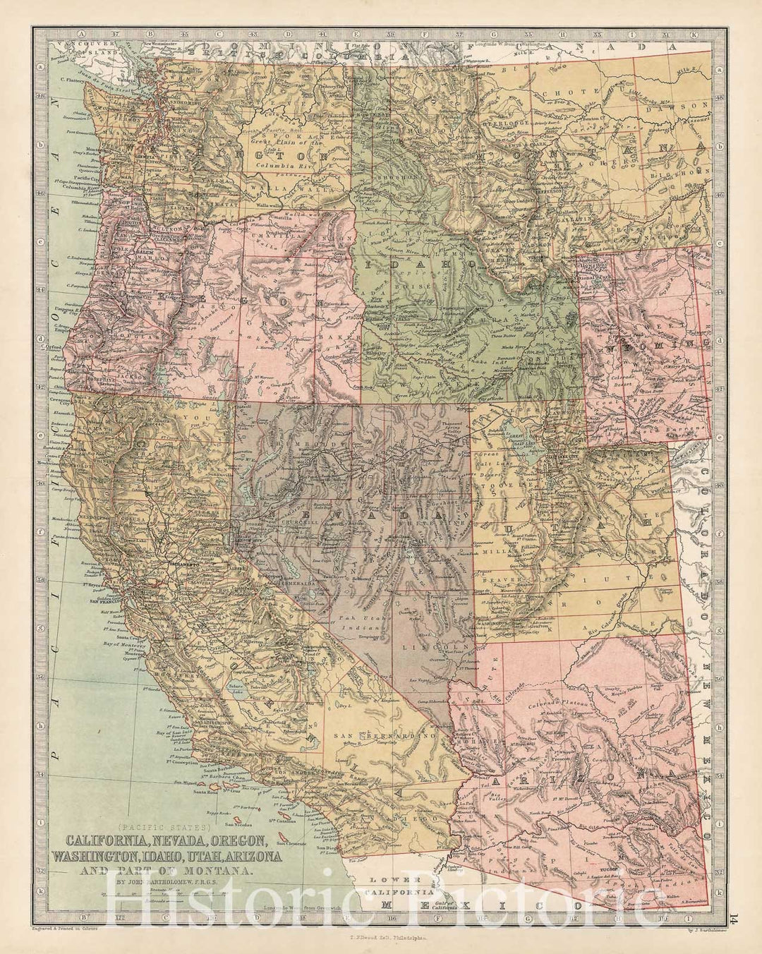
Historic Map - Pacific States California, Nevada, Oregon, Washington, Idaho, Utah, Arizona and Part of Montana, 1873, T. Ellwood Zell - Vintage Wall Art
From:
$49.99
Historic Map : Plan of the City of Washington.The Capitol of the United States of America., 1864, Vintage Wall Art
From:
$49.99
Historic Map : Plan of the City of Washington.The Capitol of the United States of America., 1861, Vintage Wall Art
From:
$49.99
Historic Map : Plan of the City of Washington in the Territory of Columbia, ceded by the States of Virginia and Maryland to the United States of America, 1792 , Vintage Wall Art
From:
$49.99
Historic Map : State of Maine Washington County, 1973 , Vintage Wall Art
From:
$49.99
Historic Map : Plan of the city of Washington : the capitol of the United States of America, 1870 , Vintage Wall Art
From:
$49.99
Historic Map : Johnson's Georgetown and the City of Washington, the Capital of the United States of America. By Johnson and Ward, 1862 , Vintage Wall Art
From:
$49.99
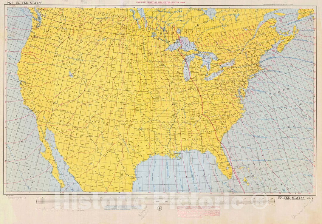
Historic Nautical Map - Isogonic Chart Of The United States, 1960 NOAA Magnetic Historic Nautical Map - California, Washington, Florida (CA, WA, FL) - Vintage Wall Art
From:
$49.99
Historic Nautical Map - Great Circle Chart United States, 1941 NOAA Chart - Maine, California, Washington, Florida (ME, CA, WA, FL) - Vintage Wall Art
From:
$49.99
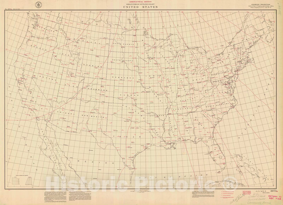
Historic Nautical Map - Great Circle Outline Chart United States, 1941 NOAA Chart - Maine, California, Washington, Florida (ME, CA, WA, FL) - Vintage Wall Art
From:
$49.99
Historic Nautical Map - Map Of The United States, 1954 NOAA Base Historic Nautical Map - Washington, South Dakota, Wyoming (WA, SD, WY) - Vintage Wall Art
From:
$49.99
Historic Map : United States Maps, Washington 1894 , Vintage Wall Art
From:
$49.99
Historic Map : Norfolk & North Canaan & Salisbury & Washington 1893 , Town and City Atlas State of Connecticut , Vintage Wall Art
From:
$49.99
Historic Map : Atlas State of Maine, Washington 1894-95 , Vintage Wall Art
From:
$49.99
Historic Map : Goshen & Lempster & Washington 1892 , Town and City Atlas State of New Hampshire , Vintage Wall Art
From:
$49.99
Historic Map - 1850 Map Of The City Of Washington : Established As The Permanent Seat Of The Government Of The United States Of America - Vintage Wall Art
From:
$49.99
Historic Map - 1820 Georgetown, A Correct Map Of The City Of Washington : Capital Of The United States Of America : Lat. 38.53 N, Long. 0.0 - Vintage Wall Art
From:
$49.99
1
2
3
…
9
icon-chevron
Next
icon-X
"Close (esc)"
icon-chevron-left
icon-X
icon-chevron
icon-X
Washington State Maps, Posters & Prints