-
-


-
Wall Color
in
Uncheck to hide the white line Check to show the white line -
-
.


Frame
Room
Gallery
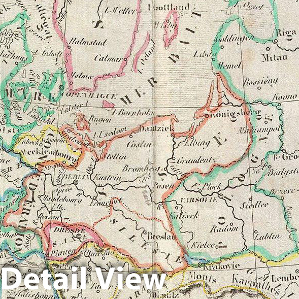
Historic Map : MalteBrun Map of Europe, Version 2, 1843, Vintage Wall Art
Historic Map : MalteBrun Map of Europe, Version 2, 1843, Vintage Wall Art
Note: Sold out or unavailable
Couldn't load pickup availability
This is a fine example of Conrad Malte-Brun's 1843 map of europe. The map covers the entire continent from the Atlantic Ocean to the Ural Mountains and from the Arctic Ocean to northern Africa and Turkey. It includes Spain, Portugal, France, Italy, european Russia, Sweden, Denmark, Norway, Germany, Ireland, Great Britain, and Turkey in europe, Greece and Iceland. Issued following the defeat of Napoleonic France and the Congress of Vienna, europe is shown under a new peaceful balance of power, centered on the five most important powers (also referred to as the five 'Great Powers'): the United Kingdom, France, Russia, Prussia and the Austrian empire. Alas, the 'peace' was but an illusion as the treaties ending the Napoleonic era were inherently flawed. Old rivalries festered and nationalism, liberalism, revolution (industrial and otherwise) was once again on the rise throughout europe. Various cities, countries, towns, islands, rivers, lakes and various other topographical details are marked, with relief shown by hachures. Boundaries are color coded according to countries and regions. This map was issued as plate nos. 35 and 36 in Conrad Malte-Brun's 1843 Precis de la Geographie Universelle.
- VINTAGE MAP REPRODUCTION: Add style to any room's decor with this beautiful decorative print. Whether your interior design is modern, rustic or classic, a map is never out of fashion
- MUSEUM QUALITY INKS AND PAPER: Printed on thick 192gsm heavyweight matte paper with archival giclee inks, this historic fine art will decorate your wall for years to come
- ARTWORK MADE TO ORDER IN THE USA: We make each reprint only when you order it. Every antique map is edited for image quality, color and vibrance, so it can look its best while retaining historical character. Makes a great gift!
- FRAME READY: Your unframed poster ships crease-free, rolled in a sturdy mailing tube. Many maps fit easy-to-find standard size frames 16x20, 16x24, 18x24, 24x30, 24x36, saving on custom framing
- Watermarks will not appear in the printed picture. Old maps sometimes have blemishes, tears, or stamps that may be removed from the final print
Why choose Historic Pictoric
Every artwork we offer is carefully edited by our small but dedicated team of image professionals, ensuring each detail is perfect. We print every order to demand right here in the USA, treating every piece with the same care and attention we would give our own work. From editing to printing to packaging, we take pride in delivering artwork that meets our high standards—and we love knowing it’s heading to a home where it will be appreciated.