-
-


-
Wall Color
in
Uncheck to hide the white line Check to show the white line -
-
-


 Frame
Frame Room
Room Gallery
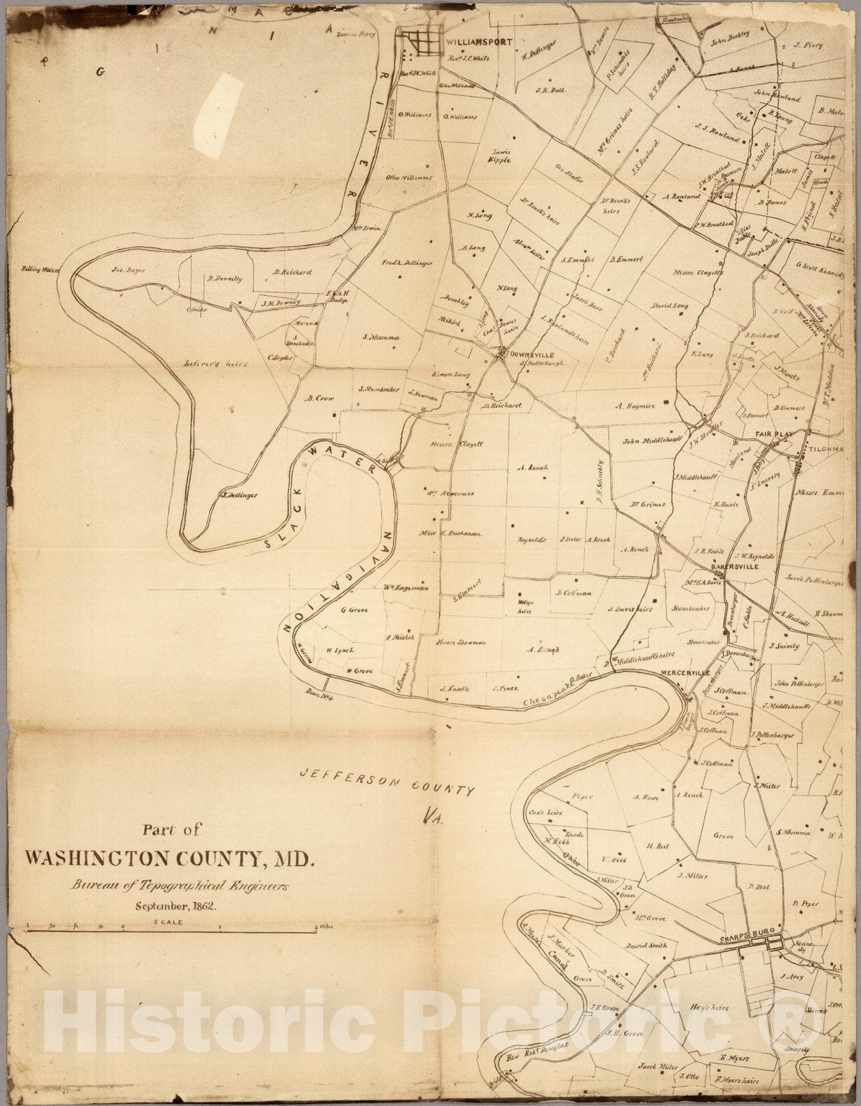
Washington County, Maryland - Civil War, 1862 Historical Map Print
Washington County, Maryland - Civil War, 1862 Historical Map Print
Regular price
Sale price
$49.99 USD
Note: Sold out or unavailable
Couldn't load pickup availability
Made-to-order print of Washington County, Maryland - Civil War, 1862. A historical map reproduction for wall art, offices, studies, and collectors.
- VINTAGE MAP REPRODUCTION: Add style to any room's decor with this beautiful decorative print. Whether your interior design is modern, rustic or classic, a map is never out of fashion
- MUSEUM QUALITY INKS AND PAPER: Printed on thick 192gsm heavyweight matte paper with archival giclee inks, this historic fine art will decorate your wall for years to come
- ARTWORK MADE TO ORDER IN THE USA: We make each reprint only when you order it. Every antique map is edited for image quality, color and vibrance, so it can look its best while retaining historical character. Makes a great gift!
- FRAME READY: Your unframed poster ships crease-free, rolled in a sturdy mailing tube. Many maps fit easy-to-find standard size frames 16x20, 16x24, 18x24, 24x30, 24x36, saving on custom framing
- Watermarks will not appear in the printed picture. Old maps sometimes have blemishes, tears, or stamps that may be removed from the final print
Why choose Historic Pictoric
Every artwork we offer is carefully edited by our small but dedicated team of image professionals, ensuring each detail is perfect. We print every order to demand right here in the USA, treating every piece with the same care and attention we would give our own work. From editing to printing to packaging, we take pride in delivering artwork that meets our high standards—and we love knowing it’s heading to a home where it will be appreciated. What our customers say.