-
-


-
Wall Color
in
Uncheck to hide the white line Check to show the white line -
-
.


Frame
Room
Gallery
Historic Map : Spain, 36. Mapa geographico de la provincia de Palencia, 1782 , Vintage Wall Art
Historic Map : Spain, 36. Mapa geographico de la provincia de Palencia, 1782 , Vintage Wall Art
Note: Sold out or unavailable
Couldn't load pickup availability
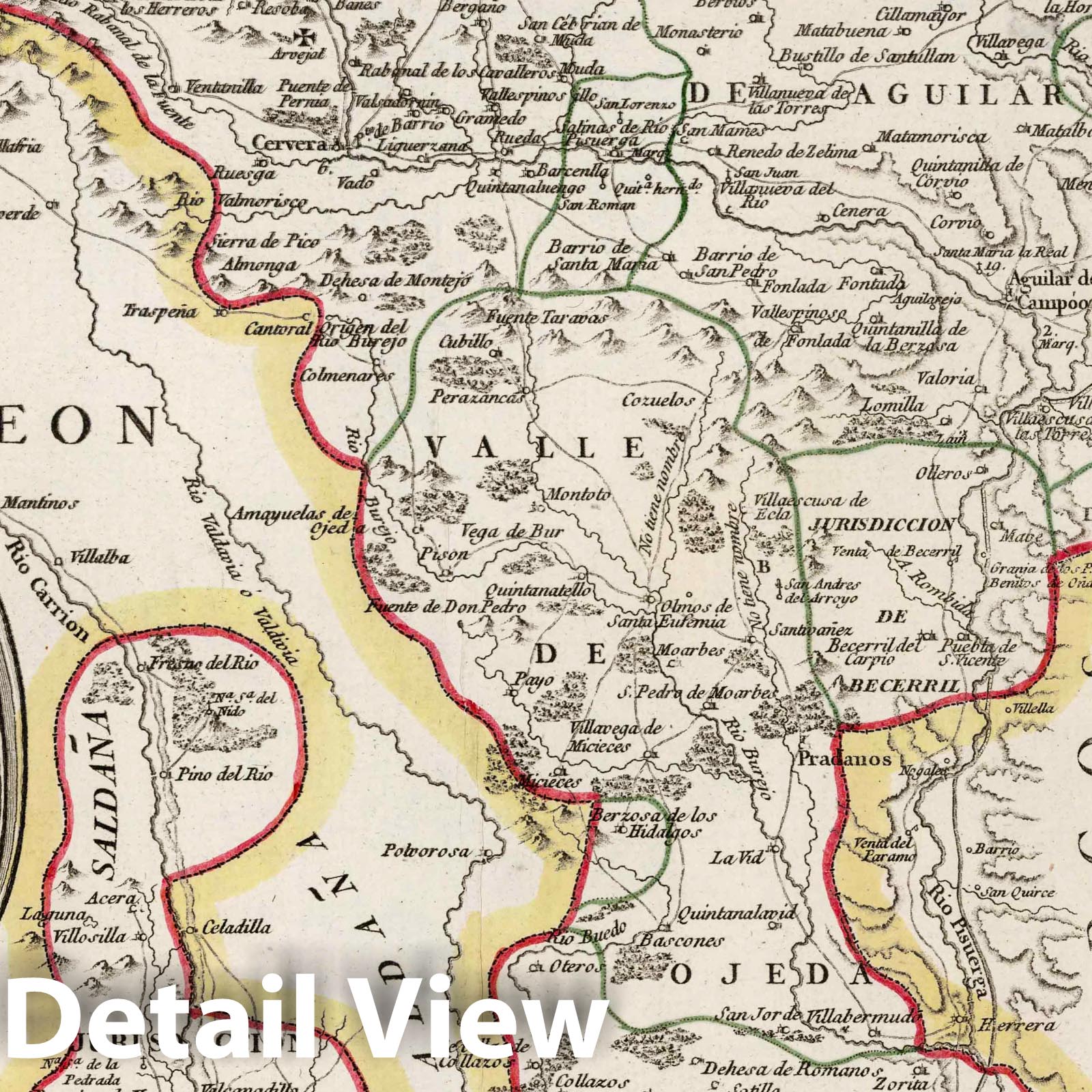
Mapa geographico de la provincia de Palencia : que comprehende todos sus valles y jurisdicciones ... Por Don Tomas Lopez Geografo de los Dominios de S.M. ... Madrid, ano de 1782. (to accompany) Atlas geografico de Espana ... por Don Tomas Lopez ... Tomo Primero. Ano 1810. | Atlas geografico de Espana : que comprende el mapa general de la peninsula, todos los particulares de nuestras provincias, y el del reyno de Portugal. por Don Tomas Lopez, geo�?grafo que fue de los dominios de S.M. e individuo de varias academias y sociedades. Tomo Primero. Ano 1810. Se hallara en Madrid, Calle de Atocha frente a la plazuela del Angel no. 1, y a la casa de los Gremios no. 3. | Second edition of the geographic atlas of Spain, published in 1810, with half title page, 4 pages of index, contents and text. Comprising 38 maps on 98 sheets, Madrid (sheet 99) added later by owner, along with three other maps later removed. Some maps on multiple sheets. Maps dated 1765 - 1802. Contains the general map of the peninsula, all the provinces, and the kingdom of Portugal By Don Tomas Lopez. Maps are engraved outline hand colored, with decorative title cartouche, text and tables, showing administrative divisions, major cities, towns, villages, landmarks, public buildings, roads, rivers, canals and mountains. Bound in half leather marbled paper covers with title " Atlas geografico de Espana I" on spine in gilt. Relief shown pictorially. Don Tomas Lopez (1730-1802) a Spanish cartographer, began his studies at the Imperial College of the Spanish capital. In 1752 he went to continue his training in Paris to learn cartography with the great French mapmaker Jean Baptiste Bourguignon d'Anville (1697-1782). In Paris he was accompanied by, among others, Juan de la Cruz Cano y Olmedilla, Manuel Salvador Carmona and Alonso Cruzado.
Some of these images may show signs of wear and tear - we believe that in many cases this contributes to the aesthetics of the item.
- VINTAGE MAP REPRODUCTION: Add style to any room's decor with this beautiful decorative print. Whether your interior design is modern, rustic or classic, a map is never out of fashion
- MUSEUM QUALITY INKS AND PAPER: Printed on thick 192gsm heavyweight matte paper with archival giclee inks, this historic fine art will decorate your wall for years to come
- ARTWORK MADE TO ORDER IN THE USA: We make each reprint only when you order it. Every antique map is edited for image quality, color and vibrance, so it can look its best while retaining historical character. Makes a great gift!
- FRAME READY: Your unframed poster ships crease-free, rolled in a sturdy mailing tube. Many maps fit easy-to-find standard size frames 16x20, 16x24, 18x24, 24x30, 24x36, saving on custom framing
- Watermarks will not appear in the printed picture. Old maps sometimes have blemishes, tears, or stamps that may be removed from the final print
Why choose Historic Pictoric
Every artwork we offer is carefully edited by our small but dedicated team of image professionals, ensuring each detail is perfect. We print every order to demand right here in the USA, treating every piece with the same care and attention we would give our own work. From editing to printing to packaging, we take pride in delivering artwork that meets our high standards—and we love knowing it’s heading to a home where it will be appreciated.