-
-


-
Wall Color
in
Uncheck to hide the white line Check to show the white line -
-
.


Frame
Room
Gallery
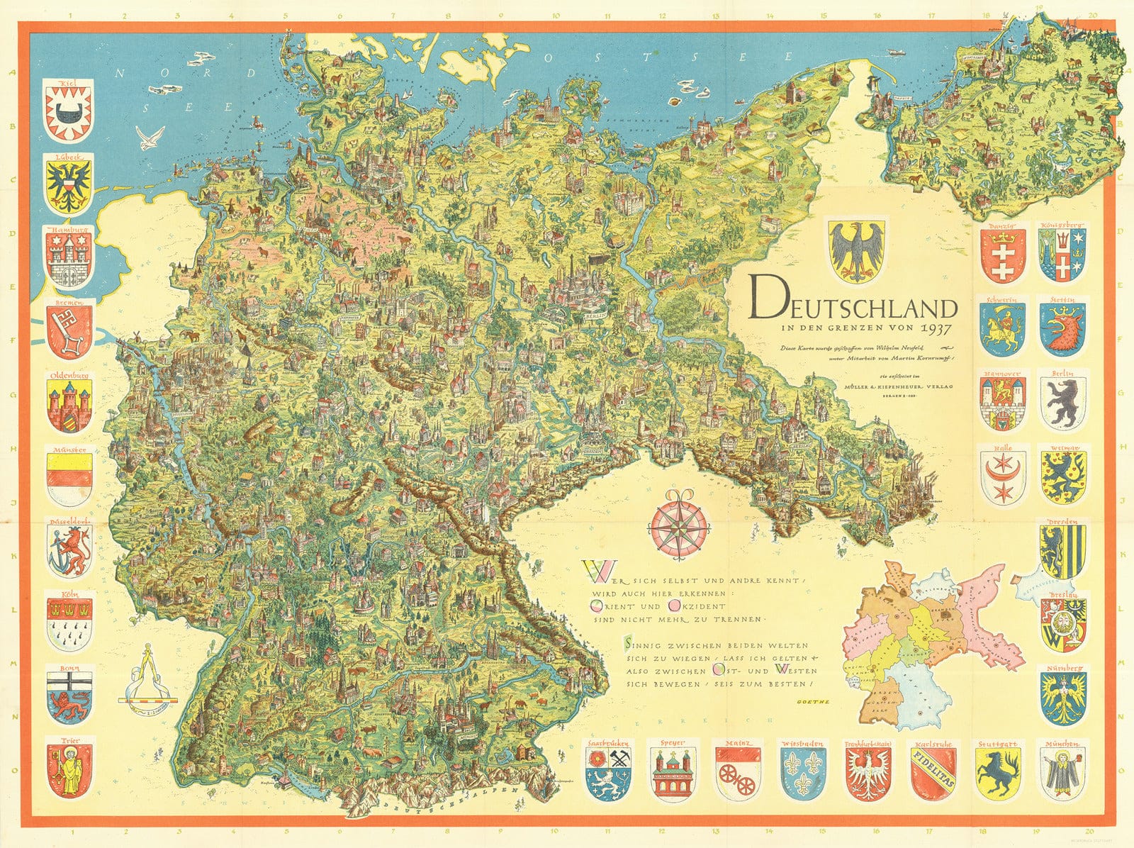
Historic Wall Map - Deutschland in Den Grenzen von 1937 (Germany in the Borders of 1937)
Historic Wall Map - Deutschland in Den Grenzen von 1937 (Germany in the Borders of 1937)
Note: Sold out or unavailable
Couldn't load pickup availability
A magnificent pictorial map of Germany during the mid-20th century is presented, capturing a period of intense internal and international deliberation surrounding the feasibility and scope of German reunification.
Illustrated within the map are the borders of Germany as it stood on December 31, 1937, which represented the furthest reach achieved without violating international laws. Consequently, following the conclusion of the war, certain nationalists advocated for the restoration of these borders upon reunification.
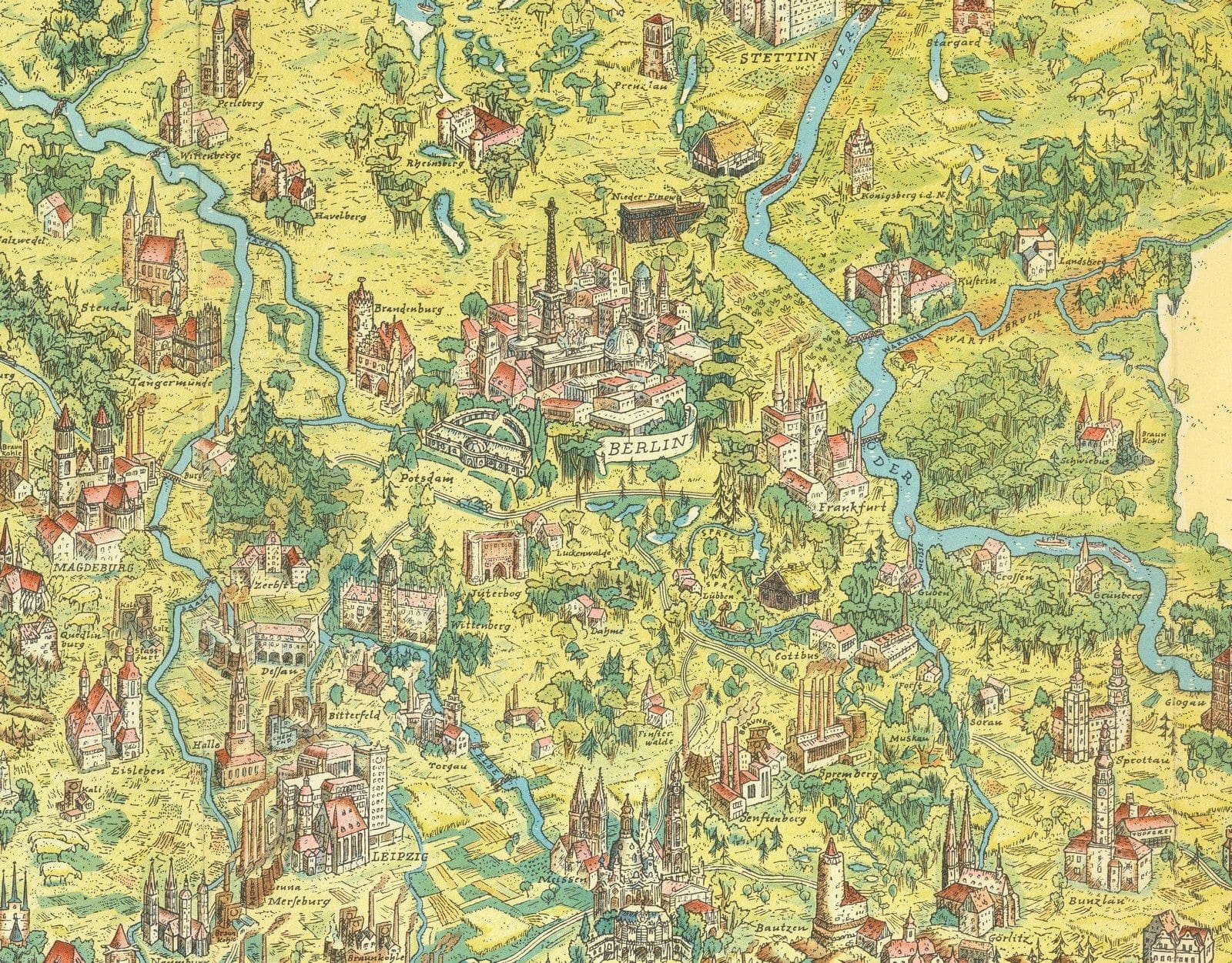
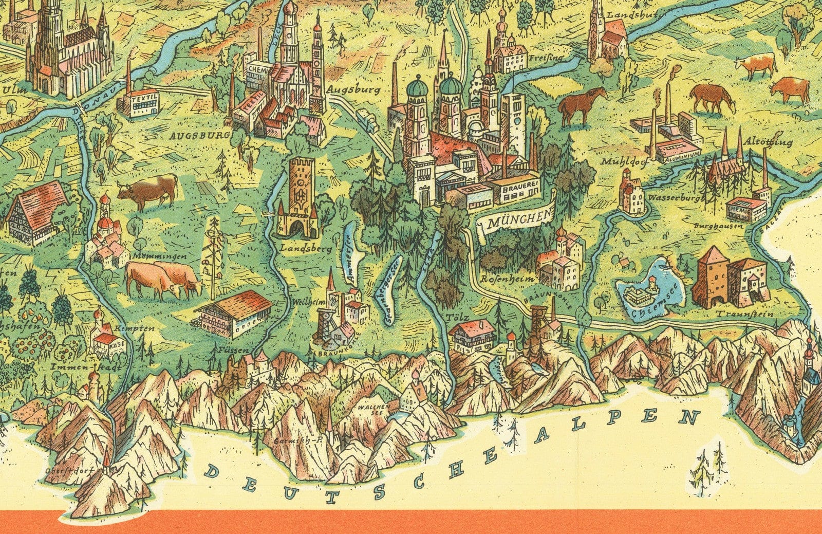
The map's adornments are truly remarkable, featuring pictorial elements that showcase the rich tapestry of traditional German culture. Throughout the map, towns and cities are artfully displayed, with meticulous attention given to the largest urban centers.
The "German Question" is about whether the German-speaking people in Europe should be united under one leadership. This issue has been discussed since the 19th century. Initially, it focused on whether Austria should be included in the unification of Germany. However, the frequent changes in the size of the German state during the first half of the 20th century made this question less important.
The German Question became relevant again when East and West Germany were divided after World War II. After the uprisings in East Germany were suppressed in 1953, people in West Germany started talking about the possibility of reunification in the future. The Soviet Union had taken away a significant amount of land from East Germany, including important parts of the old Kingdom of Prussia, so it was uncertain what the borders of a reunited Germany would be.
Many Germans argued that the borders should go back to how they were on December 31, 1937. This date is after the legal annexation of the Saar but before the Anschluss (annexation of Austria) and the invasion of Czechoslovakia. These borders were also used by the Allies when they first divided Germany. However, after the Soviet Union dissolved, a part of Germany shown on this map ended up being divided between Russia and Poland, and the country became much smaller.
- MUSEUM QUALITY INKS AND PAPER: Printed on thick 192gsm heavyweight matte paper with archival giclee inks, this historic fine art will decorate your wall for years to come.
- VINTAGE MAP REPRODUCTION: Add style to any room's decor with this beautiful print. Whether your interior design is modern or classic, a map is never out of fashion.
- ATTENTION TO DETAIL: We edit every antique map for image quality, color and vibrance, so it can look its best while retaining historical character. Makes a great gift!
- FRAME READY: Your unframed poster will arrive crease-free, rolled in a sturdy mailing tube. Many maps fit easy-to-find standard size frames 16x20, 16x24, 18x24, 24x30, 24x36, saving on custom framing.
- Watermarks will not appear in the printed picture. Some blemishes, tears, or stamps may be removed from the final print.
Why choose Historic Pictoric
Every artwork we offer is carefully edited by our small but dedicated team of image professionals, ensuring each detail is perfect. We print every order to demand right here in the USA, treating every piece with the same care and attention we would give our own work. From editing to printing to packaging, we take pride in delivering artwork that meets our high standards—and we love knowing it’s heading to a home where it will be appreciated.
- Choosing a selection results in a full page refresh.
- Opens in a new window.