icon

Free Shipping     |     Satisfaction Guaranteed

American Revolution Maps

The Revolutionary War collection documents battle maps of the Revolutionary War and troop movements and other logistical details outlining the course of particular military campaigns or engagements. The collection also features more general maps of North America, with period maps of each of the original thirteen states and Canada. This includes individual cities including New York, Philadelphia and Charleston.
Showing products 1 - 80 of 240
Sort by:

Historic Map - An Accurate Map of North and South Carolina With Their Indian Frontiers, 1775, Henry Mouzon - Vintage Wall Art

An Accurate Map of North and South Carolina With Their Indian Frontiers, 1775, Henry MouzonWe print high quality reproductions of historical maps, photographs, prints, etc. Because of their historical nature,...
From: $49.99

Historical Map, 1777 [Plan of The Battles of Saratoga], Vintage Wall Art

This highly important manuscript plan of the Battle of Saratoga is signed by Tadeusz Kościuszko, one of the great heroes of that battle. In September 1777 Kościuszko was instrumental in...
From: $49.99

Historic Map : An Accurate Map of North America. (Northern section), 1776 - Vintage Wall Art

An Accurate Map Of North America. Describing and distinguishing the British and Spanish Dominions on the great Continent; According to the Definitive Treaty Concluded at Paris 10th Feby. 1763. Also...
From: $34.99

Historic Map : Action Huberton. 1780 - Vintage Wall Art

Plan of the action at Huberton under Brigadier Genl. Frazier, supported by Major Genl. Reidesel, on the 7th. July 1777. Drawn by P. Gerlach, Deputy Quarter Master General. Engraved by...
From: $49.99

Historic Map - Carte Generale des Colonies Angloises dans l'Amerique/Carte Generale des Angloises Colonies in America, 1783, Rene Phelippeaux - Vintage Wall Art

Carte Generale des Colonies Angloises dans l'Amerique/Carte Generale des Angloises Colonies in America, 1783, Rene Phelippeaux
From: $49.99

Historic Map - A plan of the town and harbour of Boston and the country adjacent with the road from Boston to Concord, 1775, J. De Costa - Vintage Wall Art

A plan of the town and harbour of Boston and the country adjacent with the road from Boston to Concord, 1775, J. De Costa
From: $49.99

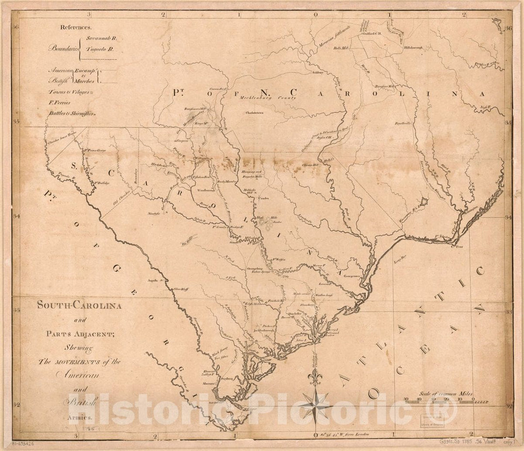
Historic 1781 Map - South-Carolina and Parts Adjacent, shewing The Movements of The American and British Armies.

South-Carolina and parts adjacent, shewing the movements of the American and British armies.We print high quality reproductions of historical maps, photographs, prints, etc. Because of their historical nature, some of...
From: $49.99

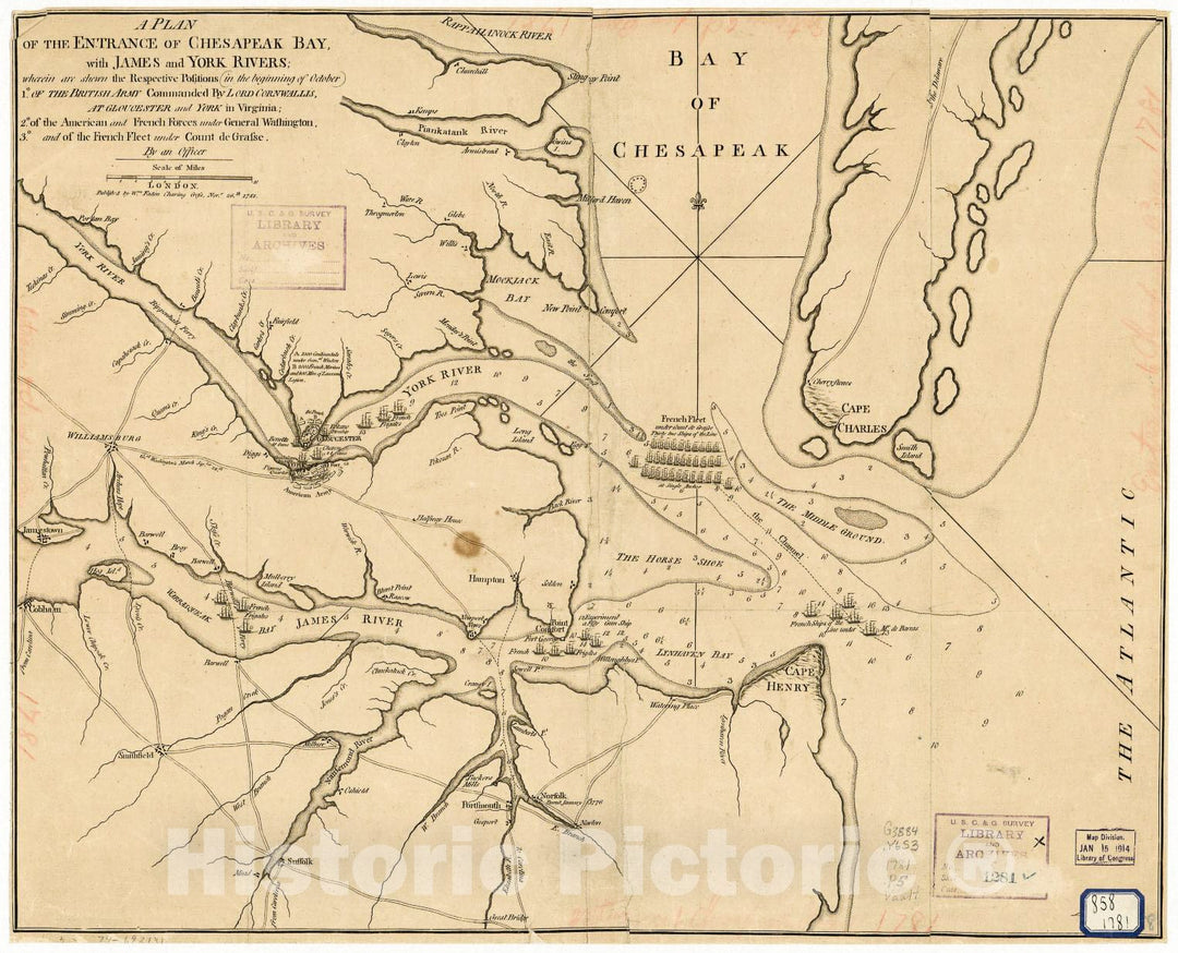
Historic 1781 Map - A Plan of The Entrance of Chesapeak Bay, with James and York Rivers; wherein are Shewn The respective Positions (in The Beginning of October) 1. of The British Army

A Plan of the entrance of Chesapeak Bay, with James and York rivers; wherein are shewn the respective positions (in the beginning of October) 1. of the British Army commanded...
From: $49.99

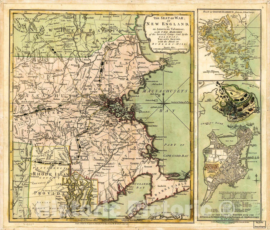
Historic 1775 Map - The Seat of war in New England, by an American Volunteer, with The marches of The Several Corps Sent by The Colonies Towards Boston, with The Attack on Bunkers-Hill.

The Seat of war in New England, by an American volunteer, with the marches of the several corps sent by the Colonies towards Boston, with the attack on Bunkers-Hill.We print...
From: $49.99

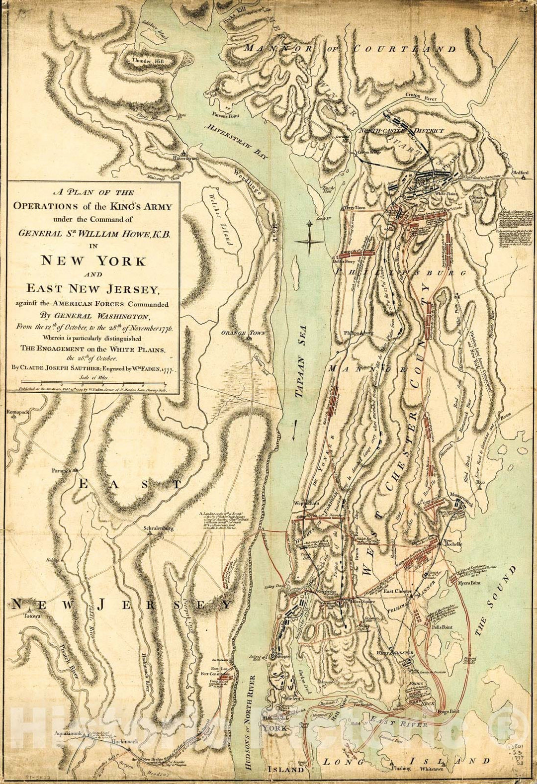
Historic 1777 Map - A Plan of The Operations of The King's Army Under The Command of General Sr. William Howe, K.B. in New York and East New Jersey Against The American Forces

A plan of the operations of the King's army under the command of General Sr. William Howe, K.B. in New York and east New Jersey against the American forces commanded...
From: $49.99

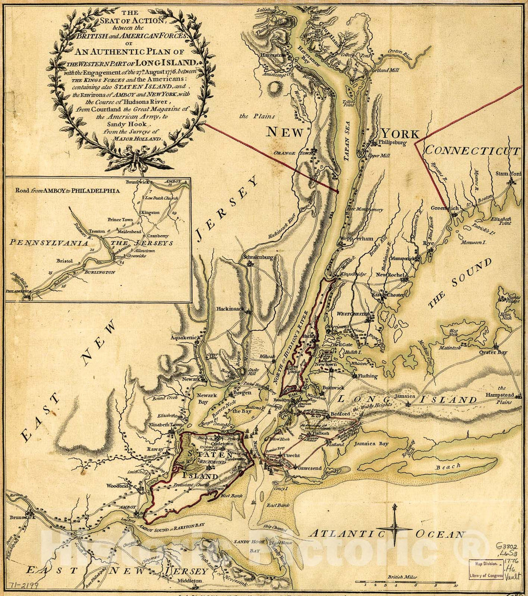
Historic 1776 Map - The seat of Action, Between The British and American Forces; or, an Authentic Plan of The Western Part of Long Island, with The Engagement of The 27th August 1776

The seat of action, between the British and American forces; or, An authentic plan of the western part of Long Island, with the engagement of the 27th August 1776 between...
From: $34.99

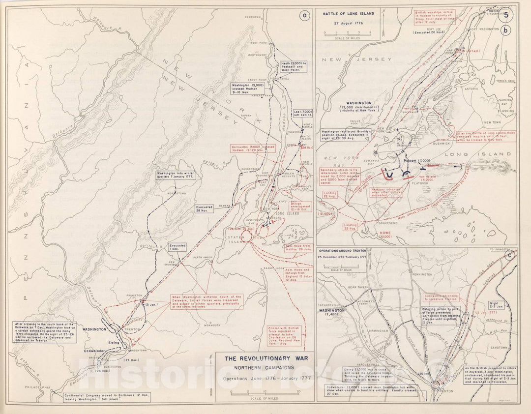
Historic 1959 Map - The West Point Atlas of American Wars - Revolutionary War - Pennsylvania and New Jersey

The West Point atlas of American warsWe print high quality reproductions of historical maps, photographs, prints, etc. Because of their historical nature, some of these images may show signs of...
From: $49.99

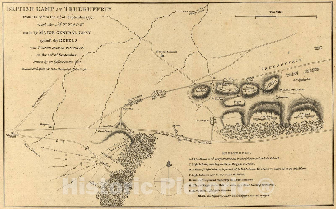
Historic 1845 Map - American Revolution, shewing The Routes of The British and American Armies - Plan of Position of Army, 17 & 19 September 1777

Atlas of the battles of the American Revolution, together with maps shewing the routes of the British and American Armies, plans of cities, surveys of harbors, &c.,We print high quality...
From: $34.99

Historic 1845 Map - American Revolution, Together with maps shewing The Routes of The British and American Armies - Plan of Boston, 1775

Atlas of the battles of the American Revolution, together with maps shewing the routes of the British and American Armies, plans of cities, surveys of harbors, &c.,We print high quality...
From: $34.99

Historic Map - Provinces of New-York and New-Jersey, with a part of Pennsylvania and the Province of Qubec, 1777, Mathais Albrecht Lotter - Vintage Wall Art

Provinces of New-York and New-Jersey, with a part of Pennsylvania and the Province of Qu?ec , 1777, Mathais Albrecht Lotter
From: $49.99

Historic Map - The Peninsula and Gulf of Florida or Channel of Bahama with the Bahama Islands, 1775, Thomas Jefferys - Vintage Wall Art

The Peninsula and Gulf of Florida or Channel of Bahama with the Bahama Islands, 1775, Thomas Jefferys
From: $49.99

Historic Map - Carte du Canada, de la Nouvelle Ecosse, et de l'Acadie; d'apres les Origin :: Canada, Nova Scotia and New Brunswick, 1782 - Vintage Wall Art

Carte du Canada, de la Nouvelle Ecosse, et de l'Acadie; d'apres les Origin :: Canada, Nova Scotia and New Brunswick, 1782
From: $49.99

Historic Map - America Septentrionalis a Domino d'Anville in Galliis edita nunc in Anglia :: Lord d'Anville in North America with England Colonies, 1777 - Vintage Wall Art

America Septentrionalis a Domino d'Anville in Galliis edita nunc in Anglia :: Lord d'Anville in North America with England Colonies, 1777
From: $34.99

Historic Map - A New & Accurate Map of North America, 1770, Thomas Bowen - Vintage Wall Art

A New & Accurate Map of North America , 1770, Thomas Bowen
From: $49.99

Historic Map - America Septentrionalis a Domino d'Anville in Galliis edita nunc in Anglia Coloniis in Interiorem Virginiam nec non Ohio curu, 1777 - Vintage Wall Art

America Septentrionalis a Domino d'Anville in Galliis edita nunc in Anglia Coloniis in Interiorem Virginiam nec non Ohio curu, 1777
From: $34.99

Historic Map - Most Inhabited Part Of New England Containing The Provinces Of Massachusets Bay and New Hampshire. With the Colonies of Conecticut and Rh, 1776 - Vintage Wall Art

Most Inhabited Part Of New England Containing The Provinces Of Massachusets Bay and New Hampshire. With the Colonies of Conecticut and Rh, 1776
From: $34.99

Historic Map - Carte Des Deux Carolines et De La Georgie/The Southern States at the Conclusion of the American Revolution, 1782 - Vintage Wall Art

Carte Des Deux Carolines et De La Georgie / The Southern States at the Conclusion of the American Revolution, 1782
From: $49.99

Historic Map - Virginie, du Maryland et de l'Etat de Delaware. [Early Fort Pi :: of Virginia, Maryland and the State of Delaware. [Early and Fort Pitt, 1782 - Vintage Wall Art

Virginie, du Maryland et de l'Etat de Delaware. [Early Fort Pi :: of Virginia, Maryland and the State of Delaware. [Early and Fort Pitt, 1782
From: $49.99

Historic Map - Connecticut, and Parts adjacent, 1780, Bernard Romans - Vintage Wall Art

Connecticut, and Parts adjacent, 1780, Bernard Romans
From: $34.99

Historic Map - A Chorographical Map, of the Northern Department of North-America, 1780, Bernard Romans - Vintage Wall Art

A Chorographical Map, of the Northern Department of North-America , 1780, Bernard Romans
From: $49.99

Historic Map - A Chorographical Map, of the Country, round Philadelphia/Carte Particuliere, des Environs de Philadelphie, 1780, Bernard Romans - Vintage Wall Art

A Chorographical Map, of the Country, round Philadelphia / Carte Particuliere, des Environs de Philadelphie, 1780, Bernard Romans
From: $34.99

Historic Map - Map of Hudson's River, with the adjacent Country, 1778, Gentleman's Magazine - Vintage Wall Art

Map of Hudson's River, with the adjacent Country, 1778, Gentleman's Magazine
From: $49.99

Historic Map - Seat of War in the Environs of Philadelphia, 1777, Thomas Kitchin - Vintage Wall Art

Seat of War in the Environs of Philadelphia, 1777, Thomas Kitchin
From: $49.99

Historic Map - A Map of 100 Miles around Boston (The Battles of Lexington & Concord), 1775, Gentleman's Magazine v2

A Map of 100 Miles around Boston (The Battles of Lexington & Concord), 1775, Gentleman's Magazine
From: $34.99

Historic Map - A New and Accurate Map of New Jersey, from the Best Authorities, 1780, Universal Magazine - Vintage Wall Art

A New and Accurate Map of New Jersey, from the Best Authorities, 1780, Universal Magazine
From: $49.99

Historic Map - Plan D'York en Virginie avec les attaques et les Campemens de l'Armee combinee de France et d'Amerique/Plan of the Battle of Yorktown, 1787 - Vintage Wall Art

Plan D'York en Virginie avec les attaques et les Campemens de l'Armee combinee de France et d'Amerique / Plan of the Battle of Yorktown, 1787
From: $49.99

Historic Map - Course of the River Mississippi, from the Balise to Fort Chartres; Taken on an Expedition to the Illinois, in the latter end of the Year 1765, 1775 - Vintage Wall Art

Course of the River Mississippi, from the Balise to Fort Chartres; Taken on an Expedition to the Illinois, in the latter end of the Year 1765, 1775
From: $34.99

Historic Map - An Exact Map of North and South Carolina, Georgia, with East and West Florida, from the latest Discoveries, 1775, John Lodge - Vintage Wall Art

An Exact Map of North and South Carolina, & Georgia, with East and West Florida, from the latest Discoveries., 1775, John Lodge
From: $49.99

Historic Map - A Plan of Fort Montgomery & Fort Clinton, taken, 1779, Joseph Frederick Wallet Des Barres - Vintage Wall Art

A Plan of Fort Montgomery & Fort Clinton, taken , 1779, Joseph Frederick Wallet Des Barres
From: $34.99

Historic Map - Plan of York Town in Virginia And Adjacent Country, Exhibiting the operations of the American French and British armies, 1825 - Vintage Wall Art

Plan of York Town in Virginia And Adjacent Country, Exhibiting the operations of the American French and British armies, 1825
From: $49.99

Historic Map - Partie Meridionale de la Louisiane, avec la Floride, la Caroline et la Virginie, Par Le Sr. D'Anville, 1776, Paolo Santini - Vintage Wall Art

Partie Meridionale de la Louisiane, avec la Floride, la Caroline et la Virginie, Par Le Sr. D'Anville , 1776, Paolo Santini
From: $49.99

Historic Map - Plano del Pto de Cartaga de Indias Situado/Plane Pto de Indias Located Cartaga, 1784, Anonymous - Vintage Wall Art

Plano del Pto de Cartaga de Indias Situado /Plane Pto de Indias Located Cartaga. . ., 1784, Anonymous
From: $49.99

Historic Map - A New and Accurate Plan of the Town of Boston in New England. [with] A New Plan of Boston Harbor from an Actual Survey, 1774 - Vintage Wall Art

A New and Accurate Plan of the Town of Boston in New England. [with] A New Plan of Boston Harbor from an Actual Survey., 1774
From: $49.99

Historic Map - New & Accurate Map of North America Including Nootka Sound: with new discovered Islands on the East Coast of Asia, 1785, C. Cooke - Vintage Wall Art

New & Accurate Map of North America Including Nootka Sound: with new discovered Islands on the East Coast of Asia, 1785, C. Cooke
From: $49.99

Historic Map - The Coast of West Florida and Louisiana, 1775, Thomas Jefferys - Vintage Wall Art

The Coast of West Florida and Louisiana , 1775, Thomas Jefferys
From: $34.99

Historic Map - Pennsylvania, 1796, Jedidiah Morse - Vintage Wall Art

Pennsylvania , 1796, Jedidiah Morse
From: $49.99

Historic Map - A Map of Massachusetts, From the best Authorities, 1796, Jedidiah Morse - Vintage Wall Art

A Map of Massachusetts, From the best Authorities , 1796, Jedidiah Morse
From: $49.99

Historic Map - Course of the River Mississipi, from the Balise to Fort Chartres; Taken on an Expedition to the Illinois, in the latter end of the Year 1765, 1775 v3

Course of the River Mississipi, from the Balise to Fort Chartres; Taken on an Expedition to the Illinois, in the latter end of the Year 1765, 1775
From: $34.99

Historic Map - Map of Hudson's River, with the adjacent Country, 1778, Gentleman's Magazine v2

Map of Hudson's River, with the adjacent Country, 1778, Gentleman's Magazine
From: $49.99

Historic Map - Caroline Meridionale avec les Parties adjacentes: pour servir a l'Intelligence Des Mouvemens shows Charleston, 1787, Charles Picquet v2

Caroline Meridionale avec les Parties adjacentes: pour servir a l'Intelligence Des Mouvemens shows Charleston, 1787, Charles Picquet
From: $34.99

Historic Map - New & Accurate Map of North America Including Nootka Sound: with new discovered Islands on the East Coast of Asia, 1785, C. Cooke - Vintage Wall Art

New & Accurate Map of North America Including Nootka Sound: with new discovered Islands on the East Coast of Asia, 1785, C. Cooke
From: $49.99

Historic Map - Plan De La Ville De Boston et ses Environs/Map Of The City Of Boston and its Environs, 1764, Jacques Nicolas Bellin - Vintage Wall Art

Plan De La Ville De Boston et ses Environs/Map Of The City Of Boston and its Environs, 1764, Jacques Nicolas Bellin
From: $49.99

Historic Map - Pictorial Map of the Minnesota River Valley at Fort Snelling, 1936, Nadine Semans - Vintage Wall Art

Pictorial Map of the Minnesota River Valley at Fort Snelling, 1936, Nadine Semans
From: $49.99

Historic Map - Map of Hudson's River, with the adjacent Country, 1778, Gentleman's Magazine v1

Map of Hudson's River, with the adjacent Country, 1778, Gentleman's MagazineWe print high quality reproductions of historical maps, photographs, prints, etc. Because of their historical nature, some of these images...
From: $49.99

Historic Map - Plan de la Ville et du Port de Louisbourg Leve en 1756 Suivant l'Original, 1779 - Vintage Wall Art

Plan de la Ville et du Port de Louisbourg Leve en 1756 Suivant l'Original , 1779We print high quality reproductions of historical maps, photographs, prints, etc. Because of their historical...
From: $49.99

Historic Map - Carte Du Golphe Du Mexique Dressee d'apres celles qui ont ete publiees par ordre des Cours de France, d'Espagne et d'Angleterre, 1780 v2

Carte Du Golphe Du Mexique Dressee d'apres celles qui ont ete publiees par ordre des Cours de France, d'Espagne et d'Angleterre , 1780We print high quality reproductions of historical maps,...
From: $49.99

Historic Map - Carte de l'adjonction progressive des divers etats au territoire/Map of the United States, 1825, Jean Alexandre Buchon v2

Carte de l'adjonction progressive des divers etats au territoire / Map of the United States, 1825, Jean Alexandre BuchonWe print high quality reproductions of historical maps, photographs, prints, etc. Because...
From: $49.99

Historic Map - Carte Des Isles Antilles Et Du Golfe du Mexique; avec la majeure partie de la Nouvelle Espagne, 1782, Rigobert Bonne - Vintage Wall Art

Carte Des Isles Antilles Et Du Golfe du Mexique; avec la majeure partie de la Nouvelle Espagne , 1782, Rigobert BonneWe print high quality reproductions of historical maps, photographs, prints,...
From: $34.99

Historic Map - This Map of the City of New York and Island of Manhattan, 1811, William Bridges - Vintage Wall Art

This Map of the City of New York and Island of Manhattan, 1811, William BridgesWe print high quality reproductions of historical maps, photographs, prints, etc. Because of their historical nature,...
From: $34.99

Historic Map - Most Inhabited Part Of New England Containing The Provinces Of Massachusets Bay and New Hampshire. With the Colonies of Conecticut and Rh, 1774 - Vintage Wall Art

Most Inhabited Part Of New England Containing The Provinces Of Massachusets Bay and New Hampshire. With the Colonies of Conecticut and Rh, 1774We print high quality reproductions of historical maps,...
From: $34.99

Historic Map - Carte des Isles Antilles dans L'Amerique Septentrionale avec la majeure/Revolutionary War era Chart of South Florida and the Caribbean, 1782 - Vintage Wall Art

Carte des Isles Antilles dans L'Amerique Septentrionale avec la majeure / Revolutionary War era Chart of South Florida and the Caribbean, 1782We print high quality reproductions of historical maps, photographs,...
From: $49.99

Historic Map - An Accurate Map of North and South Carolina With Their Indian Frontiers, Shewing in a distinct manner all the Mountains, 1775, Henry Mouzon - Vintage Wall Art

An Accurate Map of North and South Carolina With Their Indian Frontiers, Shewing in a distinct manner all the Mountains, 1775, Henry MouzonWe print high quality reproductions of historical maps,...
From: $49.99

Historic Map - A Map of Pennsylvania Exhibiting not only the Improved Parts of that Province, but also Its Extensive Frontiers, 1775, Nicholas Scull v2

A Map of Pennsylvania Exhibiting not only the Improved Parts of that Province, but also Its Extensive Frontiers, 1775, Nicholas ScullWe print high quality reproductions of historical maps, photographs, prints,...
From: $49.99

Historic Map - To His Excellency Sr. Henry Moore Bart. Captain General and Governour in Chief in & over the Province of New York, 1769, Bernard Ratzer - Vintage Wall Art

To His Excellency Sr. Henry Moore Bart. Captain General and Governour in Chief in & over the Province of New York, 1769, Bernard RatzerWe print high quality reproductions of historical...
From: $49.99

Historic Map - Map of the upper part of the Island of Manhattan Above Eighty-Sixth Street Arranged to Illustratre The Battle of Harlem Heights, 1868 - Vintage Wall Art

Map of the upper part of the Island of Manhattan Above Eighty-Sixth Street Arranged to Illustratre The Battle of Harlem Heights, 1868We print high quality reproductions of historical maps, photographs,...
From: $49.99

Historic Map - A Map of the British and French Dominions in North America. With the Roads, Distances, limits, and Extent of the Settlements, 1773, John Mitchell - Vintage Wall Art

A Map of the British and French Dominions in North America. With the Roads, Distances, limits, and Extent of the Settlements, 1773, John MitchellWe print high quality reproductions of historical...
From: $49.99

Historic Map - America Septentrionalis a Domino d'Anville in Galliis edita nunc in Anglia Coloniis in Interiorem Virginiam nec non Ohio curu, 1777, Homann Heirs - Vintage Wall Art

America Septentrionalis a Domino d'Anville in Galliis edita nunc in Anglia Coloniis in Interiorem Virginiam nec non Ohio curu, 1777, Homann HeirsWe print high quality reproductions of historical maps, photographs,...
From: $49.99

Historic Map - An Accurate Chart of the Tortugas and Florida Kays or Martyrs, Surveyed, 1835, William Faden - Vintage Wall Art

An Accurate Chart of the Tortugas and Florida Kays or Martyrs, Surveyed , 1835, William FadenWe print high quality reproductions of historical maps, photographs, prints, etc. Because of their historical...
From: $49.99

Historic Map - The Marches of Lord Cornwallis in the Southern Provinces, Now States of North America; with Virginia and Maryland and the Delaware Counties, 1787 - Vintage Wall Art

The Marches of Lord Cornwallis in the Southern Provinces, Now States of North America; with Virginia and Maryland and the Delaware Counties, 1787We print high quality reproductions of historical maps,...
From: $49.99

Historic Map - Province of New York & the Territories, 1769, Bernard Ratzer - Vintage Wall Art

Province of New York & the Territories, 1769, Bernard RatzerWe print high quality reproductions of historical maps, photographs, prints, etc. Because of their historical nature, some of these images may...
From: $49.99

Historic Map - Nova Scotia and Cape Breton Island with the adjacent parts of New England and Canada, 1775, Thomas Jefferys - Vintage Wall Art

Nova Scotia and Cape Breton Island with the adjacent parts of New England and Canada, 1775, Thomas JefferysWe print high quality reproductions of historical maps, photographs, prints, etc. Because of...
From: $49.99

Historic Map - The Mexican Situation, Showing Location of American Fleet and Border Forts, 1913, Chicago Milwaukee & St. Paul Railroad - Vintage Wall Art

The Mexican Situation, Showing Location of American Fleet and Border Forts, 1913, Chicago Milwaukee & St. Paul RailroadWe print high quality reproductions of historical maps, photographs, prints, etc. Because of...
From: $49.99

Historic Map - Attack of the Rebels upon Fort Penobscot in the Province of New England in which their Fleet was totally destroyed and their Army dispersed, 1785 v3

Attack of the Rebels upon Fort Penobscot in the Province of New England in which their Fleet was totally destroyed and their Army dispersed, 1785We print high quality reproductions of...
From: $34.99

Historic Map - A Chart of Delaware Bay and River, Containing a full & exact description of the Shores, Creeks, Harbours, Soundings, Shoals, Sands, 1776 - Vintage Wall Art

A Chart of Delaware Bay and River, Containing a full & exact description of the Shores, Creeks, Harbours, Soundings, Shoals, Sands, 1776We print high quality reproductions of historical maps, photographs,...
From: $49.99

Historic Map - Attack of the Rebels upon Fort Penobscot in the Province of New England in which their Fleet was totally destroyed and their Army dispersed, 1785 v2

Attack of the Rebels upon Fort Penobscot in the Province of New England in which their Fleet was totally destroyed and their Army dispersed, 1785We print high quality reproductions of...
From: $34.99

Historic Map - Partie De L'Amerique Septentrionale, qui comprend le Canada, la Louisiane, le Labrador, le Groenland, la Nouvelle Angleterre, la Floride, 1771 v1

Partie De L'Amerique Septentrionale, qui comprend le Canada, la Louisiane, le Labrador, le Groenland, la Nouvelle Angleterre, la Floride,, 1771We print high quality reproductions of historical maps, photographs, prints, etc....
From: $49.99

Historic Map - Course of the River Mississipi, from the Balise to Fort Chartres; Taken on an Expedition to the Illinois, in the latter end of the Year 1765, 1775 v2

Course of the River Mississipi, from the Balise to Fort Chartres; Taken on an Expedition to the Illinois, in the latter end of the Year 1765, 1775We print high quality...
From: $34.99

Historic Map - The Attack and Defeat of the American Fleet under Benedict Arnold, 1776, William Faden - Vintage Wall Art

The Attack and Defeat of the American Fleet under Benedict Arnold, , 1776, William FadenWe print high quality reproductions of historical maps, photographs, prints, etc. Because of their historical nature,...
From: $49.99

Historic Map - A New and Accurate Map of the Present Seat of War in North America, Comprehending New Jersey, Philadelphia, Pennsylvania, New York, 1777 v2

A New and Accurate Map of the Present Seat of War in North America, Comprehending New Jersey, Philadelphia, Pennsylvania, New York,, 1777We print high quality reproductions of historical maps, photographs,...
From: $49.99

Historic Map - Carte De L'Amerique Septle. Pour servir a l'intelligence de la Guerre entre les Anglois et les Insurgents, 1777, Jean de Beaurain - Vintage Wall Art

Carte De L'Amerique Septle. Pour servir a l'intelligence de la Guerre entre les Anglois et les Insurgents , 1777, Jean de BeaurainWe print high quality reproductions of historical maps, photographs,...
From: $49.99

Historic Map - Nouvelle de L'Amerique Angloise contenant tout ce que les Anglois po :: Amerique Angloise containing everything that the English possess, 1776 - Vintage Wall Art

Nouvelle de L'Amerique Angloise contenant tout ce que les Anglois po :: Amerique Angloise containing everything that the English possess, 1776We print high quality reproductions of historical maps, photographs, prints,...
From: $49.99

Historic Map - Plan of New Orleans The Capital of Louisiana; with the Disposition of its Quarters and Canals, 1759, Thomas Jefferys - Vintage Wall Art

Plan of New Orleans The Capital of Louisiana; with the Disposition of its Quarters and Canals, 1759, Thomas JefferysWe print high quality reproductions of historical maps, photographs, prints, etc. Because...
From: $49.99

Historic Map - A Plan of the Town of Newport in Rhode Island. Surveyed, 1777, William Faden - Vintage Wall Art

A Plan of the Town of Newport in Rhode Island. Surveyed , 1777, William FadenWe print high quality reproductions of historical maps, photographs, prints, etc. Because of their historical nature,...
From: $34.99

Historic Map - Caroline Meridionale avec les Parties adjacentes: pour servir a l'Intelligence Des Mouvemens shows Charleston, 1787, Charles Picquet v1

Caroline Meridionale avec les Parties adjacentes: pour servir a l'Intelligence Des Mouvemens shows Charleston, 1787, Charles PicquetWe print high quality reproductions of historical maps, photographs, prints, etc. Because of their...
From: $34.99

Historic Map - A New and Accurate Map of the Present Seat of War in North America, Comprehending New Jersey, Philadelphia, Pennsylvania, New York, 1777 v1

A New and Accurate Map of the Present Seat of War in North America, Comprehending New Jersey, Philadelphia, Pennsylvania, New York,, 1777We print high quality reproductions of historical maps, photographs,...
From: $49.99
Showing products 1 - 80 of 240

Free Shipping

We offer Free Standard Shipping for all orders within the United States. If you want your stuff there faster, see Expedited and Overnight shipping cost at checkout.

Our Guarantee

If you are not completely satisfied, just send the product back to us and we'll replace it with another one of your choice OR refund your purchase price 100%. Our address is on the contact us page.

100% Satisfaction

We painstakingly labor over the preparation and printing of each individual product we sell. We stand behind the materials and workmanship, and want nothing more than for you to be 100% happy with your order.

Just added to your wishlist:
My Wishlist
Just added to your cart:
My Cart