Skip to content
icon-X
Close menu
Maps
World Maps
World War 2 Maps
Pictorial Maps
USGS TopoGraphic Maps
Art Prints
Blueprints
Fine Art Museum Collections
Claude Monet
Photographs
Modern Photos
Posters
Collections
Kid's Room
Autos, Trains & Rails
Monet and Manet
Brewery, Beer, Liquor & more
Holiday Ready to Gift Products
Log in
Follow Us
instagram
Instagram
Facebook
twitter
Twitter
Maps
World Maps
World War 2 Maps
Pictorial Maps
USGS TopoGraphic Maps
Art Prints
Blueprints
Fine Art Museum Collections
Claude Monet
Photographs
Modern Photos
Posters
Collections
Kid's Room
Autos, Trains & Rails
Monet and Manet
Brewery, Beer, Liquor & more
Holiday Ready to Gift Products
account
Log in
icon-search
Search
icon-hamburger
Site navigation
icon-bag-minimal
Cart
Search
Search
Free economy shipping for unframed orders of $75 or more!
Filter
icon-X
Close menu
Lake Maps
icon-filter
Filter
Historic Map : Plattsburgh and Cumberland Bay Lake Champlain New York 1873, 1873, Vintage Wall Art
From:
$29.99
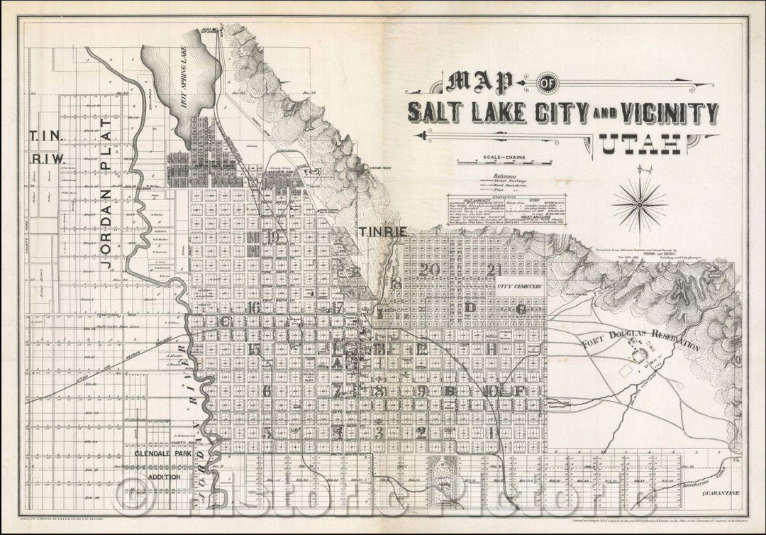
Historic Map - Map of Salt Lake and Vicinity Utah, 1888, Browne & Brooks v2
From:
$49.99
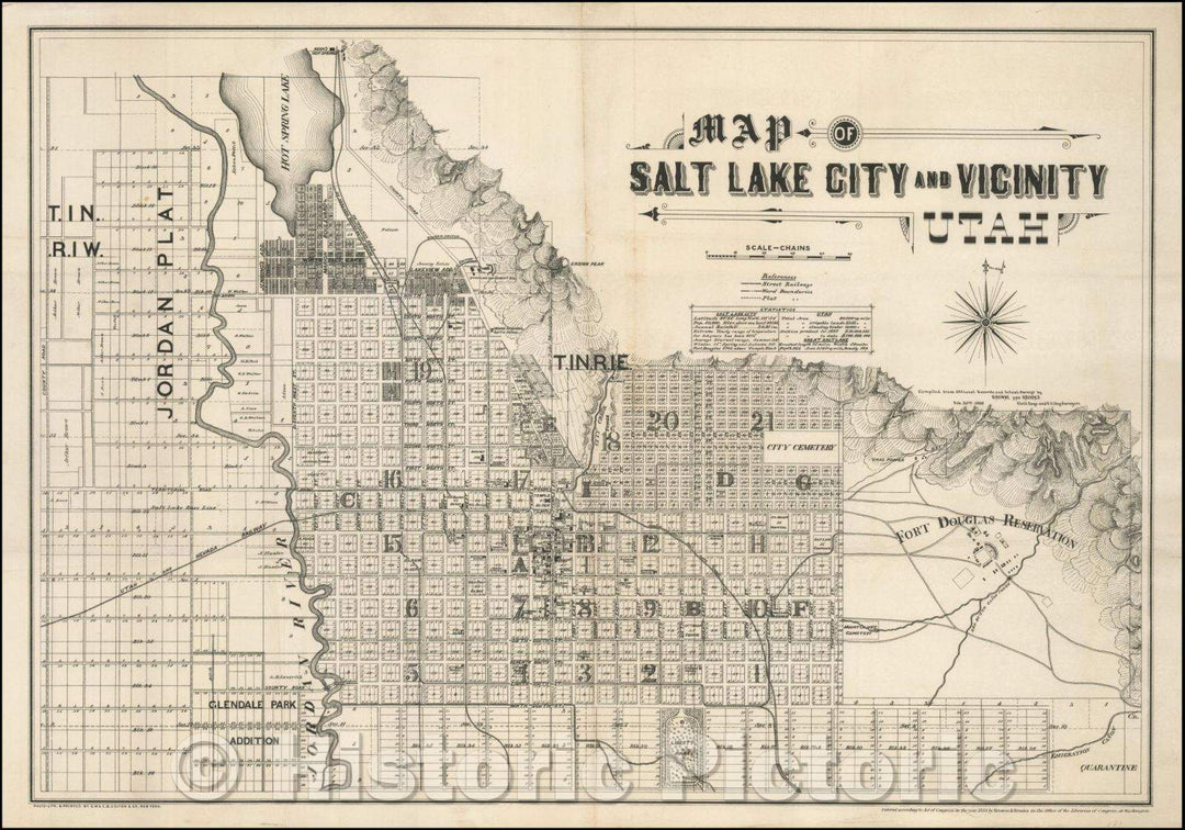
Historic Map - Map of Salt Lake and Vicinity Utah, 1888, Browne & Brooks v1
From:
$49.99
Historic Map - A Circle of Enchantment Mammoth Lakes, Mono County, Cal. The Paradise of the Sierras (Tamarack Lodge Promotional Map), 1934, Hayden Map Co - Vintage Wall Art
From:
$49.99
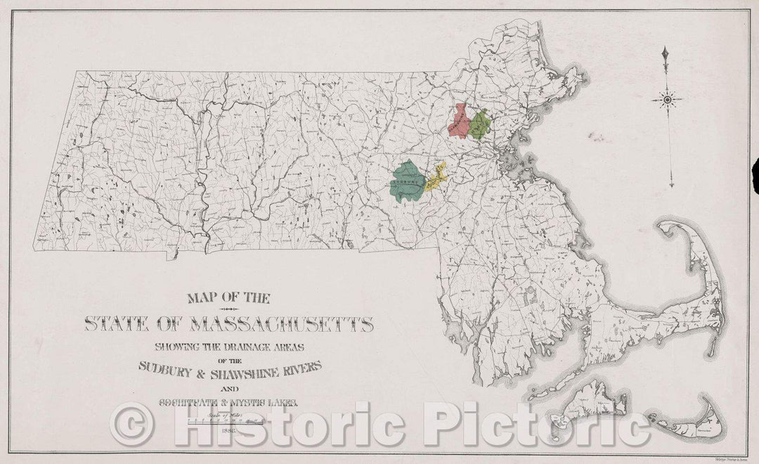
Historic Map : Map of the State of Massachusetts showing the drainage areas of the Sudbury and Shawshine Rivers and Cochituate and Mystic Lakes, 1886 , Vintage Wall Art
From:
$49.99
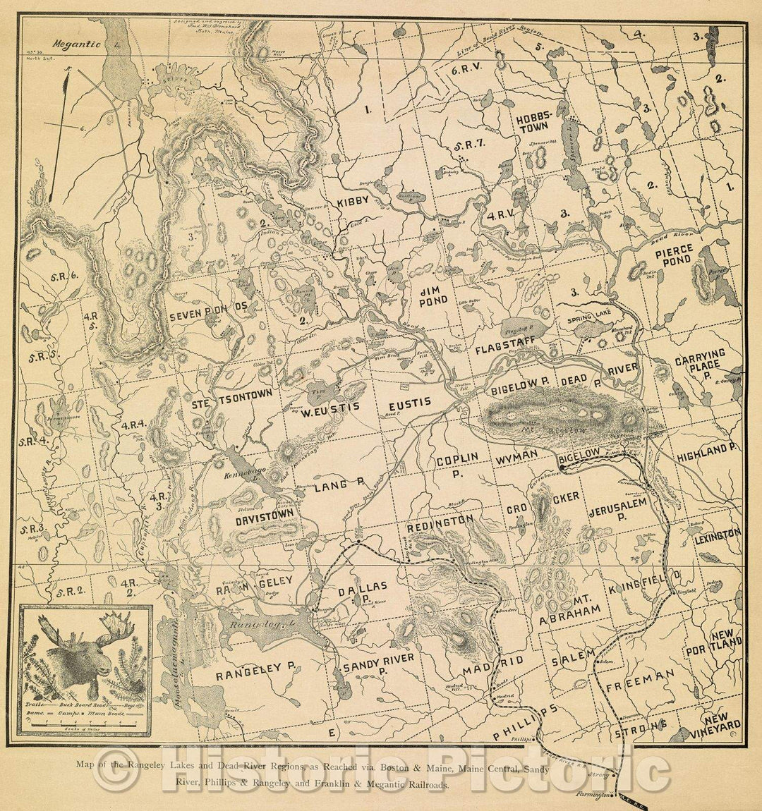
Historic Map : Map of the Rangeley Lakes and Dead River Regions, as Reached via. Boston and Maine, Maine Central, Sandy River, c. 1920 , Vintage Wall Art
From:
$34.99
Historic Map : Ducatus Chablasius et Lacus Lemanus cum Regionibus adjacentibus invenitur Amstelodami apud... Lake Geneva, 1700 , Vintage Wall Art
From:
$49.99
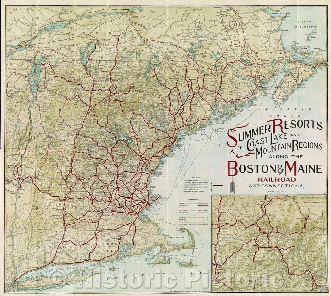
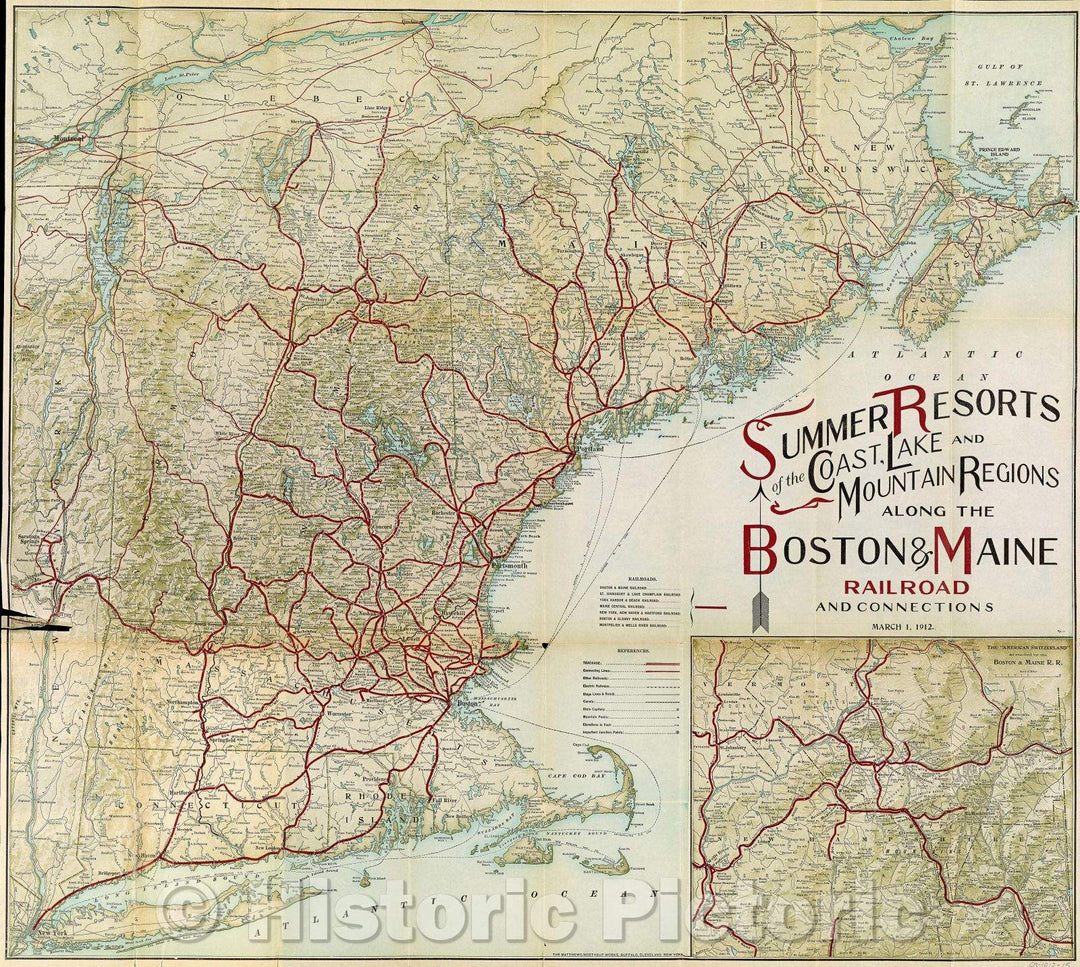
Historic Map : Summer Resorts of the Coast, Lake and Mountain Regions along the Boston and Maine Railroad and connections, 1912 , Vintage Wall Art
From:
$29.99
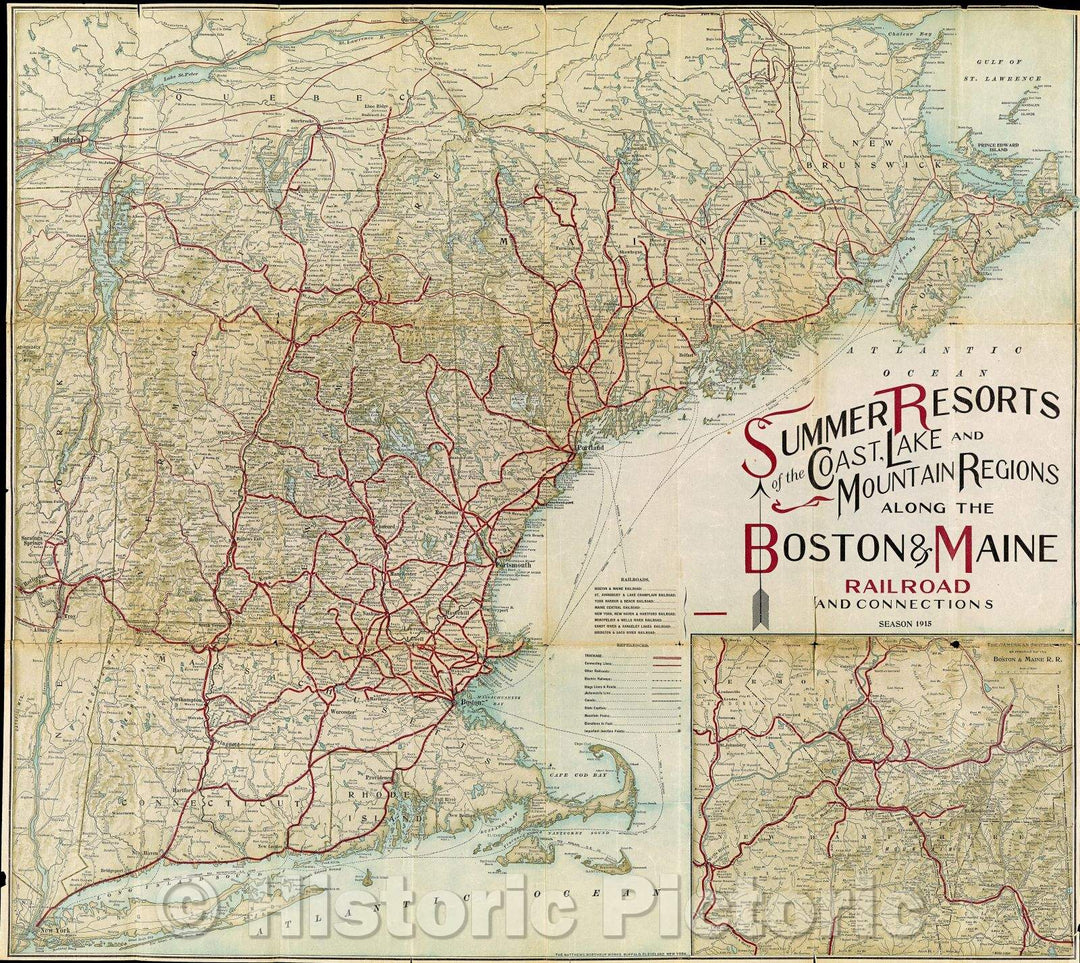
Historic Map : Summer Resorts of the Coast, Lake and Mountain Regions along the Boston and Maine Railroad and Connections Season 1915, 1915 , Vintage Wall Art
From:
$29.99
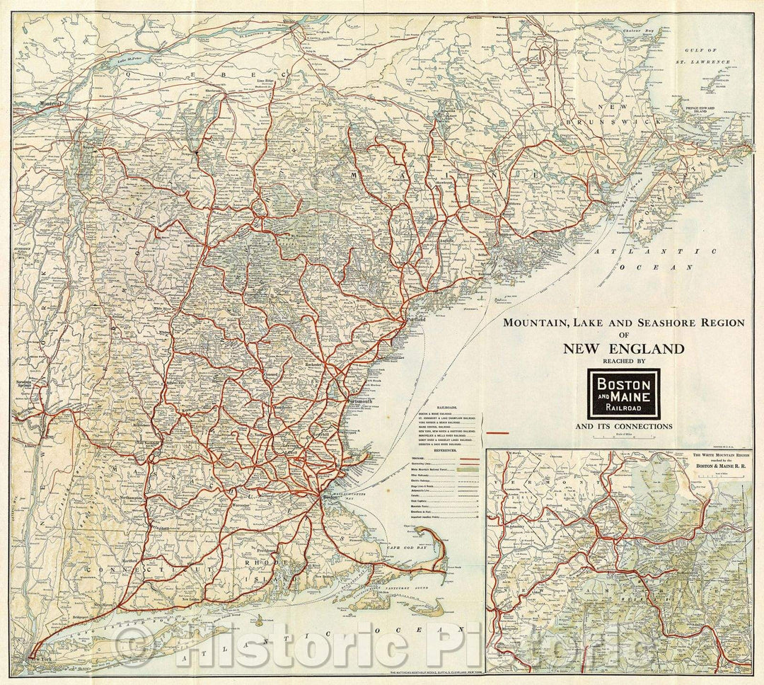
Historic Map : Mountain, Lake and Seashore Region of New England reached by Boston and Maine Railroad and its connections, 1923 , Vintage Wall Art
From:
$29.99
Historic Map : Moosehead Lake Region, Somerset and Piscataquis Counties, Maine, 1962 , Vintage Wall Art
From:
$39.99
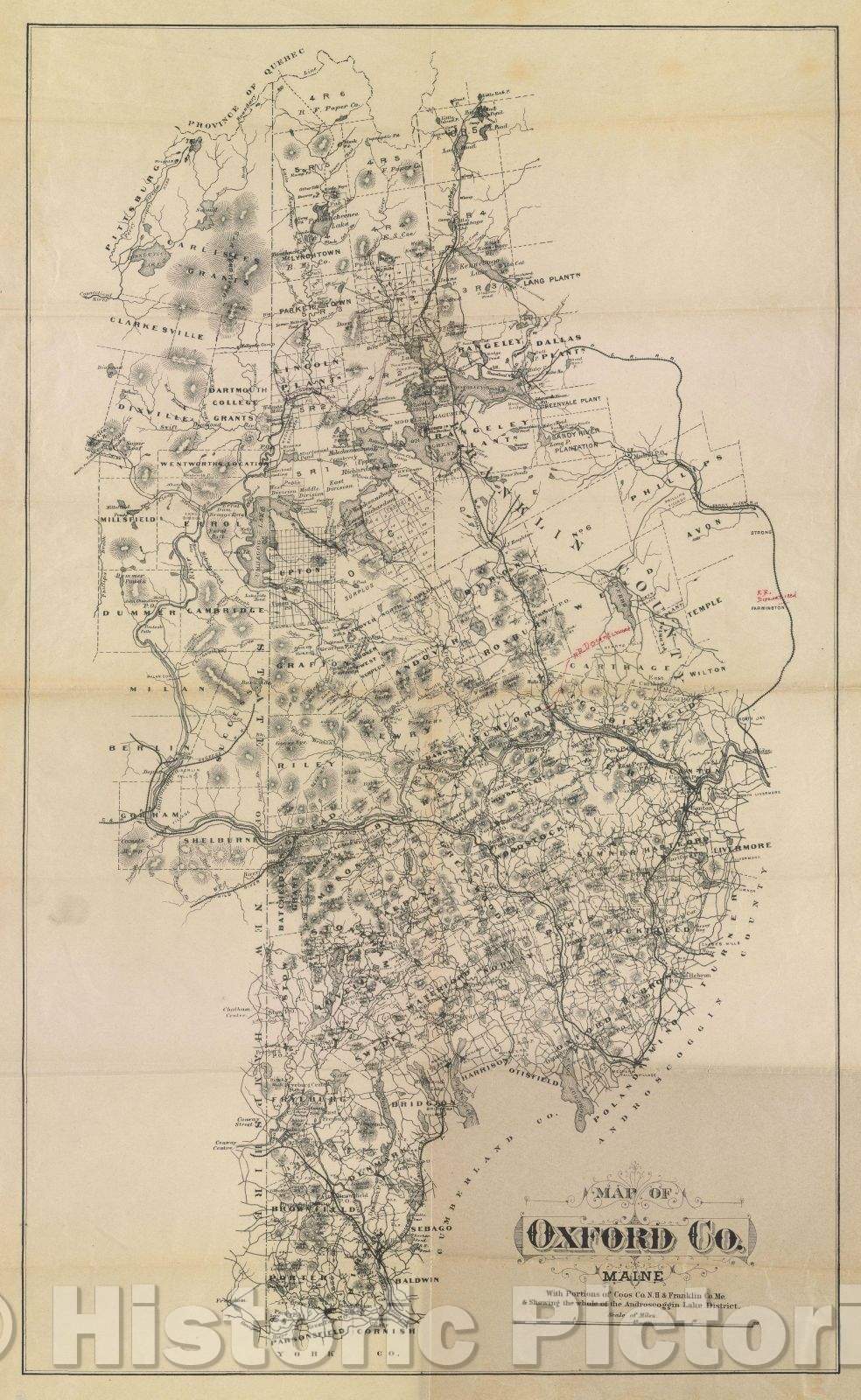
Historic Map : Map of Oxford Co. Maine. With portions of Coos Co. N.H. and Franklin Co. Me. and showing the whole of the Androscoggin Lake District., 1895 , Vintage Wall Art
From:
$49.99
Historic Map : New England Vacation Resorts Seashore, Mountain and Lake Regions Descriptive A detailed list of Hotels and Boarding-Houses reached via the Boston, 1912 , Vintage Wall Art
From:
$29.99
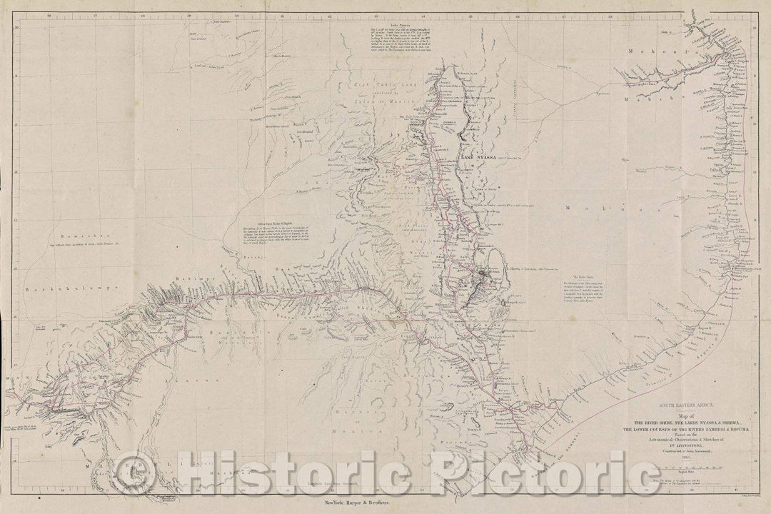
Historic Map : Map of the River Shire, the lakes Nyassa and Shirwa, the lower courses of the rivers Zambesi and Rovuma / based on the astronomical observations, 1875 , Vintage Wall Art
From:
$49.99
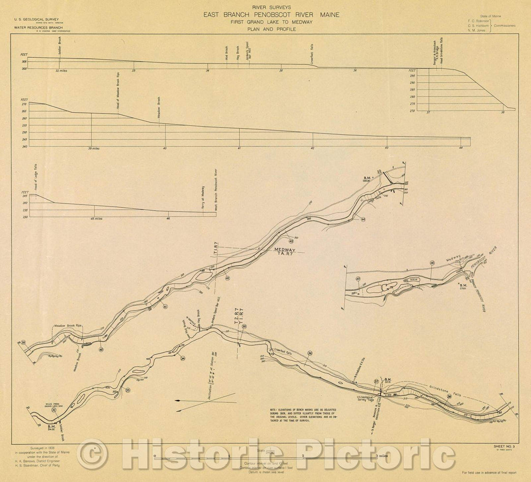
Historic Map : River Surveys : East Branch Penobscot River Maine, First Grand Lake to Medway, Plan and Profile, 1908 , Vintage Wall Art
From:
$29.99
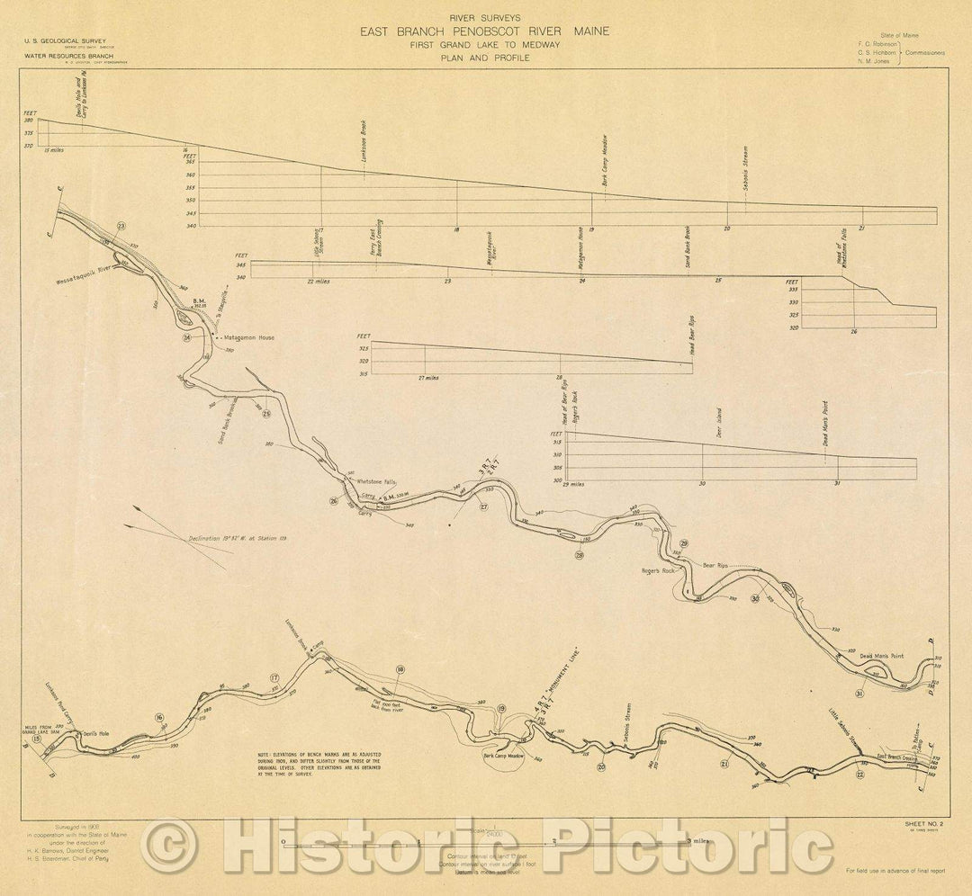
Historic Map : River Surveys : East Branch Penobscot River Maine, First Grand Lake to Medway, Plan and Profile, 1908 , Vintage Wall Art , v2
From:
$34.99
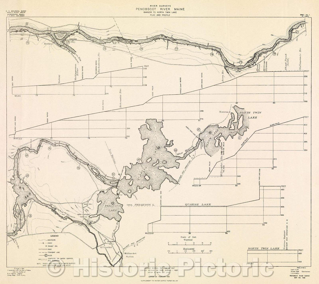
Historic Map : River Surveys : Penobscot River Maine, Bangor to North Twin Lake, Plan and Profile, 1906 , Vintage Wall Art
From:
$29.99
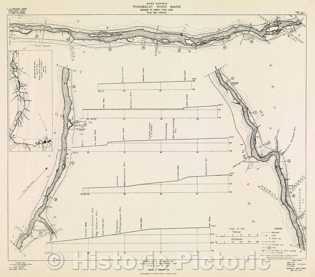
Historic Map : River Surveys : Penobscot River Maine, Bangor to North Twin Lake, Plan and Profile, 1906 , Vintage Wall Art , v2
From:
$29.99
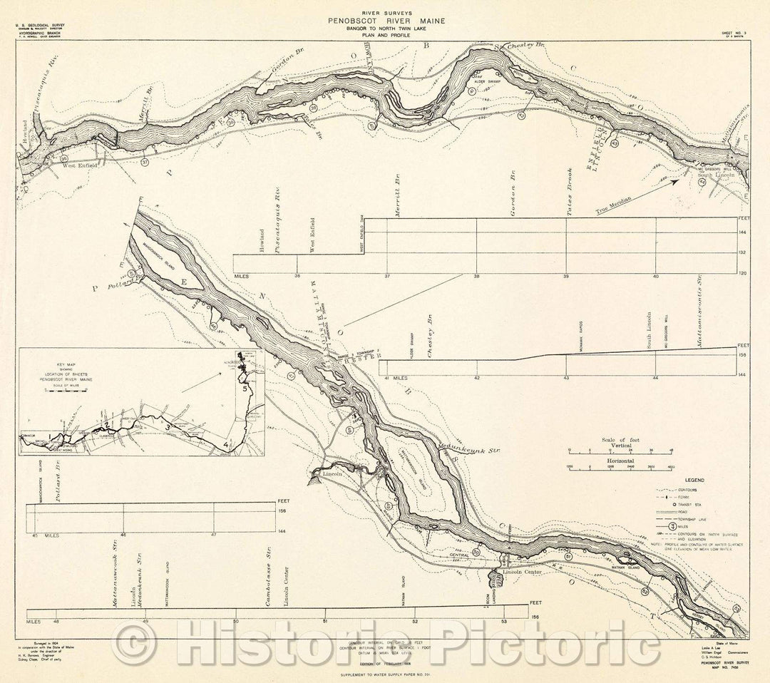
Historic Map : River Surveys : Penobscot River Maine, Bangor to North Twin Lake, Plan and Profile, 1906 , Vintage Wall Art , v3
From:
$29.99
icon-chevron-left
Previous
1
…
3
4
5
6
7
…
395
icon-chevron
Next
icon-X
"Close (esc)"
icon-chevron-left
icon-X
icon-chevron
icon-X
Lake Maps, Posters & Prints