Skip to content
icon-X
Close menu
Maps
World Maps
World War 2 Maps
Pictorial Maps
USGS TopoGraphic Maps
Art Prints
Blueprints
Fine Art Museum Collections
Claude Monet
Photographs
Modern Photos
Posters
Collections
Kid's Room
Autos, Trains & Rails
Monet and Manet
Brewery, Beer, Liquor & more
Holiday Ready to Gift Products
Log in
Follow Us
instagram
Instagram
Facebook
twitter
Twitter
Maps
World Maps
World War 2 Maps
Pictorial Maps
USGS TopoGraphic Maps
Art Prints
Blueprints
Fine Art Museum Collections
Claude Monet
Photographs
Modern Photos
Posters
Collections
Kid's Room
Autos, Trains & Rails
Monet and Manet
Brewery, Beer, Liquor & more
Holiday Ready to Gift Products
account
Log in
icon-search
Search
icon-hamburger
Site navigation
icon-bag-minimal
Cart
Search
Search
Free economy shipping for unframed orders of $75 or more!
Filter
icon-X
Close menu
Product type
Geologic Map
(4)
Map
(121)
Topographic Map
(3)
Availability
In stock
(128)
Out of stock
(0)
Price
Massachusetts State Maps
icon-filter
Filter
Historical Map, 1800 The State of Massachusetts : compiled from The Best Authorities, Vintage Wall Art
From:
$49.99
Historical Map, 1850-1869 Plan of The Estate of Stephen R. and Charles F. Benton, Richmond Township, Berkshire Co, State of Massachusetts, Vintage Wall Art
From:
$49.99
Historical Map, 1799 The State of Massachusetts from The Best Information, Vintage Wall Art
$119.99
Historical Map, 1795 The state of Massachusetts, Vintage Wall Art
From:
$49.99
Historical Map, 1838 Sketch of The States of Massachusetts, Connecticut, and Rhode Island, and Parts of New Hampshire & New York exhibiting The Several Rail Road, Vintage Wall Art
From:
$49.99
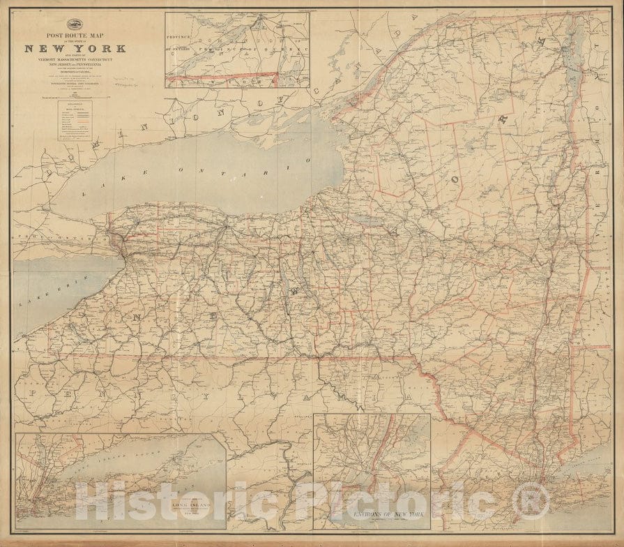
Historical Map, 1891 Post route map of the State of New York and parts of Vermont, Massachusetts, Connecticut, New Jersey, and Pennsylvania, Vintage Wall Art
From:
$49.99
Historical Map, Outline map of Massachusetts showing population according to the United States census of 1890, Vintage Wall Art
From:
$49.99
Historical Map, 1858 Map of Franklin County, Massachusetts : Based Upon The Trigonometrical Survey of The State, Vintage Wall Art
From:
$49.99
Historical Map, 1789 A Map of The seat of The Late war at Boston in The State of Massachusetts, Vintage Wall Art
From:
$49.99
Historical Map, 1861 Topographical map of The State of Massachusetts, Vintage Wall Art
From:
$49.99
Historical Map, Outline map of Massachusetts Showing Population According to The United States Census of 1890, and Congressional Districts, Vintage Wall Art
From:
$49.99
Historical Map, 1826 A map of The New England States : Maine, New Hampshire, Vermont, Massachusetts, Rhode Island & Connecticut, Vintage Wall Art
From:
$49.99
Historical Map, 1826 Survey of a Valley and Ponds Auxiliary to a contemplated Canal Between Buzzard's & Barnstable Bays, State of Massachusetts and Town of Sandwich, Vintage Wall Art
From:
$49.99
Historical Map, 1818 Plan of Charlestown peninsula in the state of Massachusetts, Vintage Wall Art
From:
$49.99
Historical Map, 1838 Sketch of The States of Massachusetts, Connecticut, and Rhode Island, and Parts of New Hampshire & New York exhibiting The Several Railroad, Vintage Wall Art
From:
$49.99
Historic Map : Map of the Electric Railways of the State of Massachusetts accompanying the Report of the Railroad Commissioners. Copyright 1899 by Geo. H. Walker, c. 1901 , Vintage Wall Art
From:
$49.99
Historical Map, 1852 Map of Bristol County Massachusetts : Based on The Trigonometrical Survey of The State, Vintage Wall Art
From:
$49.99
Historical Map, 1876 Index map Showing The Principal River basins Within The State of Massachusetts, Vintage Wall Art
From:
$49.99
Historical Map, 1889 Post Route map of The State of New York and Parts of Vermont, Massachusetts, Connecticut, New Jersey, and Pennsylvania, Vintage Wall Art
From:
$49.99
icon-chevron-left
Previous
1
…
3
4
5
6
7
icon-chevron
Next
icon-X
"Close (esc)"
icon-chevron-left
icon-X
icon-chevron
icon-X
Massachusetts State Wall Maps, Posters & Prints