Skip to content
icon-X
Close menu
Maps
World Maps
World War 2 Maps
Pictorial Maps
USGS TopoGraphic Maps
Art Prints
Blueprints
Fine Art Museum Collections
Claude Monet
Photographs
Modern Photos
Posters
Collections
Kid's Room
Autos, Trains & Rails
Monet and Manet
Brewery, Beer, Liquor & more
Holiday Ready to Gift Products
Log in
Follow Us
instagram
Instagram
Facebook
twitter
Twitter
Maps
World Maps
World War 2 Maps
Pictorial Maps
USGS TopoGraphic Maps
Art Prints
Blueprints
Fine Art Museum Collections
Claude Monet
Photographs
Modern Photos
Posters
Collections
Kid's Room
Autos, Trains & Rails
Monet and Manet
Brewery, Beer, Liquor & more
Holiday Ready to Gift Products
account
Log in
icon-search
Search
icon-hamburger
Site navigation
icon-bag-minimal
Cart
Search
Search
Free economy shipping for unframed orders of $75 or more!
Filter
icon-X
Close menu
State Maps
icon-filter
Filter
Historic 1924 Map - Aeronautical Strip maps of The United States. - No. 105, 1930 - Air Corps map
From:
$34.99
Historic 1924 Map - Aeronautical Strip maps of The United States. - No. 44, 1929 - rev. 1932 - Air Corps map
From:
$49.99
Historic 1924 Map - Aeronautical Strip maps of The United States. - No. 2 Recto, 1930 - rev. Mar. 1934 - Air Corps map
From:
$34.99
Historic 1915 Map - Atlas and plat Book of Holt County, Nebraska - Map of The United States - Standard Atlas and Directory of Holt County, Nebraska
From:
$49.99
Historic 1924 Map - Aeronautical Strip maps of The United States. - No. 15, 1926 - Air Corps map
From:
$34.99
Historic 1970 Map - The National Atlas of The United States of America. - Geologic Maps
From:
$49.99
Historic 1924 Map - Aeronautical Strip maps of The United States. - No. 29 Recto, 1932 - Air Corps map
From:
$34.99
Historic 1924 Map - Aeronautical Strip maps of The United States. - No. 1, 1926 - Air Corps map
From:
$49.99
Historic 1887 Map - Colby's Atlas of The State of Maine - Freeport Village; Saccarappa; Cumberland Mills
From:
$49.99
Historic 1875 Map - Atlas of Lewis Co, New York - Plan of The State of New York - Atlas of Lewis County, New York
From:
$49.99
Historic 1835 Map - Sketches of The Various Societies of Belivers i.e. Believers in The States of Ohio & Kentucky - Watervliet - Sketches of The Various Societies of Belivers
From:
$49.99
Historic 1924 Map - Aeronautical Strip maps of The United States. - No. 57, 1933 - rev. Sept. 1933 - Air Corps map
From:
$34.99
Historic 1924 Map - Aeronautical Strip maps of The United States. - No. 112, 1930 - Air Corps map
From:
$34.99
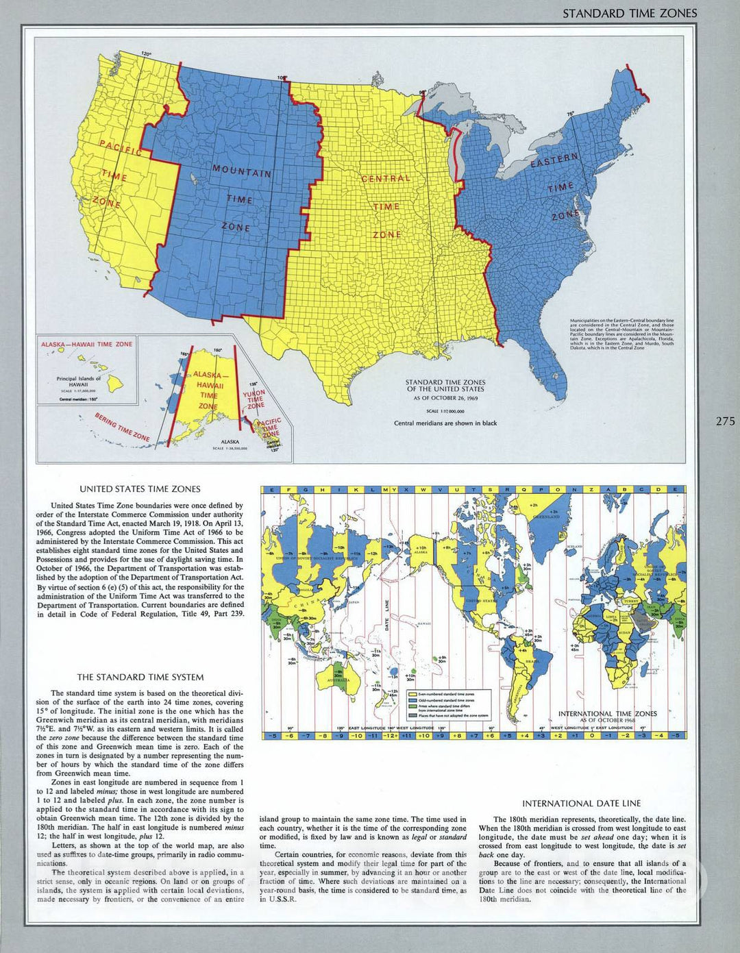
Historic 1970 Map - The National Atlas of The United States of America. - Standard Time Zones
From:
$49.99
Historic 1887 Map - Colby's Atlas of The State of Maine - Gray's New Map of The United States
From:
$49.99
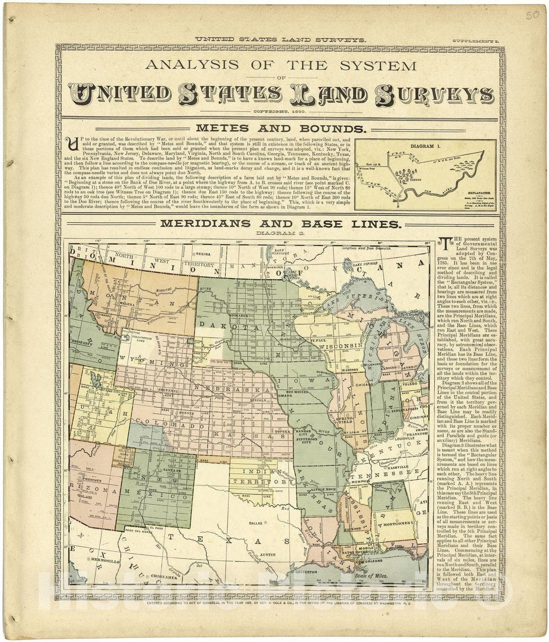
Historic 1901 Map - Standard Atlas of Lyon County, Kansas - Analysis of The System of United States Land Surveys
From:
$49.99
Historic 1924 Map - Aeronautical Strip maps of The United States. - No. 54, 1933 - rev. Sept. 1933 - Air Corps map
From:
$49.99
Historic 1924 Map - Aeronautical Strip maps of The United States. - No. 25, 1928 - rev. Feb. 1935 - Air Corps map
From:
$34.99
Historic 1887 Map - Colby's Atlas of The State of Maine - Mount Desert and Adjacent Islands
From:
$49.99
icon-chevron-left
Previous
1
…
244
245
246
247
248
…
509
icon-chevron
Next
icon-X
"Close (esc)"
icon-chevron-left
icon-X
icon-chevron
icon-X
State Wall Maps, Posters & Prints