-
-


-
Wall Color
in
Uncheck to hide the white line Check to show the white line -
-
.


Frame
Room
Gallery
Historic Map : Bocage Map of Boeotia, Ancient Greece, 1987, Vintage Wall Art
Historic Map : Bocage Map of Boeotia, Ancient Greece, 1987, Vintage Wall Art
Note: Sold out or unavailable
Couldn't load pickup availability
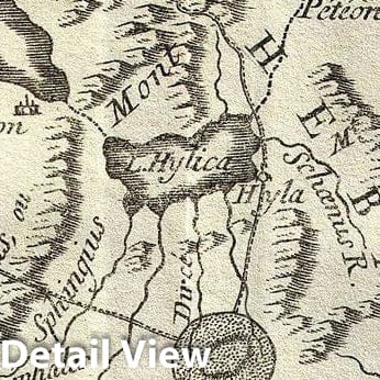
This is an attractive 1787 map of Boeotia, one of the regions in Ancient Greece. Cartographically based on an early map by D'Anville, this map is centered on Thebes and details the ancient region's important towns and cities. The map also attempts to illustrate events associated with the Battle of Plataea. The battle of Plataea occurred in 479 BC and was the last battle in the second Persian invasion of Greece. It took place near the city of Plataea in Boeotia, and was fought by an alliance of the Greek city-states, including Sparta, Athens, Corinth and Megara, against the Persian empire of in xerin xes I. The map features Mount Cithaeron, where the tide of the battle turned. The battle concluded with a large portion of the Persian army trapped in their camp where they were slaughtered, essentially brining the invasion to a close. Prepared by M. Barbie de Bocage in 1787 to illustrate the Travels of Anacharsis.
Anacharsis was a Scythian philosopher who travelled from his homeland on the northern shores of the Black Sea to Athens in the early 6th century BCe. Apparently he made a great impression on the Greeks, who considered him a forthright, outspoken 'barbarian. He is considered a forerunner of the Cynics.
- MUSEUM QUALITY INKS AND PAPER: Printed on thick 192gsm heavyweight matte paper with archival giclee inks, this historic fine art will decorate your wall for years to come.
- VINTAGE MAP REPRODUCTION: Add style to any room's decor with this beautiful print. Whether your interior design is modern or classic, a map is never out of fashion.
- ATTENTION TO DETAIL: We edit every antique map for image quality, color and vibrance, so it can look its best while retaining historical character. Makes a great gift!
- FRAME READY: Your unframed poster will arrive crease-free, rolled in a sturdy mailing tube. Many maps fit easy-to-find standard size frames 16x20, 16x24, 18x24, 24x30, 24x36, saving on custom framing.
- Watermarks will not appear in the printed picture. Some blemishes, tears, or stamps may be removed from the final print.
Why choose Historic Pictoric
Every artwork we offer is carefully edited by our small but dedicated team of image professionals, ensuring each detail is perfect. We print every order to demand right here in the USA, treating every piece with the same care and attention we would give our own work. From editing to printing to packaging, we take pride in delivering artwork that meets our high standards—and we love knowing it’s heading to a home where it will be appreciated.
- Choosing a selection results in a full page refresh.
- Opens in a new window.