-
-


-
Wall Color
in
Uncheck to hide the white line Check to show the white line -
-
.


Frame
Room
Gallery
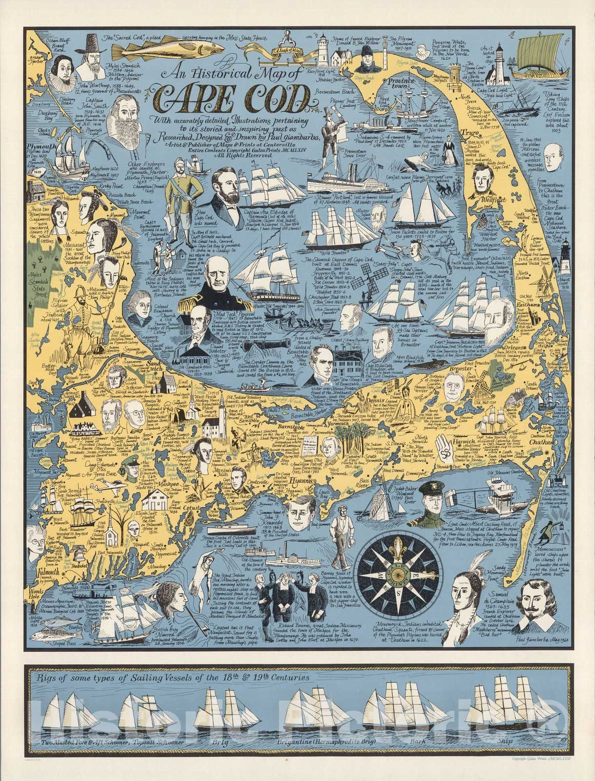
Historic Map : An historical map of Cape Cod, 1964 - Vintage Wall Art
Historic Map : An historical map of Cape Cod, 1964 - Vintage Wall Art
Note: Sold out or unavailable
Couldn't load pickup availability
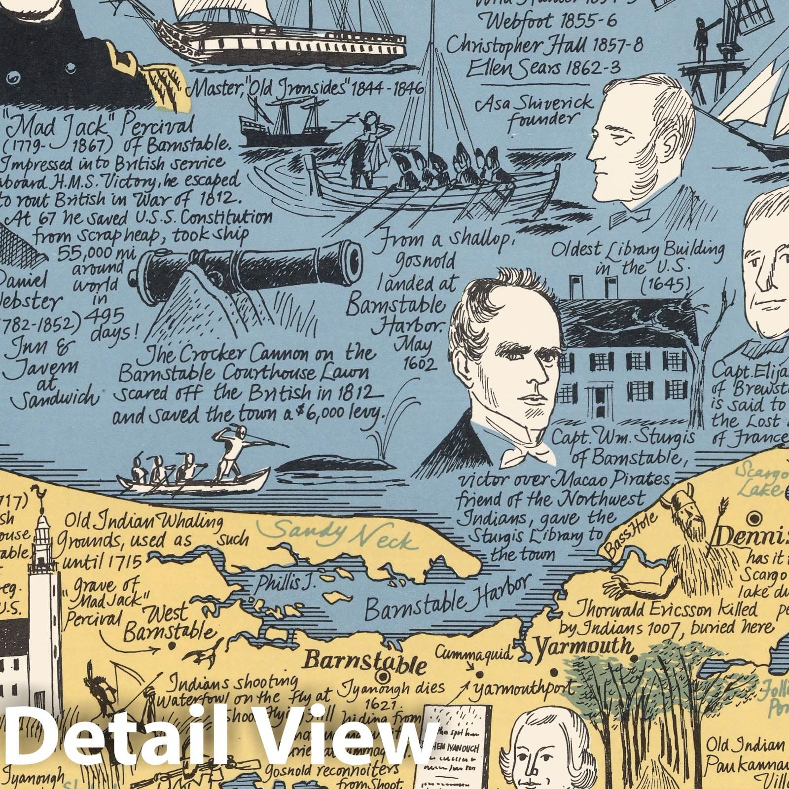
An historical map of Cape Cod : with accurately detailed illustrations pertaining to its storied and inspiring past as researched designed and drawn by Paul Giambarba, artist & publisher of map, and prints at Centerville. Entire contents copyright Galea Prints MCMLXIV. Paul Giambarba, May 1964. (inset) Rigs of some types of sailing vessels of the 18th & 19th centuries. | An historical map of Cape Cod : with accurately detailed illustrations pertaining to its storied and inspiring past as researched designed and drawn by Paul Giambarba, artist & publisher of map, and prints at Centerville. Entire contents copyright Galea Prints MCMLXIV. Paul Giambarba, May 1964. (inset) Rigs of some types of sailing vessels of the 18th & 19th centuries. |
We print high quality reproductions of historical maps, photographs, prints, etc. Because of their historical nature, some of these images may show signs of wear and tear - small rips, stains, creases, etc. We believe that in many cases this contributes to the historical character of the item.
- MUSEUM QUALITY INKS AND PAPER: Printed on thick 192gsm heavyweight matte paper with archival giclee inks, this historic fine art will decorate your wall for years to come.
- VINTAGE MAP REPRODUCTION: Add style to any room's decor with this beautiful print. Whether your interior design is modern or classic, a map is never out of fashion.
- ATTENTION TO DETAIL: We edit every antique map for image quality, color and vibrance, so it can look its best while retaining historical character. Makes a great gift!
- FRAME READY: Your unframed poster will arrive crease-free, rolled in a sturdy mailing tube. Many maps fit easy-to-find standard size frames 16x20, 16x24, 18x24, 24x30, 24x36, saving on custom framing.
- Watermarks will not appear in the printed picture. Some blemishes, tears, or stamps may be removed from the final print.
Why choose Historic Pictoric
Every artwork we offer is carefully edited by our small but dedicated team of image professionals, ensuring each detail is perfect. We print every order to demand right here in the USA, treating every piece with the same care and attention we would give our own work. From editing to printing to packaging, we take pride in delivering artwork that meets our high standards—and we love knowing it’s heading to a home where it will be appreciated.