-
-


-
Wall Color
in
Uncheck to hide the white line Check to show the white line -
-
.


Frame
Room
Gallery
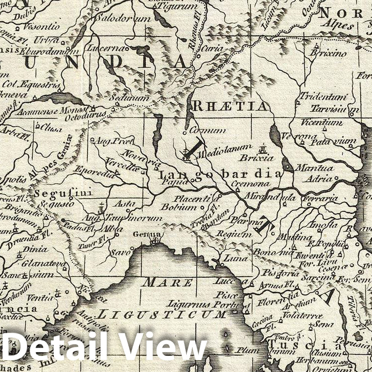
Historic Map : Kitchin Map of Europe Under Charlemagne, 1768, Vintage Wall Art
Historic Map : Kitchin Map of Europe Under Charlemagne, 1768, Vintage Wall Art
Note: Sold out or unavailable
Couldn't load pickup availability
This is a beautiful example of a 1768 Thomas Kitchin map of the Empire of Charlemagne. It covers Europe and the European empire of Charles the Great from Scotland south as far as Africa and from Portugal to the Black Sea in the east. The map is highly detailed, noting several towns, rivers, islands and other topographical details. A decorative title cartouche appears in the top right quadrant. After ruling and reforming France in 768, Charlemagne conquered Italy and, in 800, was crowned Holy Roman Emperor. For the next 14 years until his death, Charlemagne's empire untied much of Western and Central Europe for the first time since the collapse of the Roman Empire. The 'Carolingian Renaissance' witnessed a catholic themed revival of art, religion and culture, encouraging the formation of a common European identity. This map was issued by Thomas Kitchin in 1768.
- MUSEUM QUALITY INKS AND PAPER: Printed on thick 192gsm heavyweight matte paper with archival giclee inks, this historic fine art will decorate your wall for years to come.
- VINTAGE MAP REPRODUCTION: Add style to any room's decor with this beautiful print. Whether your interior design is modern or classic, a map is never out of fashion.
- ATTENTION TO DETAIL: We edit every antique map for image quality, color and vibrance, so it can look its best while retaining historical character. Makes a great gift!
- FRAME READY: Your unframed poster will arrive crease-free, rolled in a sturdy mailing tube. Many maps fit easy-to-find standard size frames 16x20, 16x24, 18x24, 24x30, 24x36, saving on custom framing.
- Watermarks will not appear in the printed picture. Some blemishes, tears, or stamps may be removed from the final print.
Why choose Historic Pictoric
Every artwork we offer is carefully edited by our small but dedicated team of image professionals, ensuring each detail is perfect. We print every order to demand right here in the USA, treating every piece with the same care and attention we would give our own work. From editing to printing to packaging, we take pride in delivering artwork that meets our high standards—and we love knowing it’s heading to a home where it will be appreciated.
- Choosing a selection results in a full page refresh.
- Opens in a new window.