-
-


-
Wall Color
in
Uncheck to hide the white line Check to show the white line -
-
.


Frame
Room
Gallery
Historic Map : Memhardt Map of Berlin, Germany, 1652, Vintage Wall Art
Historic Map : Memhardt Map of Berlin, Germany, 1652, Vintage Wall Art
Note: Sold out or unavailable
Couldn't load pickup availability
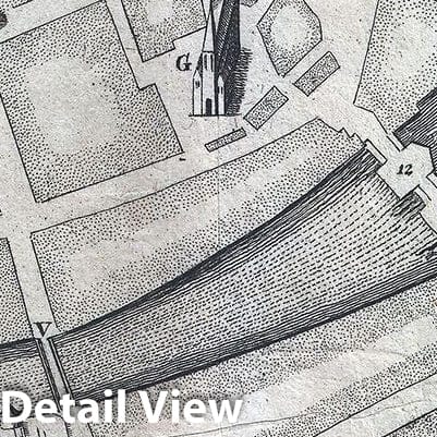
Drawn in 1652 by Johann Gregor Memhardt, and thus known as the Mamhardt Plan, this is the earliest known map of Berlin. Menhardt prepared this plan while employed by Frederick William, the Great Elector, to restore and rebuild the royal residences in and around Berlin following the devastation of the Thirty Year War, in which much of Berlin was destroyed and nearly half of its population lost. Oriented to the east and centered on the Spree River, Memhardt's map covers mediaeval Berlin, Colln, and the Castle District. It is the only surviving document to illustrate Berlin's medieval walls. Important buildings are rendered in profile and include the royal residence, several churches, the Mühlendamm, and the 'Olde Markt.' THis map was prepared in 1652 to illustrate Merian's Topographia Electorat, Brandenburgici et Ducatus Pomeraniae.
- MUSEUM QUALITY INKS AND PAPER: Printed on thick 192gsm heavyweight matte paper with archival giclee inks, this historic fine art will decorate your wall for years to come.
- VINTAGE MAP REPRODUCTION: Add style to any room's decor with this beautiful print. Whether your interior design is modern or classic, a map is never out of fashion.
- ATTENTION TO DETAIL: We edit every antique map for image quality, color and vibrance, so it can look its best while retaining historical character. Makes a great gift!
- FRAME READY: Your unframed poster will arrive crease-free, rolled in a sturdy mailing tube. Many maps fit easy-to-find standard size frames 16x20, 16x24, 18x24, 24x30, 24x36, saving on custom framing.
- Watermarks will not appear in the printed picture. Some blemishes, tears, or stamps may be removed from the final print.
Why choose Historic Pictoric
Every artwork we offer is carefully edited by our small but dedicated team of image professionals, ensuring each detail is perfect. We print every order to demand right here in the USA, treating every piece with the same care and attention we would give our own work. From editing to printing to packaging, we take pride in delivering artwork that meets our high standards—and we love knowing it’s heading to a home where it will be appreciated.