-
-


-
Wall Color
in
Uncheck to hide the white line Check to show the white line -
-
.


Frame
Room
Gallery
Historic Map : Norie and Wilson Nautical Chart or Map of The Canary Islands and Maderia, 1867, Vintage Wall Art
Historic Map : Norie and Wilson Nautical Chart or Map of The Canary Islands and Maderia, 1867, Vintage Wall Art
Note: Sold out or unavailable
Couldn't load pickup availability
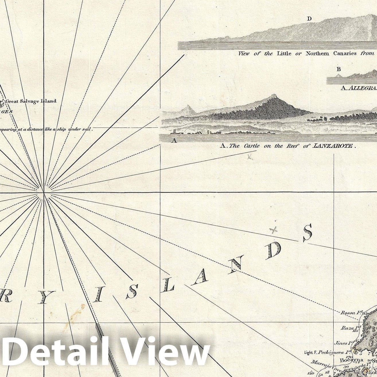
An exceptionally beautiful 1867 James Norie and Charles Wilson nautical chart or maritime map of the Canary Islands and Madeira, including part of western Africa. As a whole the map offers excellent detail with inland topography on all of the islands as well as countless depth soundings throughout. There are three inset detail maps in the lower left quadrant focusing on Arrecife, Funchal, and Santa Cruz. There are an additional seventeen land profile charts filling the upper right and lower right quadrants. The title is set in an elaborate typeface just outside the map's upper border.
The Canary Islands were a popular stopping point for ships traveling between Europe and the Americas. By the time this map was made, Madeira was known around the world for its fine desert wines, among the most popular luin xury beverages in the Western Hemisphere throughout the 17th and 18th centuries. Cartographically this map is based on the work of J. S. Hobbs. It was engraved by Charles Wilson, of 'Norie and Wilson,' a nautical publishing firm based at 157 Leadenhall Street, London.
- MUSEUM QUALITY INKS AND PAPER: Printed on thick 192gsm heavyweight matte paper with archival giclee inks, this historic fine art will decorate your wall for years to come.
- VINTAGE MAP REPRODUCTION: Add style to any room's decor with this beautiful print. Whether your interior design is modern or classic, a map is never out of fashion.
- ATTENTION TO DETAIL: We edit every antique map for image quality, color and vibrance, so it can look its best while retaining historical character. Makes a great gift!
- FRAME READY: Your unframed poster will arrive crease-free, rolled in a sturdy mailing tube. Many maps fit easy-to-find standard size frames 16x20, 16x24, 18x24, 24x30, 24x36, saving on custom framing.
- Watermarks will not appear in the printed picture. Some blemishes, tears, or stamps may be removed from the final print.
Why choose Historic Pictoric
Every artwork we offer is carefully edited by our small but dedicated team of image professionals, ensuring each detail is perfect. We print every order to demand right here in the USA, treating every piece with the same care and attention we would give our own work. From editing to printing to packaging, we take pride in delivering artwork that meets our high standards—and we love knowing it’s heading to a home where it will be appreciated.