-
-


-
Wall Color
in
Uncheck to hide the white line Check to show the white line -
-
.


Frame
Room
Gallery
Historic Map : U.S. Coast Survey Map of The Delaware Bay Entrance, 1866, Vintage Wall Art
Historic Map : U.S. Coast Survey Map of The Delaware Bay Entrance, 1866, Vintage Wall Art
Note: Sold out or unavailable
Couldn't load pickup availability
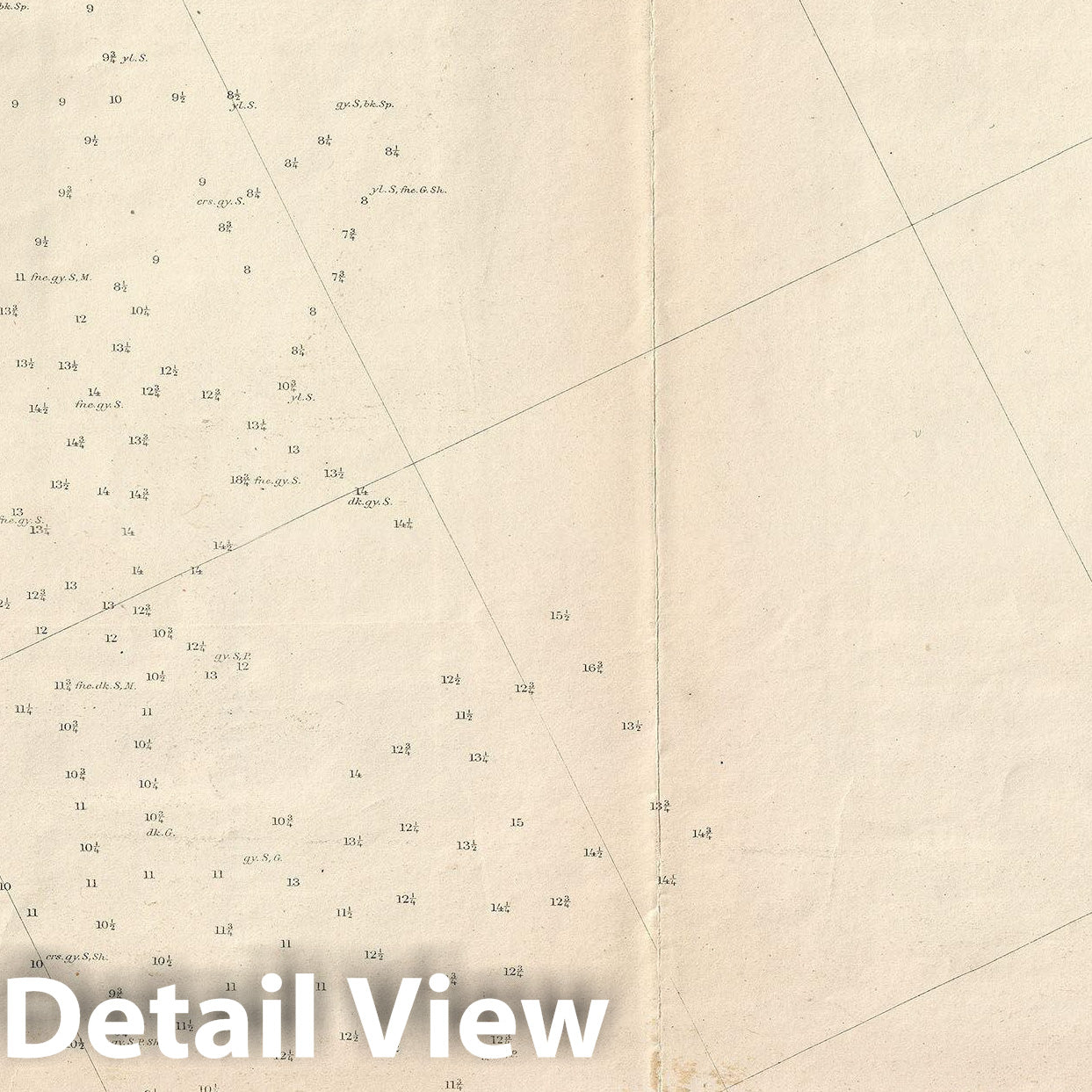
An unusual 1866 U.S. Coast Survey map of the entrance to Delaware Bay. The map covers the entrance of the bay from Cape May, New Jersey to Assawoman Bay, Delaware. The map offers countless depth soundings throughout as well as excellent coastal detail, especially in Cape Map and along Rehoboth Bay, Indian River Bay, and Assawoman Bay. An inset in the lower left quadrant focuses on the Delaware Breakwater near Cape Henlopen. Presumably this is part of a larger set that extends southwards as far as the Isle of Wight. We have not seen the other charts.
The triangulation for this chart was accomplished by E. Blunt, J. E. Johnstone and J. Farley. The topography is the work of J. J. S. Hassler and G. D. Wise. The Hydrography was completed by parties under the commands of T. R. Gedney, G. S. Blake, G. M. Bache, S. P. Lee, and R. Bache. The whole was compiled under the superintendence of A. D. Bache, one of the most influential and prolific heads of the U.S. Coast Survey.
- MUSEUM QUALITY INKS AND PAPER: Printed on thick 192gsm heavyweight matte paper with archival giclee inks, this historic fine art will decorate your wall for years to come.
- VINTAGE MAP REPRODUCTION: Add style to any room's decor with this beautiful print. Whether your interior design is modern or classic, a map is never out of fashion.
- ATTENTION TO DETAIL: We edit every antique map for image quality, color and vibrance, so it can look its best while retaining historical character. Makes a great gift!
- FRAME READY: Your unframed poster will arrive crease-free, rolled in a sturdy mailing tube. Many maps fit easy-to-find standard size frames 16x20, 16x24, 18x24, 24x30, 24x36, saving on custom framing.
- Watermarks will not appear in the printed picture. Some blemishes, tears, or stamps may be removed from the final print.
Why choose Historic Pictoric
Every artwork we offer is carefully edited by our small but dedicated team of image professionals, ensuring each detail is perfect. We print every order to demand right here in the USA, treating every piece with the same care and attention we would give our own work. From editing to printing to packaging, we take pride in delivering artwork that meets our high standards—and we love knowing it’s heading to a home where it will be appreciated.