-
-


-
Wall Color
in
Uncheck to hide the white line Check to show the white line -
-
.


Frame
Room
Gallery
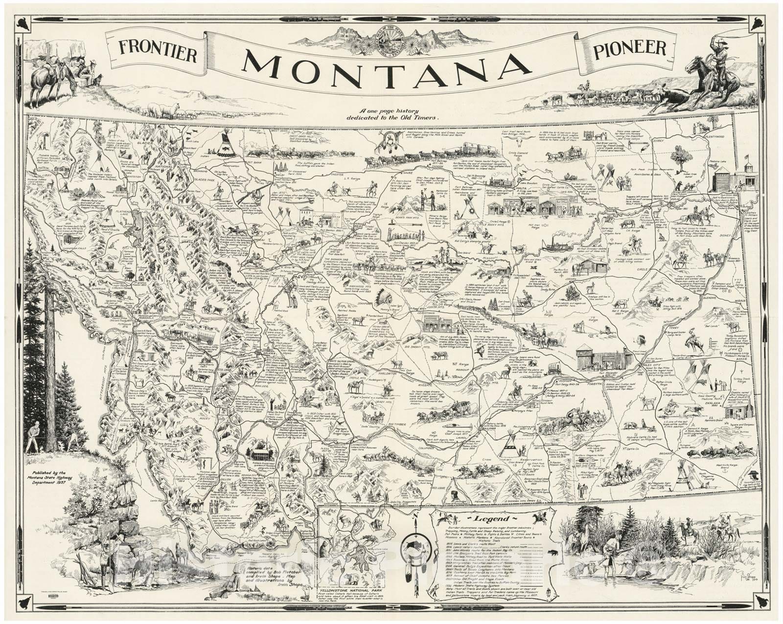
A Map of Montana whereon is Depicted and Inscribed the Pioneer History of the Land of Shining Mountains, 1937 - Vintage Wall Art
A Map of Montana whereon is Depicted and Inscribed the Pioneer History of the Land of Shining Mountains, 1937 - Vintage Wall Art
Note: Sold out or unavailable
Couldn't load pickup availability
The Map of Montana, whereon is Depicted and Inscribed the Pioneer History of the Land of Shining Mountains, 1937, is a remarkable work of cartography that provides a unique perspective on the history and geography of Montana. Created in 1937, the map features an intricate design that includes detailed illustrations and descriptions of the state's natural landmarks, cultural heritage, and pioneer history. The map's illustrations are drawn in a charming, folksy style that captures the spirit of Montana's pioneering past and the natural beauty of its landscape.
One of the most notable features of the Map of Montana is its focus on the state's pioneer history. The map includes detailed descriptions of early settlements, Indian tribes, and pioneer trails, as well as illustrations of notable figures in Montana's history, such as Lewis and Clark and Chief Joseph. The map also features important landmarks from Montana's pioneer era, such as forts, mining camps, and railroad lines. Overall, the Map of Montana, whereon is Depicted and Inscribed the Pioneer History of the Land of Shining Mountains, 1937, is a fascinating and informative work of cartography that provides a window into Montana's rich and diverse history.
- MUSEUM QUALITY INKS AND PAPER: Printed on thick 192gsm heavyweight matte paper with archival giclee inks, this historic fine art will decorate your wall for years to come.
- VINTAGE MAP REPRODUCTION: Add style to any room's decor with this beautiful print. Whether your interior design is modern or classic, a map is never out of fashion.
- ATTENTION TO DETAIL: We edit every antique map for image quality, color and vibrance, so it can look its best while retaining historical character. Makes a great gift!
- FRAME READY: Your unframed poster will arrive crease-free, rolled in a sturdy mailing tube. Many maps fit easy-to-find standard size frames 16x20, 16x24, 18x24, 24x30, 24x36, saving on custom framing.
- Watermarks will not appear in the printed picture. Some blemishes, tears, or stamps may be removed from the final print.
What our customers are saying
★★★★★I purchased an historic map, 16x24 inch. It is beautifully printed on heavy stock. The lettering, colors, and details of the map are crisp and easy to read. I am highly satisfied and would certainly purchase from Historic Pictoric again!
Kent A.
★★★★★Ordered the Pan American Midway print to fit a lovely thrift-store gilded frame. I love showing off Buffalo's rich history and this is a pretty entertaining photo from 1901. Prompt shipping. Sturdy packaging.
Cindy O.
★★★★★I received my print within days of ordering, and it arrived well packed in a mailing tube. The print is high quality and exactly as advertised. I will use Historic Pictoric again in the future!
Cheryl H.
★★★★★Excellent product. Great fidelity in reproduction of the original. Fine/minute details were sharp, colors were vibrant, and thickness, texture and overall feel and quality of the paper were excellent. Very satisfied with my purchase.
Konrad B.
★★★★★I have purchased six maps from Historic Pictoric. I find the quality to be excellent. Their customers service is also excellent. Outstanding! I called to exchange a few for different sizes and I could not have asked for a better experience.
Aaron C.
★★★★★The original map I ordered lacked some of the detail that I had hoped for, but they responded with several more map possibilities to choose from. Excellent service- a far step beyond what anyone expects from online purchases.
Dan M.
★★★★★I am a owner of 5 maps from Historic Pictoric. From Okinawa, 1945, Europe 1940-1945 battle maps. Now they’re helping me with the battle of Gettysburg. These maps are so much superior to the map on a page in a book. I have framed two of them.
Steven Ko
★★★★★Great heavy paper quality and clarity of my nautical map. Will be a great addition to our home close to the beach!
Jennifer A


