You have no items in your shopping cart.
- Home
- Maps
-
State Maps
- Alabama
- Alaska
- Arizona
- Arkansas
- California
- Colorado
- Connecticut
- Delaware
- Florida
- Georgia
- Hawaii
- Idaho
- Illinois
- Indiana
- Iowa
- Kansas
- Kentucky
- Louisiana
- Maine
- Maryland
- Massachusetts
- Michigan
- Minnesota
- Mississippi
- Missouri
- Nebraska
- Nevada
- New Hampshire
- New Jersey
- New Mexico
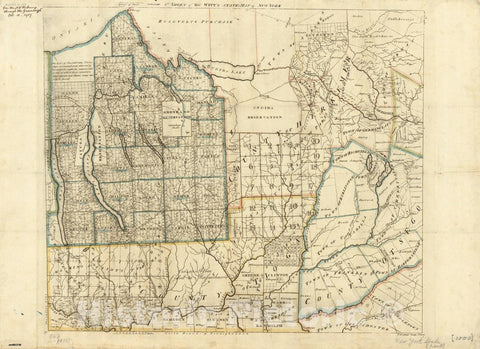
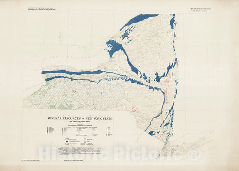
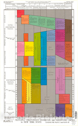
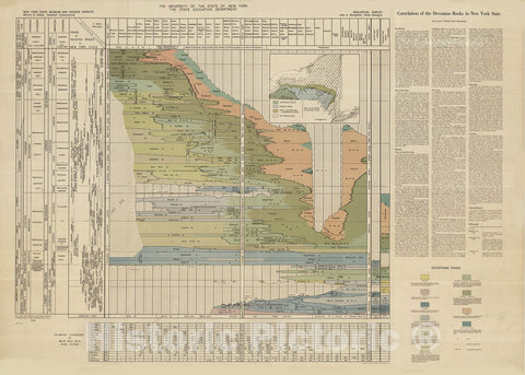
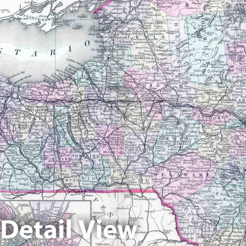
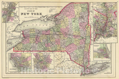
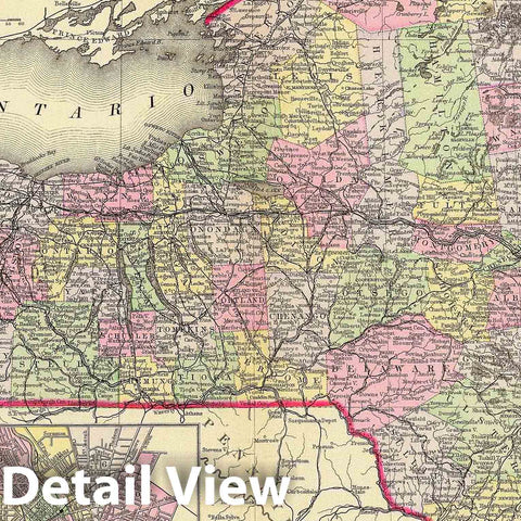
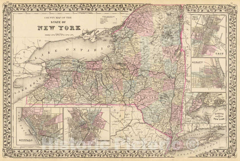
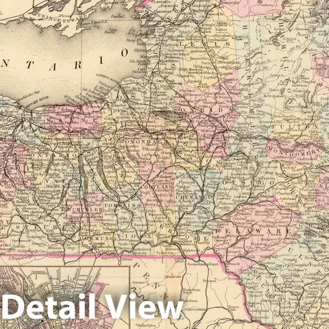
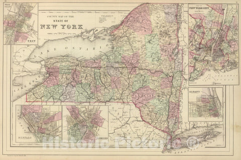
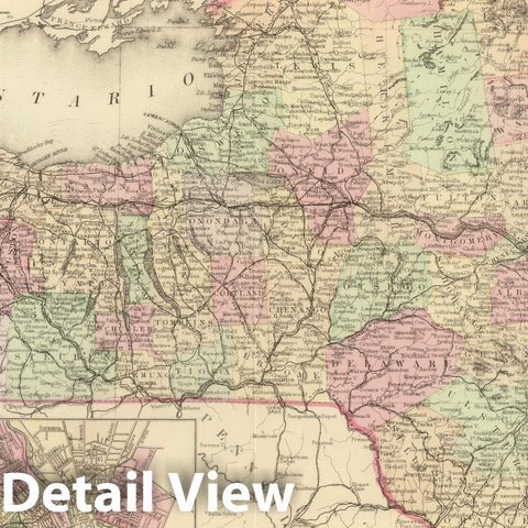
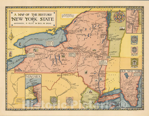
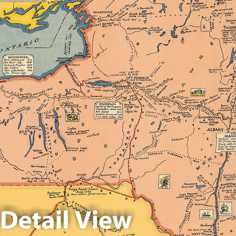
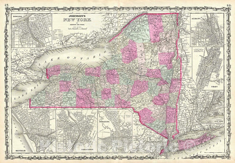
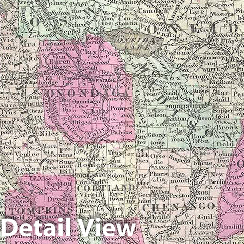
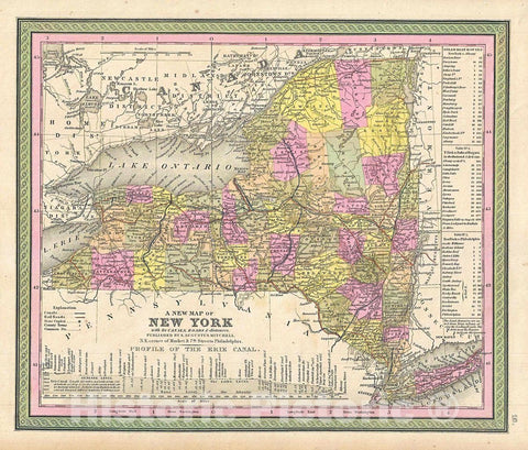
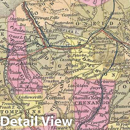
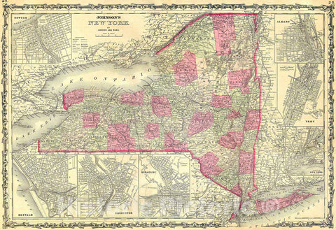
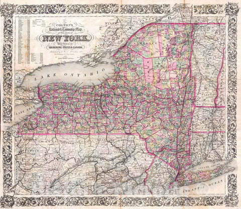
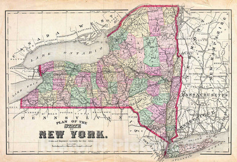
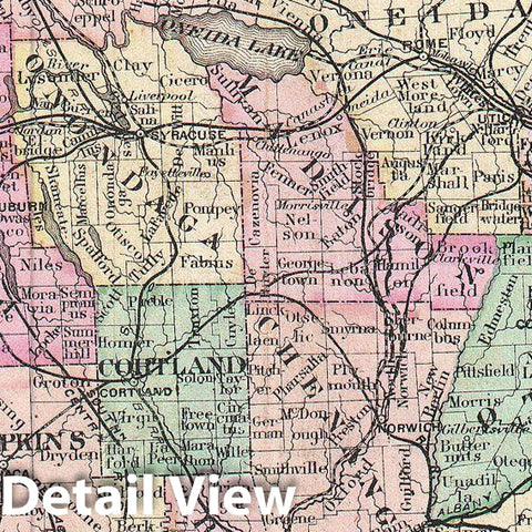
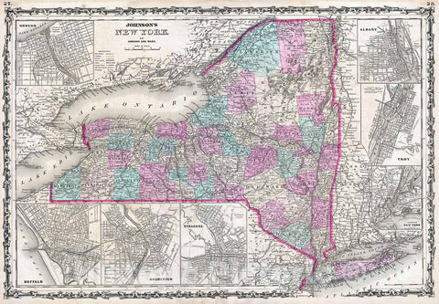
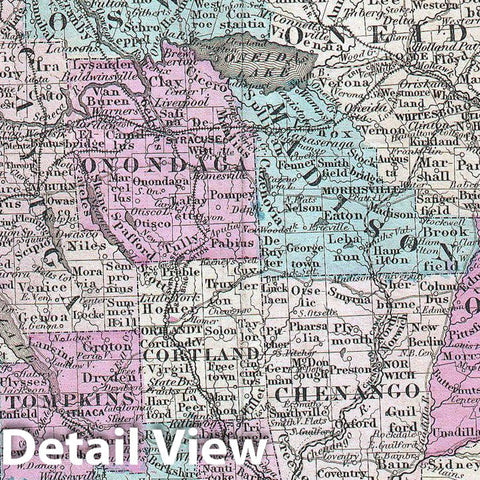
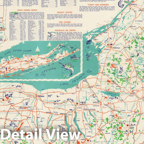
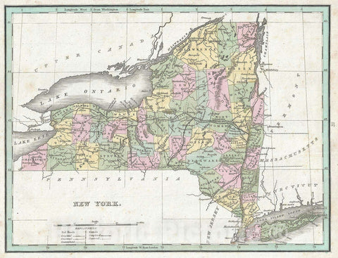
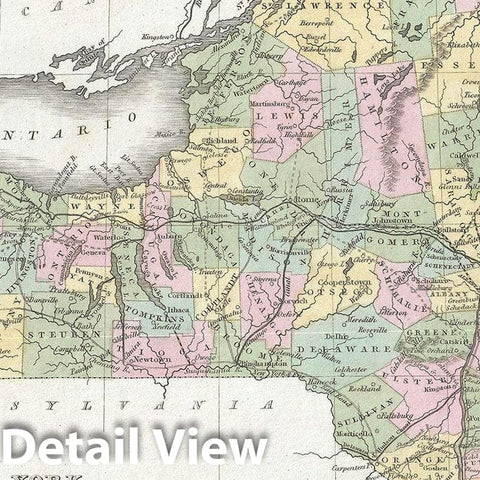
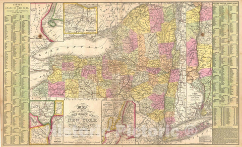
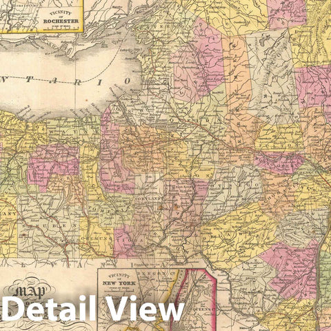
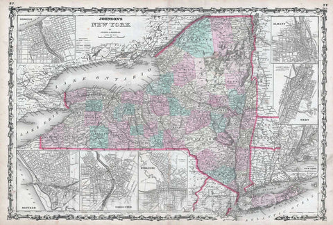
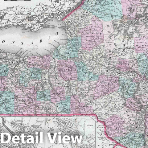
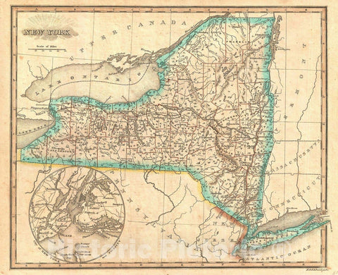
- New York
- North Carolina
- North Dakota
- Ohio
- Oklahoma
- Oregon
- Pennsylvania
- Rhode Island
- South Carolina
- South Dakota
- Tennessee
- Texas
- Utah
- Vermont
- Virginia
- Washington
- West Virginia
- Wisconsin
- Wyoming
- Art Prints
- Photographs
- Contact Us
![Historic Map - 1895 New York State, Double Page Plate No. 30 [Map Of Allegany And Steuben Counties] - Vintage Wall Art](http://www.historicpictoric.com/cdn/shop/products/5128281_edit__1wmark_large.jpg?v=1683149722)
![Historic 1895 Map - New York State, Plate No. 35 [Map Of City Of Buffalo] - Atlas Of The State Of New York - Vintage Wall Art](http://www.historicpictoric.com/cdn/shop/products/5128285_1wmark_large.jpg?v=1683149723)
![Historic Map - 1895 New York State, Plate No. 33 [Map Of City Of Rochester] - Vintage Wall Art](http://www.historicpictoric.com/cdn/shop/products/5128284_1wmark_large.jpg?v=1683149722)
![Historic Map - 1895 New York State, Plate No. 32 [Map Of Orleans, Genesee And Monroe Counties] - Vintage Wall Art](http://www.historicpictoric.com/cdn/shop/products/5128283_1wmark_large.jpg?v=1683149720)
![Historic 1895 Map - New York State, Plate No. 24 [Map Of Sullivan County] - Atlas Of The State Of New York - Vintage Wall Art](http://www.historicpictoric.com/cdn/shop/products/5128279_1wmark_large.jpg?v=1683149722)
![Historic Map - 1895 New York State, Plate No. 31 [Map Of Wyoming And Livingston Counties] - Vintage Wall Art](http://www.historicpictoric.com/cdn/shop/products/5128282_1wmark_large.jpg?v=1683149721)
![Historic Map - 1895 New York State, Plate No. 28 [Map Of City Of Syracuse] - Vintage Wall Art](http://www.historicpictoric.com/cdn/shop/products/5128280_1wmark_large.jpg?v=1683149722)
![Historic 1895 Map - New York State, Plate No. 22 [Map Of Oneida County] - Atlas Of The State Of New York - Vintage Wall Art](http://www.historicpictoric.com/cdn/shop/products/5128278_1wmark_large.jpg?v=1683149722)
![Historic 1895 Map - New York State, Plate No. 17 [Map Of Clinton County] - Atlas Of The State Of New York - Vintage Wall Art](http://www.historicpictoric.com/cdn/shop/products/5128276_1wmark_large.jpg?v=1683149723)
![Historic 1895 Map - New York State, Plate No. 21 [Map Of Lewis County] - Atlas Of The State Of New York - Vintage Wall Art](http://www.historicpictoric.com/cdn/shop/products/5128277_1wmark_large.jpg?v=1683149723)
![Historic 1895 Map - New York State, Plate No. 13 [Map Of City Of Albany] - Atlas Of The State Of New York - Vintage Wall Art](http://www.historicpictoric.com/cdn/shop/products/5128275_1wmark_large.jpg?v=1683149723)
![Historic 1895 Map - New York State, Plate No. 9 [Map Of Dutchess County] - Atlas Of The State Of New York - Vintage Wall Art](http://www.historicpictoric.com/cdn/shop/products/5128274_1wmark_large.jpg?v=1683149723)
![Historic Map - 1895 New York State, Double Page Plate No. 2 [Map Of The State Of New York] - Vintage Wall Art](http://www.historicpictoric.com/cdn/shop/products/5128273_1wmark_large.jpg?v=1683149721)
![Map : Rensselaer county, New York 1855, Map of the County of Rensselaer, [New York State] , Antique Vintage Reproduction](http://www.historicpictoric.com/cdn/shop/products/5162697_1wmrk_large.jpg?v=1683150194)